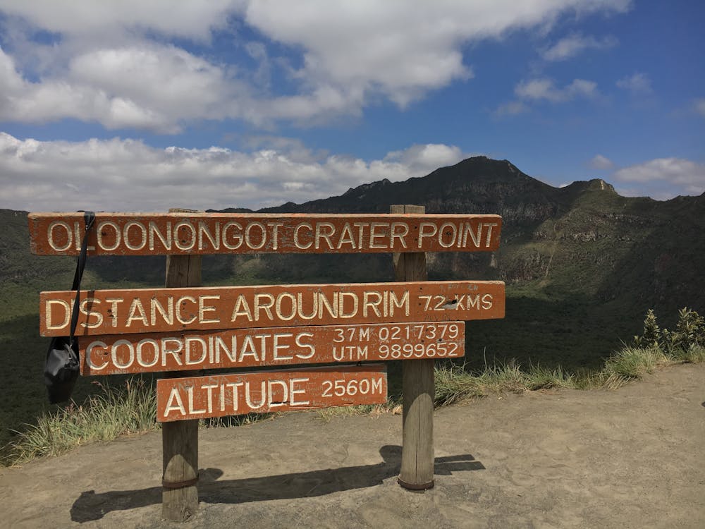
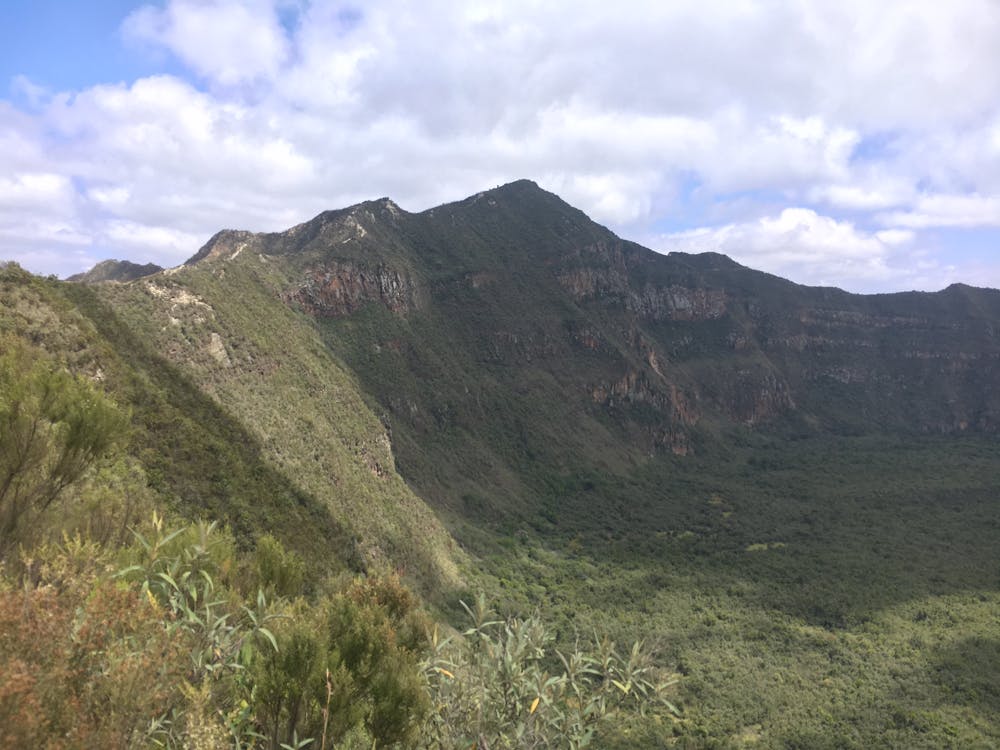
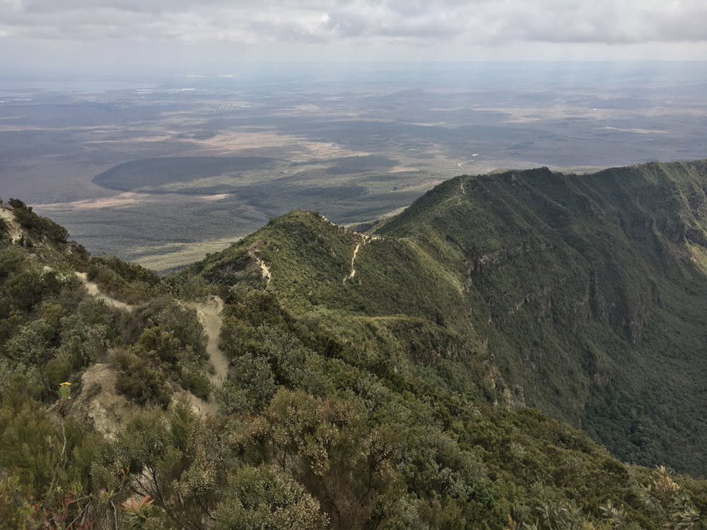
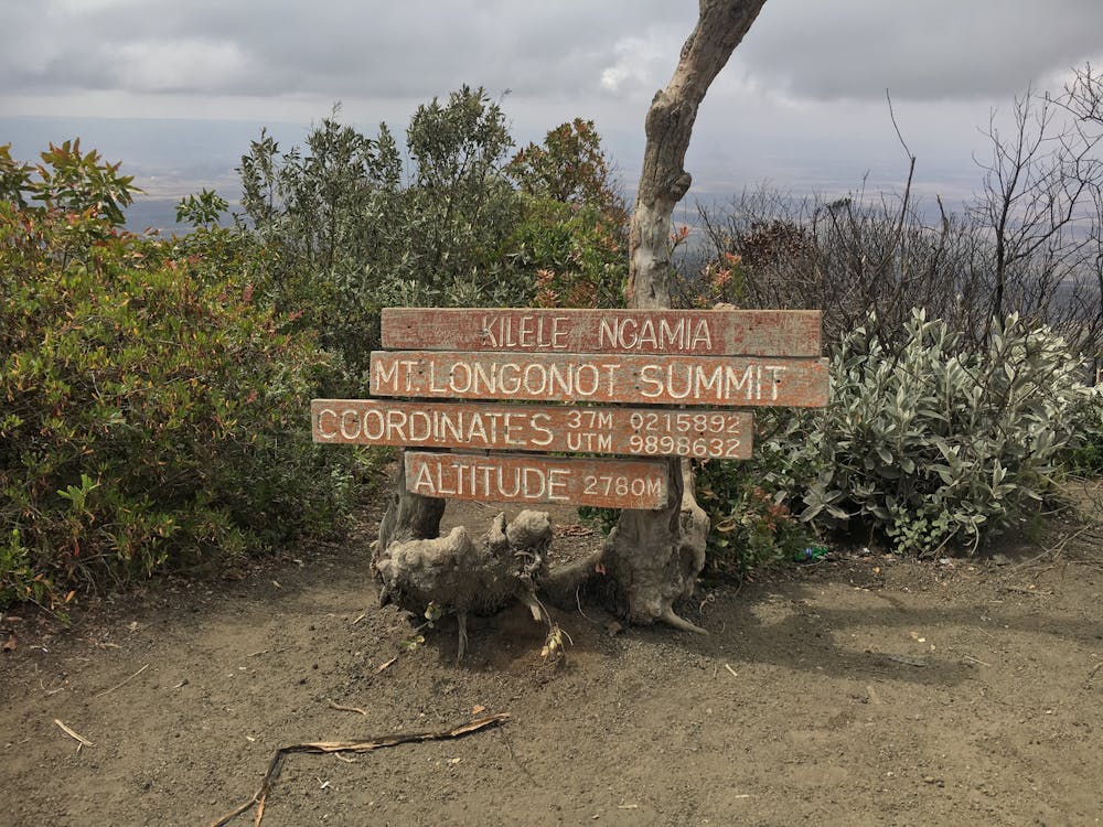
Mont Longonot
Ancien volcan situé à 1h30 du centre de Nairobi.
Hiking Moderate
- Distance
- 13 km
- Ascent
- 848 m
- Descent
- 847 m
- Duration
- 3-4 hrs
- Low Point
- 2.1 km
- High Point
- 2.7 km
- Gradient
- 17˚

This is a popular hiking route which is generally considered to be moderate. It's not remote, it features medium exposure and is typically done in January, February, March, July, August and September. From a low point of 2.1 km to the maximum altitude of 2.7 km, the route covers 13 km, 848 vertical metres of ascent and 847 vertical metres of descent.
- •
- •
- •
- •
Description
Ancien volcan situé à 1h30 du centre de Nairobi. Boucle de 12km - Départ à 2160m, sommet à 2780m. Comptez 3h de marche minimum. Entrée au parc payante
Difficulty
Moderate
Hiking along trails with some uneven terrain and small hills. Small rocks and roots may be present.
Medium Exposure

The trail contains some obstacles such as outcroppings and rock which could cause injury.
Remoteness

Close to help in case of emergency.
Best time to visit
Features
- Wildlife
- Summit Hike
- Family friendly