The couloir of Jyrgalan
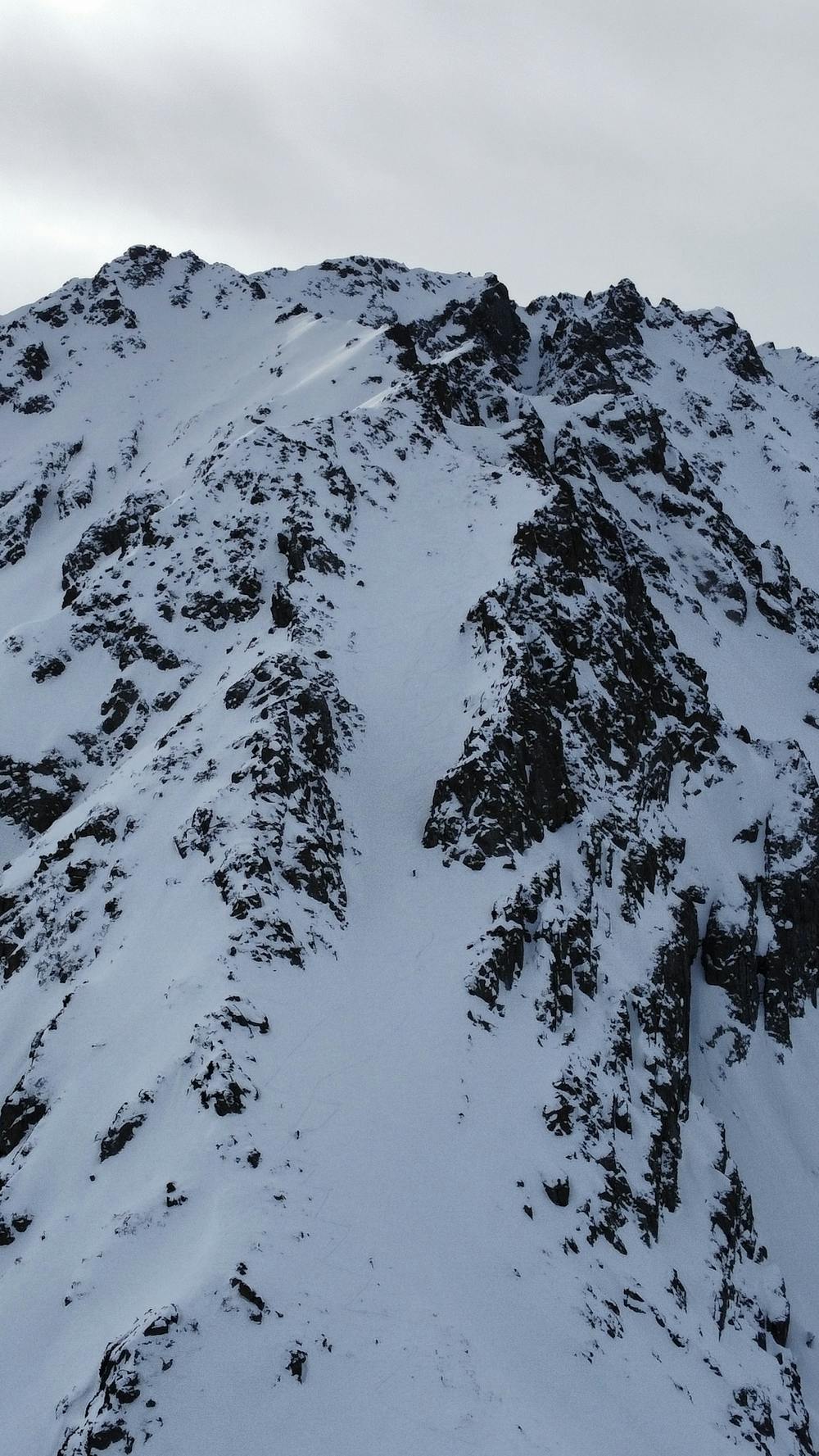
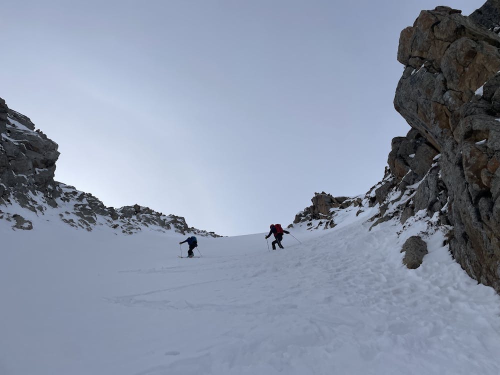
One of the nicest couloir in Jyrgalan, overlooking the village. Accessible and doable within a day. Quite wide with the slope of max 40degrees. We didn’t take the first road and turned around because there was a track leading up before! Roxyandtommyontheroad :)
Ski Touring Difficult
- Distance
- 12 km
- Ascent
- 1.2 km
- Descent
- 1.2 km
- Duration
- 5-6 hrs
- Low Point
- 2.3 km
- High Point
- 3.3 km
- Gradient
- 39˚

This is a popular ski touring route which is generally considered to be difficult. It's very remote, it features high exposure (e3) and is typically done between December and March. From a low point of 2.3 km to the maximum altitude of 3.3 km, the route covers 12 km, 1167 vertical metres of ascent and 1164 vertical metres of descent. You'll need skins, ice axe and crampons to complete it safely.

- •
- •
- •
Description
One of the nicest couloir in Jyrgalan, overlooking the village. Accessible and doable within a day. Quite wide with the slope of max 40degrees. We didn’t take the first road and turned around because there was a track leading a little ahead. Roxyandtommyontheroad :)
Difficulty
Difficult
Serious gradient of 30-38 degrees where a real risk of slipping exists.
High Exposure (E3)

In case of a fall, death is highly likely.
Remoteness
Little chance of being seen or helped in case of an accident.
Best time to visit
Features
- Couloir
Equipment required
- Skins
- Ice axe
- Crampons