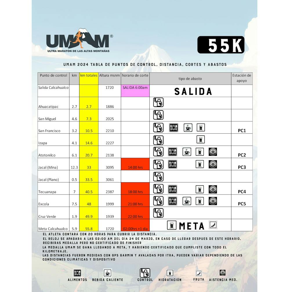
UMAM 55K 2024 (Calcahualco / Parque Nacional Pico de Orizaba)
Ruta actualizada al 18 de marzo de 2024.
Trail Running Severe
- Distance
- 56 km
- Ascent
- 3.2 km
- Descent
- 3.2 km
- Duration
- 1 day +
- Low Point
- 1.6 km
- High Point
- 3.1 km
- Gradient
- 17˚

This is a popular trail running route which is generally considered to be severe. It's very remote, it features medium exposure and is typically done in undefined. From a low point of 1.6 km to the maximum altitude of 3.1 km, the route covers 56 km, 3167 vertical metres of ascent and 3166 vertical metres of descent.
Description
Una ruta muy demandante, con más de 4 mil m de desnivel positivo y casi 10 mil de desnivel acumulado.
Difficulty
Severe
Medium Exposure

The trail contains some obstacles such as outcroppings and rock which could cause injury.
Remoteness

Little chance of being seen or helped in case of an accident.