Bollmannsveien
Lyngen
Riding on a cultural heritage site from WW II
Mountain Biking Difficult
- Distance
- 7.9 km
- Ascent
- 696 m
- Descent
- 696 m
- Duration
- 1-2 hrs
- Low Point
- -2 m
- High Point
- 546 m
- Gradient
- 18˚

The Bollmannsveien route is an old military road built by Russian, Yugoslavian and Polish prisoners of war at the end of World War II. The road was part of the defence barrier, the Lyngen Line. It’s now an important cultural heritage site, so please ride it with a care.
- •
- •
- •
- •
- •
- •
Description
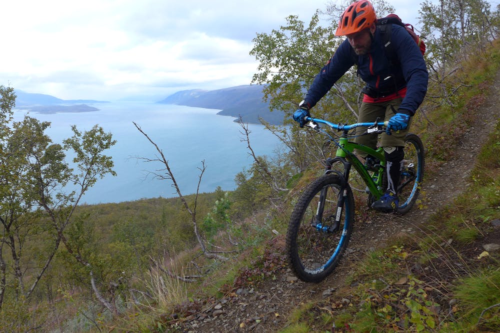
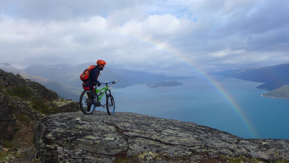
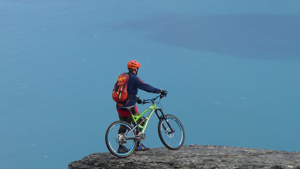
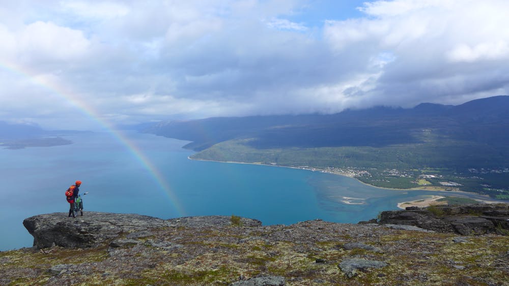
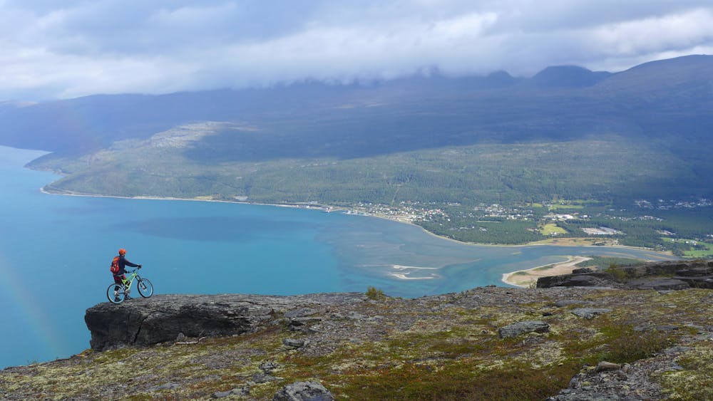
Bike 250 m along the main road until you reach the historic wartime road, which you follow all the way up to the highest point. There is only one option, so you cannot get lost. You need to cross some boulders and a waterfall. We recommend taking some breaks to enjoy the spectacular views of the Lyngen Alps. Ride down the same route you came up. The upper part is challenging and, even though it’s quite wide, is a steep S3 trail with loose gravel and tight turns. Some parts of the trail are exposed and there is a chance to fall on a steep slope. The lower part offers more relaxed riding, but the boulders and waterfall demand more attention. Tip for adventure seekers: It’s possible to ride down the other side from the highest point but it’s a rather steep route.
Difficulty
Difficult
Mostly stable trail tread with some variability featuring larger and more unavoidable obstacles that may include, but not be limited to: bigger stones, roots, steps, and narrow curves. Compared to lower intermediate, technical difficulty is more advanced and grades of slopes are steeper. Ideal for upper intermediate riders.
Medium Exposure

The trail contains some obstacles such as outcroppings and rock which could cause injury.
Remoteness
Away from help but easily accessed.
Best time to visit
Features
- Technical
- Hike a bike
- Picturesque
- Singletrack
- Rock Slabs
- Rock Gardens