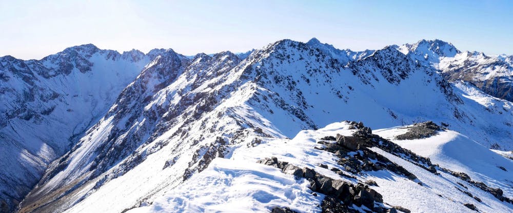
Mt Aicken
A good introduction to Arthur's Pass peak bagging east of the highway
Alpine Climbing Easy
- Distance
- 9.2 km
- Ascent
- 1.3 km
- Descent
- 1.3 km
- Low Point
- 758 m
- High Point
- 1.8 km
- Gradient
- 23˚

The track to Mt Aicken starts on the same route as the Devil's Punchbowl falls walk, then turns off steeply to the right. It takes around 5 hours round trip in summer for a normal party, allow 5-8 hours in winter. The labelled summit of Mt Aicken is at 1858m which requires an out-and-back on a tricky ridge 300m along from the high point of 1863m. So treat this last part as optional if you're keen for a bit more fun scrambling!
Difficulty
Easy
The ascent involves simple glacier hiking and/or short, straightforward rock scrambles. Equivalent to Alpine F, F+
Low Exposure

The route is well protected or easy enough that protection is not required.
Remoteness
Close to help in case of emergency.
Best time to visit
Equipment required
- Ice axe
- Crampons