7.9 km away
Te Heuheu Summit descent
Riding down the Northern aspect of Mount Ruapehu
Moderate Ski Touring
- Distance
- 7.7 km
- Ascent
- 1.1 km
- Descent
- 1.1 km
A sweet and long descent down the West side of Mount Ruapehu
Ski Touring Difficult
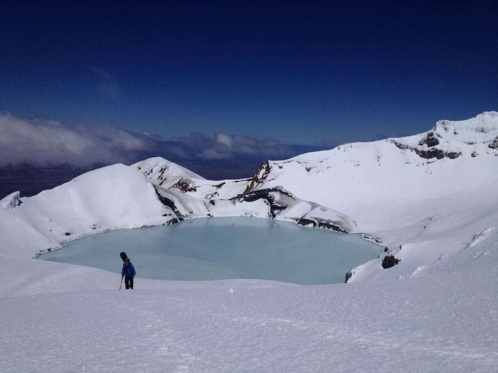
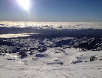
Out of all the views I had from a summit on the North Island of New Zealand this was by far the best. Standing on the top of Paretetaitonge you’re just a stones throw away from the crater lake. If this wasn’t alone enough to peak your interest the line itself is a nice and consistent pitch for almost 1000 meters before doing a long uphill traverse over to Turoa ski resort. Being south facing this slope holds powder much later than other slopes on the volcano.
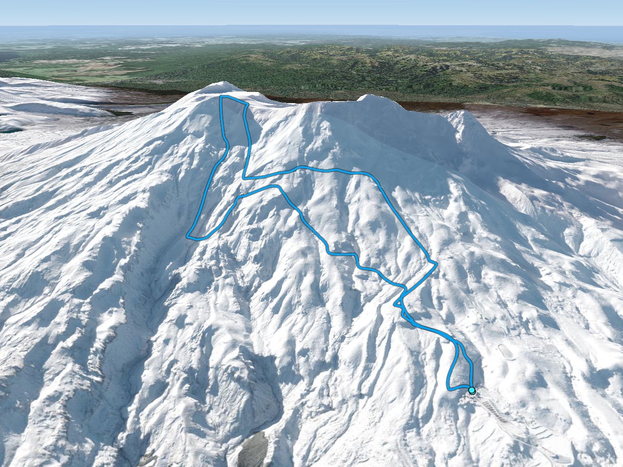
Leaving the base area of Turoa start skinning up the home run trail before taking a left on the Branchline run. Keep gaining elevation until just above the Organ Pipes Canyon and here is where you need to start traversing to the west. Because you went above the canyon it is best to do a low angle descent over towards the Mangaturuturu Glacier. At around 2300 meters you can start heading Northeast to start heading for the crater rim. Being that this slope is low angle it is possibly the easiest way to make it up to the crater.
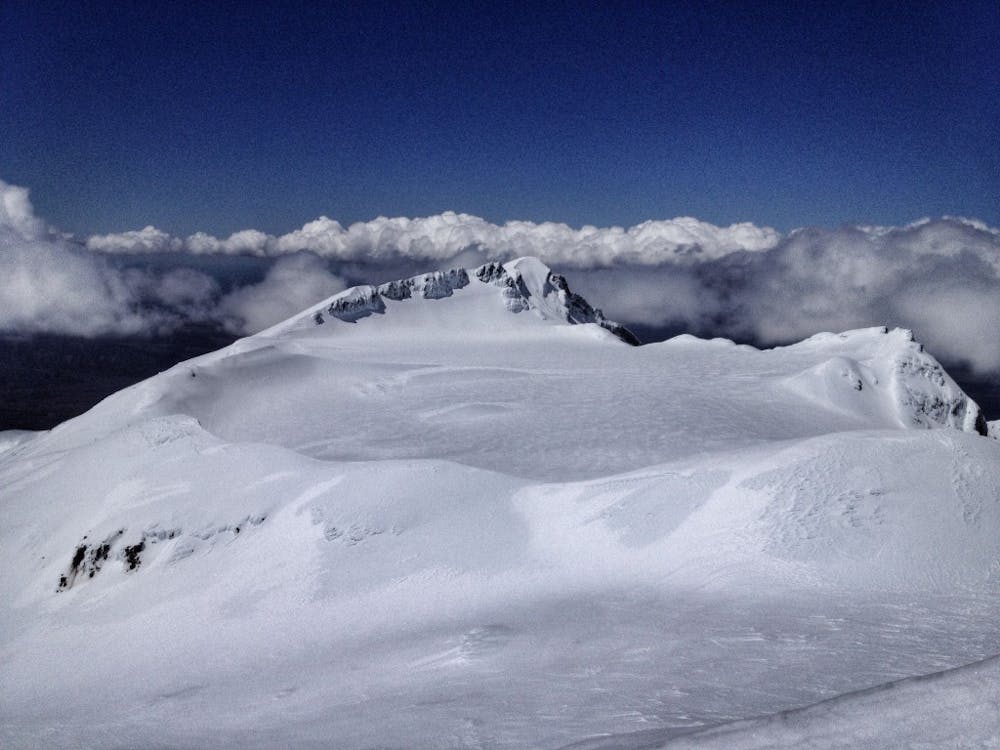
Standing on the high col now make your way north up a mellow ridge until reaching the highpoint known as Paretetaitonge. Having climbed underneath your intended descent you should have a good idea what the snow is going to be like.
Dropping off the Southwest slopes the first few turns are semi steep before its a nice ramp all the way towards the valley. While riding down you must keep in mind that you will have to climb back up so be aware of your energy levels. I was able to ride down to 1800. Looking back up I was a bit intimidated by the terrain as you are semi exposed to potential avalanches. That being said be cautious while climbing out of the basin and it is best to gain elevation and traverse over the Organ Pipes. Once past said gully system you are back in the ski resort boundaries and can ride all the way back down to the parking lot.
For more pictures and the full story check out this link https://www.whereiskylemiller.com/new-zealand/mount-ruapehu/
Difficult
Serious gradient of 30-38 degrees where a real risk of slipping exists.

As well as the slope itself, there are some obstacles (such as rock outcrops) which could aggravate injury.

Little chance of being seen or helped in case of an accident.
7.9 km away
Riding down the Northern aspect of Mount Ruapehu
Moderate Ski Touring
7.9 km away
A thorough exploration of Mount Ruapehu
Difficult Ski Touring

3 routes · Ski Touring