7 km away
Roy's Peak Track
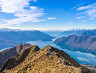
A bucket-list hike for locals and visitors alike, they all come for one thing: the view from the summit of Roy's Peak.
Moderate Hiking
- Distance
- 16 km
- Ascent
- 1.3 km
- Descent
- 1.3 km
Spacer do najlepszego punktu widokowego w Wanace, z którego rozpościerają się widoki na całą okolicę tego pięknie położonego miasta.
Hiking Moderate

This is a popular hiking route which is generally considered to be moderate. It's not remote, it features low exposure and is typically done all year round. From a low point of 324 m to the maximum altitude of 528 m, the route covers 4.6 km, 227 vertical metres of ascent and 226 vertical metres of descent.

Spacer do najlepszego punktu widokowego w Wanace, z którego rozpościerają się widoki na całą okolicę tego pięknie położonego miasta.
Więcej na https://bezsygnalu.pl/mount-iron-track/
Moderate
Hiking along trails with some uneven terrain and small hills. Small rocks and roots may be present.

The path is on completely flat land and potential injury is limited to falling over.
Close to help in case of emergency.
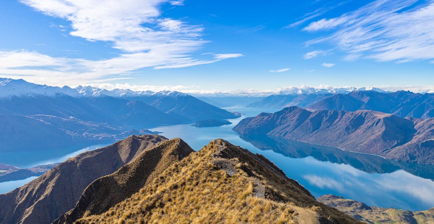
7 km away
A bucket-list hike for locals and visitors alike, they all come for one thing: the view from the summit of Roy's Peak.
Moderate Hiking
7 routes · Hiking