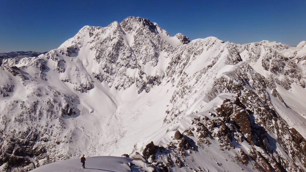
Philistine - Rolleston Traverse
A grand journey along a stunning ridgeline culminating in the High Peak of Rolleston
Alpine Climbing Moderate
- Distance
- 14 km
- Ascent
- 1.6 km
- Descent
- 1.6 km
- Low Point
- 900 m
- High Point
- 2.2 km
- Gradient
- 33˚

This is a popular alpine climbing route which is generally considered to be moderate. It's remote, it features medium exposure and is typically done between July and March. From a low point of 900 m to the maximum altitude of 2.2 km, the route covers 14 km, 1635 vertical metres of ascent and 1636 vertical metres of descent. You'll need crampons and 2 ice axes to complete it safely.
Description
An exhilarating high traverse between Philistine and Rolleston with a descent into the Otira makes for a full day of Arthur's Pass mountaineering.
Difficulty
Moderate
May involve slightly more complex glacier hikes, easy but possibly long rock ridges and steep snow up to 45 degrees. Equivalent to PD, PD+
Medium Exposure

The route features some exposed and/or difficult to protect sections.
Remoteness
Away from help but easily accessed.
Best time to visit
Equipment required
- Crampons
- 2 Ice Axes