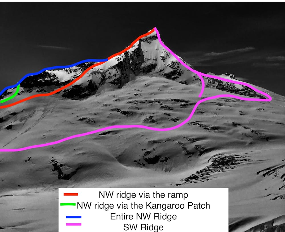
Mt Aspiring NW ridge via the ramp
NZ grade 2+ mountaineering route, early season option
Hiking Difficult
- Distance
- 3 km
- Ascent
- 1.1 km
- Descent
- 34 m
- Duration
- 2-3 hrs
- Low Point
- 1.8 km
- High Point
- 2.9 km
- Gradient
- 30˚

This is a popular hiking route which is generally considered to be difficult. It's remote, it features extreme exposure and is typically done between November and December. From a low point of 1.8 km to the maximum altitude of 2.9 km, the route covers 3 km, 1114 vertical metres of ascent and 34 vertical metres of descent.
- •
- •
- •
Description
Classic steep and moderate snow climb to the summit of Mt. Aspiring, 3030m above the tasman sea. Descend via the same route or via the kangaroo.
Difficulty
Difficult
Hiking trails where obstacles such as rocks or roots are prevalent. Some obstacles can require care to step over or around. At times, the trail can be worn and eroded. The grade of the trail is generally quite steep, and can often lead to strenuous hiking.
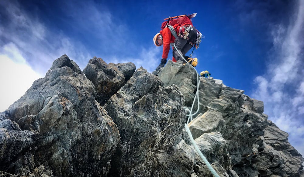
Extreme Exposure

Some trail sections are extremely exposed where falling will almost certainly result in serious injury or death.
Remoteness

Away from help but easily accessed.
Best time to visit
Features
- Alpine
- Historical
- Picturesque
- Summit Hike