Old Ghost Road - IMBA Epic
A long and epic - but never overly technical - journey through some wild terrain.
Mountain Biking Difficult
- Distance
- 80 km
- Ascent
- 2.9 km
- Descent
- 3 km
- Duration
- 1 day +
- Low Point
- 24 m
- High Point
- 1.3 km
- Gradient
- 8˚

With varied terrain encompassing everything from mountains tops to deep gorges, this is an epic journey which is suitable for highly fit riders with solid skills. You don't need to be the best technical rider on the planet to complete this route but you need to be in good shape and solid enough that you can stay safe in some wild and remote mountains. The route is 85km long and crosses no fewer than 21 bridges as it winds through some of the finest terrain on the west coast.
- •
- •
Description
This part of NZ is known for its wild weather, so be prepared for a bit of mud and rain - if you end up with neither then count yourself lucky! For most riders, dealing with a bit dampness is all part of the experience!
As you'll have realised from the map this is a linear route, so organising transport is the first challenge of the trip. Either shuttle vehicles between the start and end points (a drive of about 90 minutes) or organise a drop-off and pick-up. The next challenge is figuring out where you want to stay, and you've got the choice of (shared and private) huts or camping, all of which can be booked here - https://oldghostroad.org.nz/booking/through/
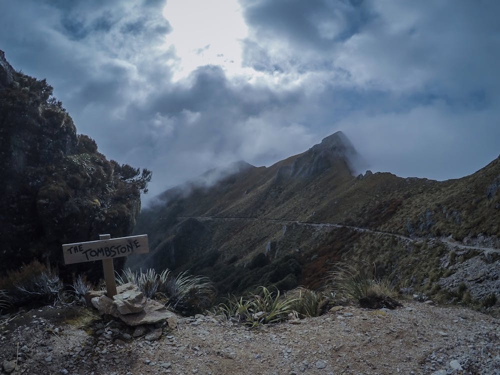
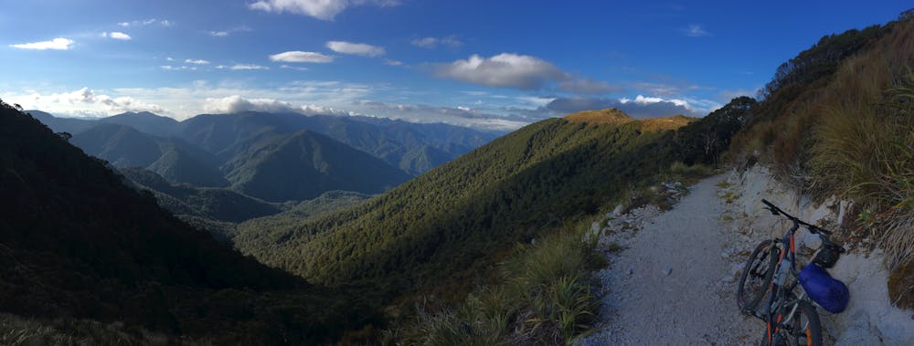
With the logistics sorted, saddle up and begin riding from Lyell Carpark (a Department of Conservation Campground) for 12km up to the Lyell Saddle Hut on a good track which ascends gently. 6km of further climbing and then 6km of spectacular undulating riding lead to the gorgeous Ghost Lake Hut. In a strong field this must be one of the best positioned hut on the South island, and offers a huge panorama across the nearby mountains, as well as peaceful ambience of the lake itself.
From the Ghost Lake Hut there follows a long section of technical descending which leads down to yet another beautiful mountain refuge - the Stern Valley Hut. From here you've got plenty of options and can end your next day at either the Goat Creek Hut, Mokihinui Forks Hut or the Specimen Point Hut. The terrain linking these little shelters is fabulous and you'll take in a series of deep, forested gorges.
From the Specimen Point Hut it's an undulating ride out to the Mokihinui River and the miners track which winds along it to the end of the ride at Seddonville Trailhead.
Difficulty
Difficult
Mostly stable trail tread with some variability featuring larger and more unavoidable obstacles that may include, but not be limited to: bigger stones, roots, steps, and narrow curves. Compared to lower intermediate, technical difficulty is more advanced and grades of slopes are steeper. Ideal for upper intermediate riders.
Medium Exposure

The trail contains some obstacles such as outcroppings and rock which could cause injury.
Remoteness

Little chance of being seen or helped in case of an accident.
Best time to visit
Features
- Technical
- Picturesque
- Singletrack
- In the forest
- Drops
- Roots
- Rock Rolls
- Rock Gardens
- Wooden Feature