The Classic - Nesbyen
Classic wilderness singletrack trail with two incredible summit views.
Mountain Biking Difficult
- Distance
- 16 km
- Ascent
- 721 m
- Descent
- 719 m
- Duration
- 1-2 hrs
- Low Point
- 893 m
- High Point
- 1.2 km
- Gradient
- 8˚

Nesbyen is popular and loved by the MTB locals but unheard of by the rest of Europe and is a true secret, hidden gem. It is host to one of the rounds of the National Enduro Series and this route takes in two of the 2018 stages, so you know it is going to be good.
- •
- •
- •
- •
- •
- •
- •
Description
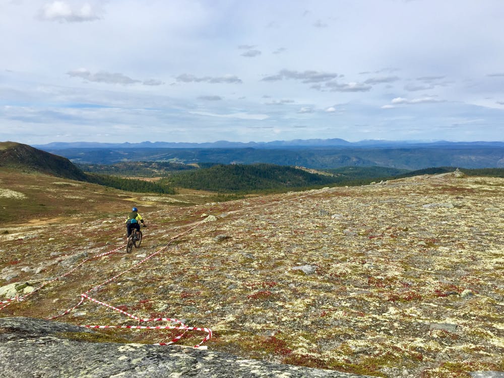
This trail is on the opposite side of the valley from the shorter, DH-style trails that lend more to an uplift, and it is a great showcase of the natural beauty and scenery of this area. It offers a longer ride experience exploring deeper into the wilderness of this beautiful, rugged, open area.
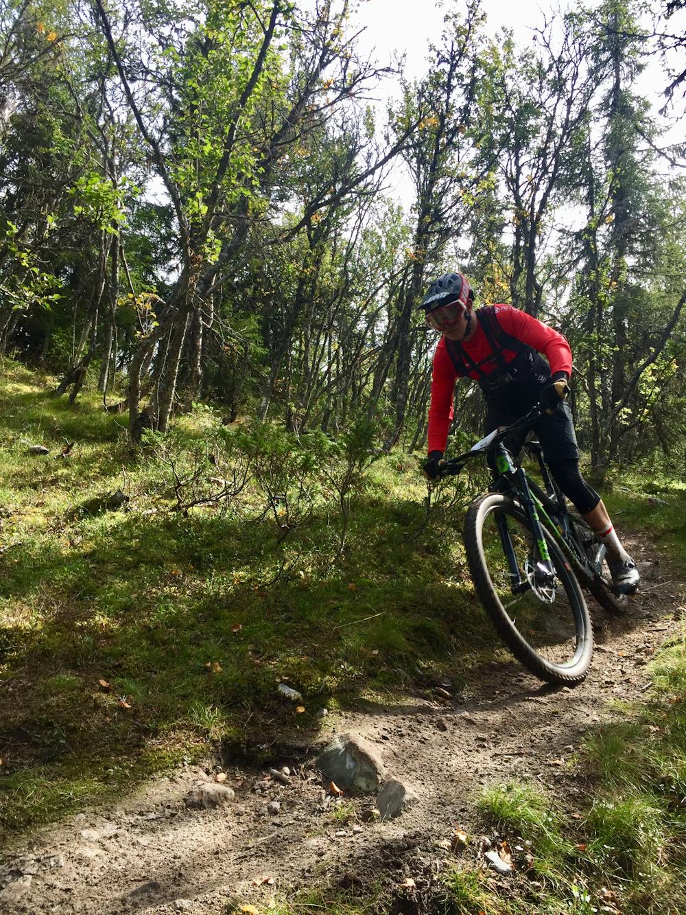
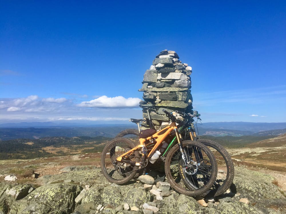
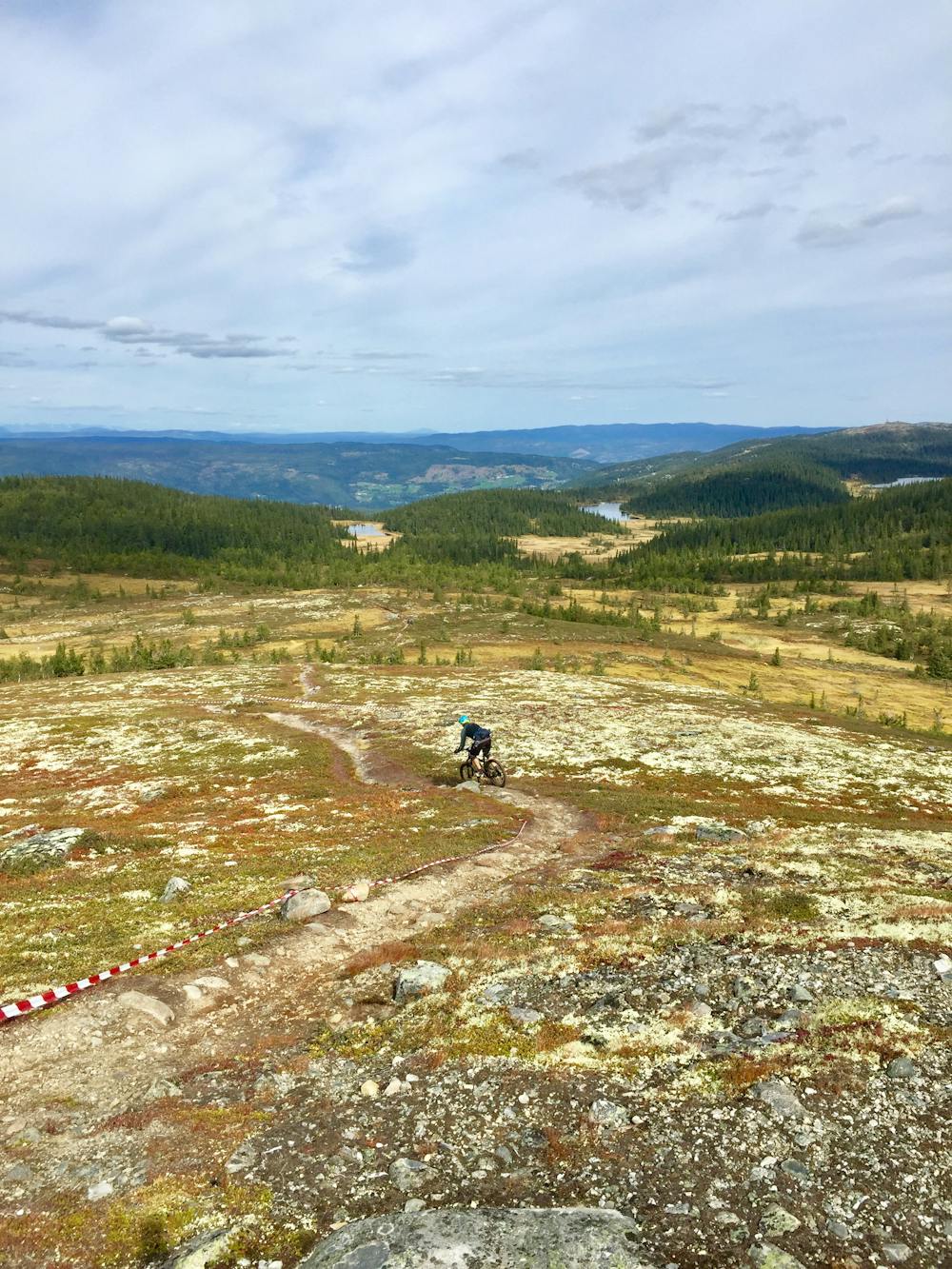
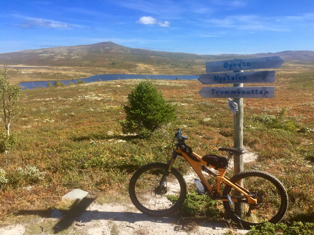
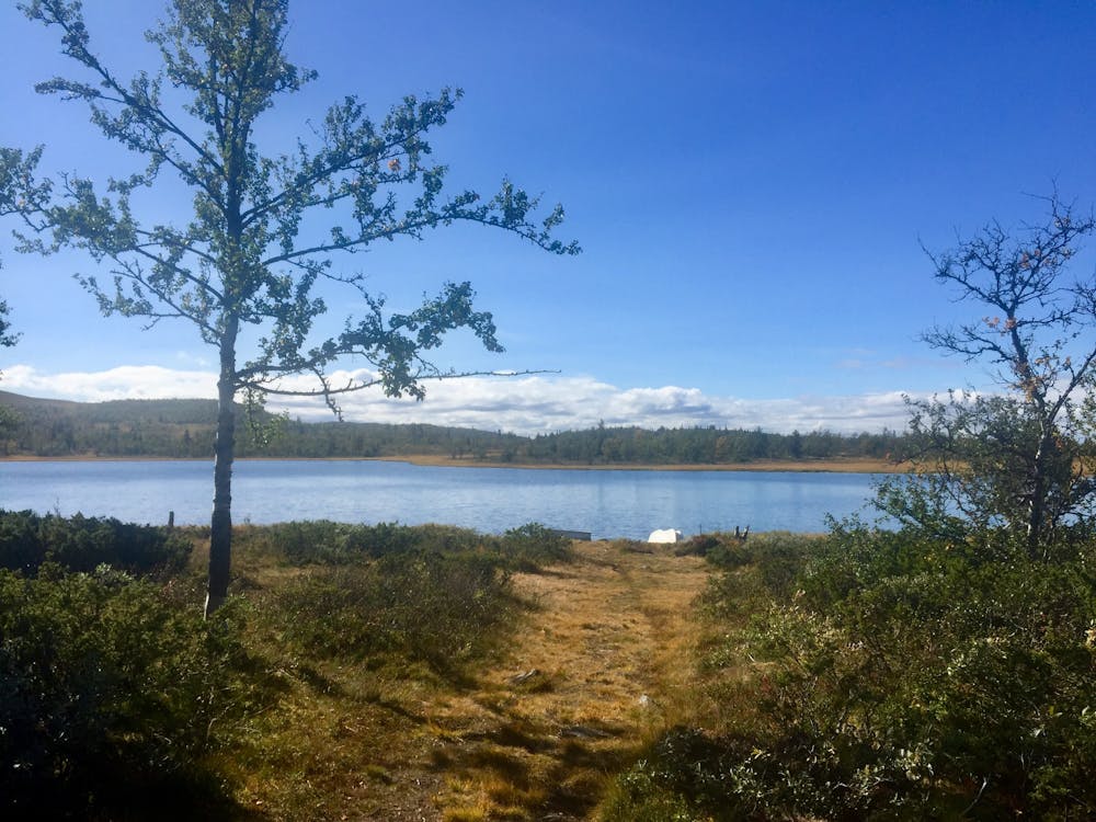
The climb starts from the get-go, initially on gravel road then doubletrack for a short distance. The majority of the route after this is on fabulous, natural singletrack which meanders through open birch forest, until above the tree line, then across an undulating plateau scattered with heath-moss and hardy shrubs and several high lakes (great for a rest place). The climb is steady, mostly without too much steepness, but is continuous and prolonged. There are a few sections where bike pushing is required, but not for longer than 5 minutes each. For a rider of average fitness, without stopping allow 1.5 hours from setting off to the summit of Trommenatten. The views from Trommenatten are amazing, looking over the surrounding areas for miles. There are two further summits after Trommenatten and two lovely, short, flowy descents to enjoy in between where not too much height is lost.
Once the third cairn-top of Smylifjell is reached, there is a long hilly ridge, and the most enjoyable and fun descent of the route starts. Initially, it has the steepest gradient. It is mostly downhill from here except for a couple of kilometers in the middle where a bit of pedaling and negotiation through an undulating birch forest is required. The initial section from the top of Smylifjell has the steepest gradient and is the most enjoyable descent of the route.
When the singletrack ends the route follows the gravel road back to the parking. Allow 3.5 - 4 hrs (without a stop) to complete the route.
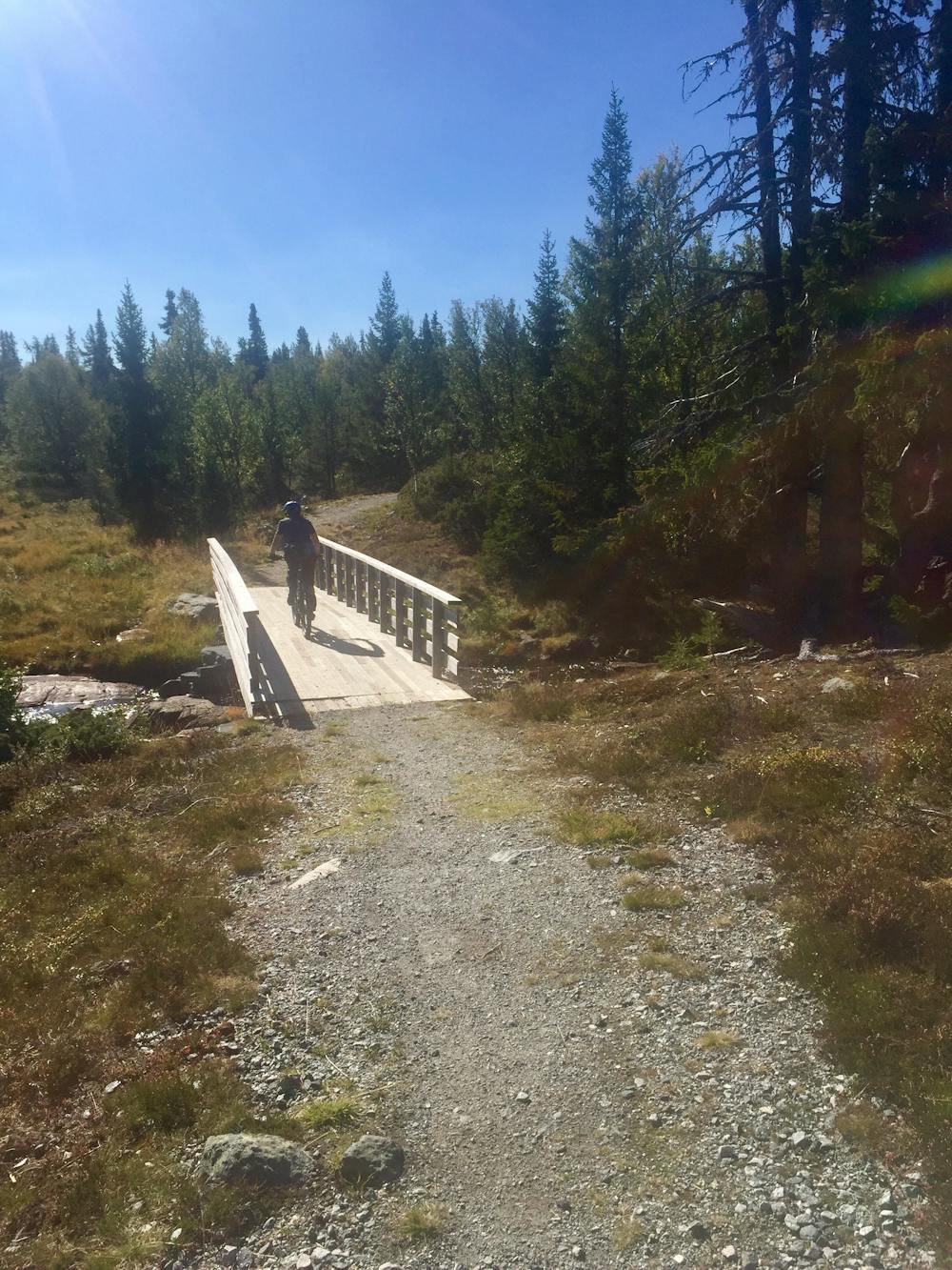
There is nothing too technical throughout the trail but there are some "babyhead" type boulders to negotiate on ascents as well as descents, a few boggy areas which are deceivingly deep (depending on time of year) but all rideable, and a couple of stream crossings (all with stepping stones or a bridge).
Difficulty
Difficult
Mostly stable trail tread with some variability featuring larger and more unavoidable obstacles that may include, but not be limited to: bigger stones, roots, steps, and narrow curves. Compared to lower intermediate, technical difficulty is more advanced and grades of slopes are steeper. Ideal for upper intermediate riders.
Extreme Exposure

Some trail sections are extremely exposed where falling will almost certainly result in serious injury or death.
Remoteness

Away from help but easily accessed.
Best time to visit
Features
- Flow
- Hike a bike
- Roots
- Rock Rolls
- Rock Gardens