Knappen - Stor-Elvdal
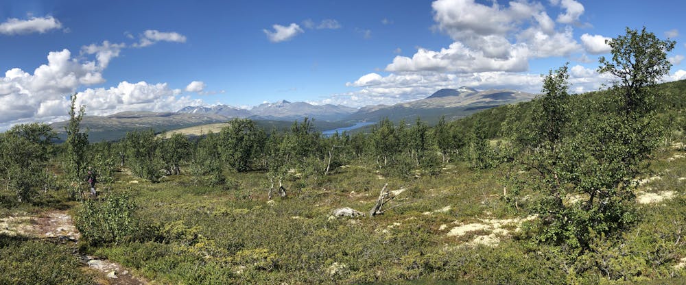
Knappen from Rondetunet, easy 2-3 hours hike to peak and back. Magnificent view.
Hiking Moderate
- Distance
- 3.3 km
- Ascent
- 318 m
- Descent
- 8 m
- Duration
- 1-2 hrs
- Low Point
- 784 m
- High Point
- 1.1 km
- Gradient
- 8˚

This is a popular hiking route which is generally considered to be moderate. It's remote, it features low exposure and is typically done between June and October. From a low point of 784 m to the maximum altitude of 1.1 km, the route covers 3.3 km, 318 vertical metres of ascent and 8 vertical metres of descent.
Description
Easily accessible hike to small peak with spectacular 360 degrees view of area around Atnsjøen: Rondane - Gravskardhøgda - Sølnkletten - Ringebufjellet.
Difficulty
Moderate
Hiking along trails with some uneven terrain and small hills. Small rocks and roots may be present.
Low Exposure

The path is on completely flat land and potential injury is limited to falling over.
Remoteness

Away from help but easily accessed.
Best time to visit
Features
- Picturesque
- Summit Hike
- Family friendly