4 km away
Litlskjorta
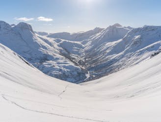
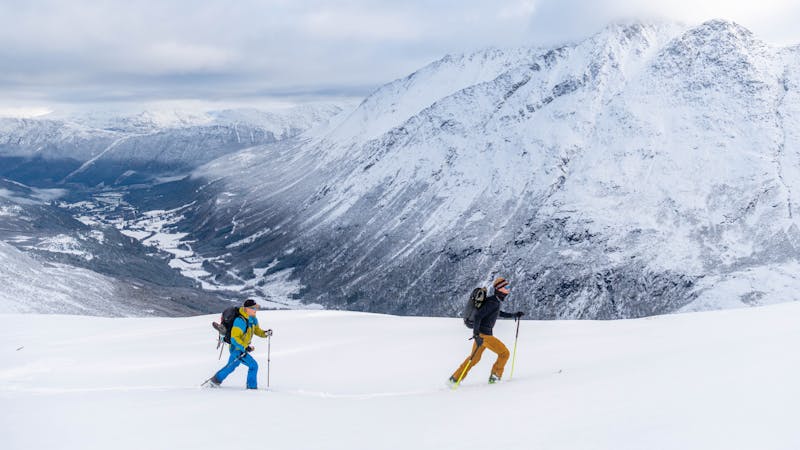
The best descent in Øksendalen!
Difficult Ski Touring
- Distance
- 9.4 km
- Ascent
- 1.4 km
- Descent
- 1.4 km
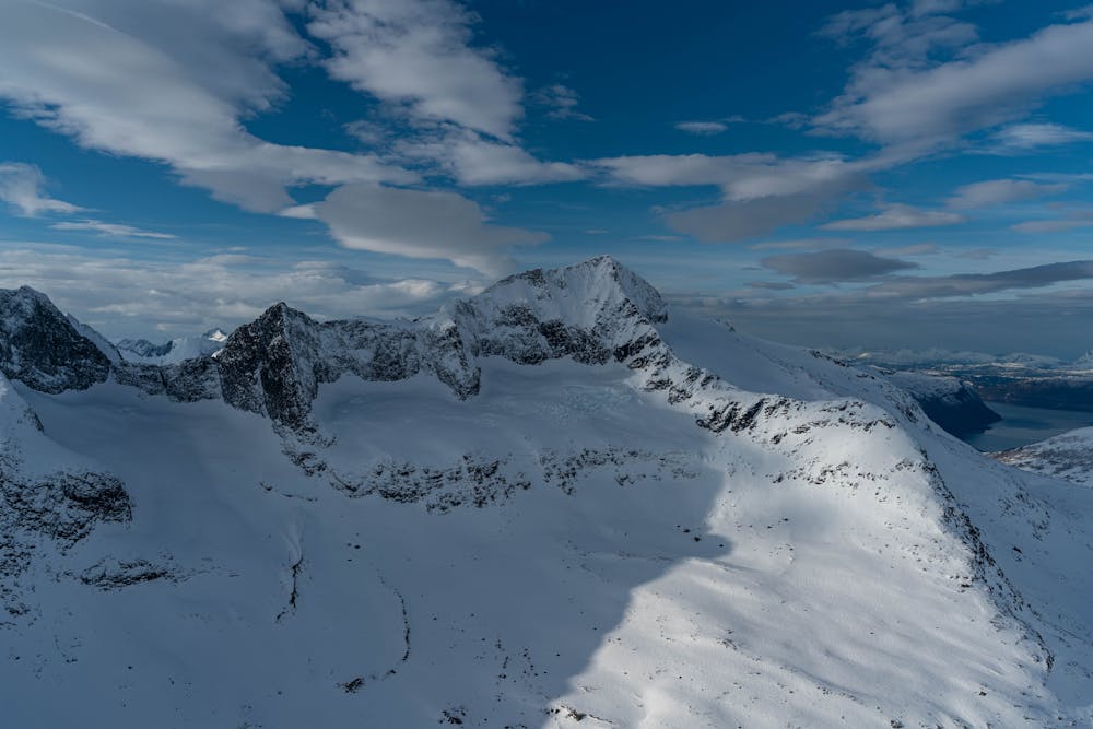
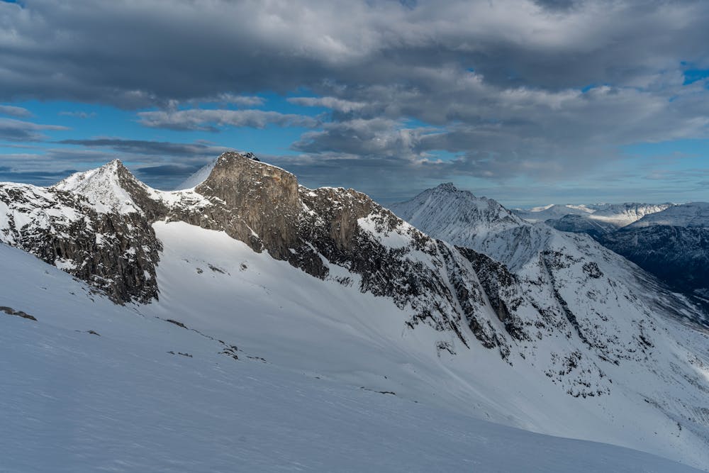
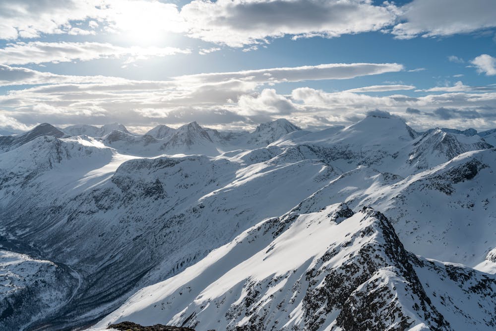
An amazing view over the Skjorta massif and a great descent with several options
Ski Touring Difficult

A less trafficked summit in Øksendalen which offers a fantastic descent in addition to beautiful view from the summit.
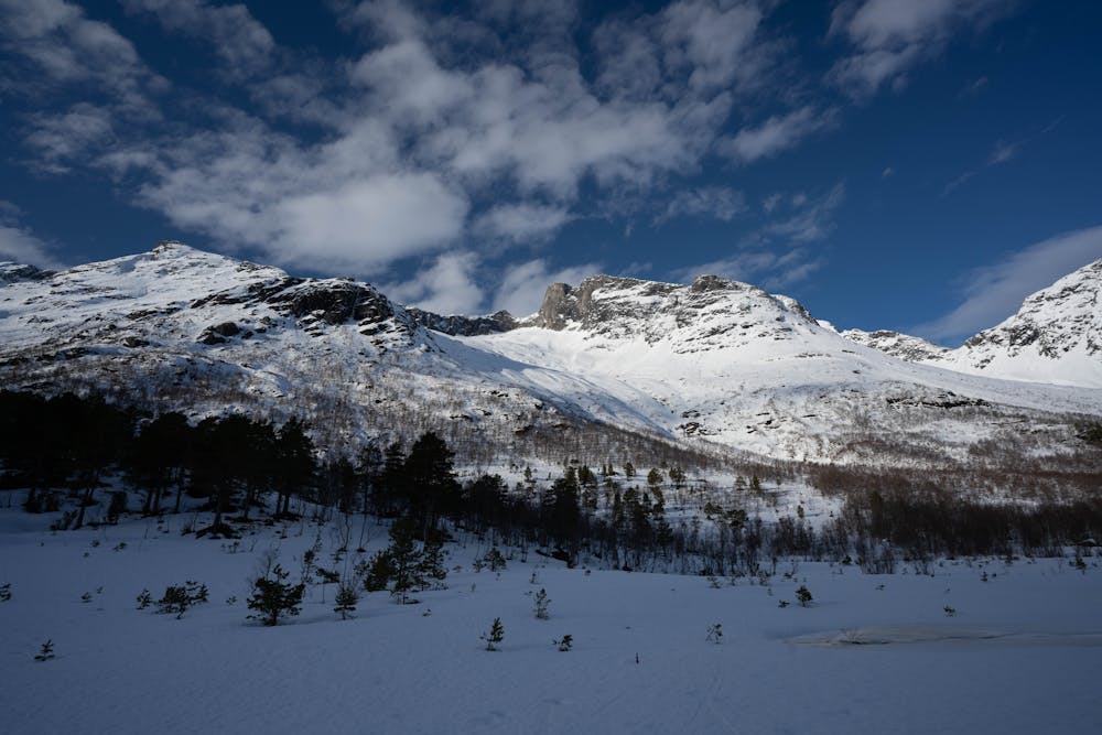
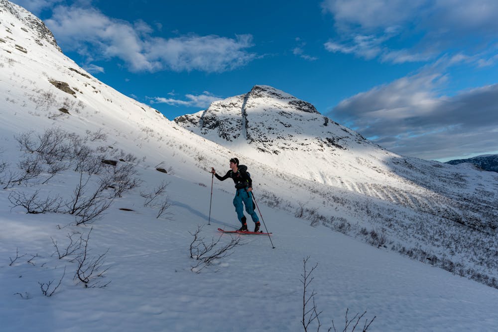
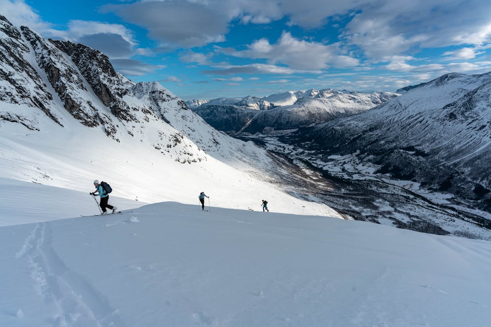
Park you car in proximity of Vollen in Øksendalen. Cross the bridge and follow the road to Bruset. Here you cross another river and follow the road to the west. When the road ends, follow the elevation level to the west. Do not fall for the temptation to gain elevation, this will only lead you to strenuous bush whacking.
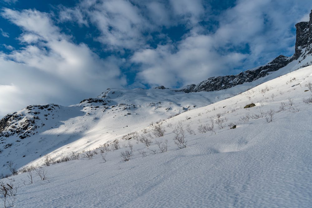
Ideally you will hit some sparse areas in the forest with swamps. Here you can start climbing to the NW above the tree line. You will soon enter a big bowl. This bowl is exposed to big avalanche outlet zones, so remember to consider the avalanche risk. Keep to the west going into more face like terrain which persist with the same incline all the way to the summit.
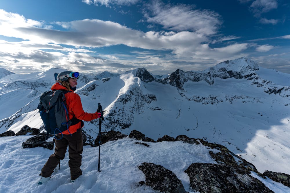
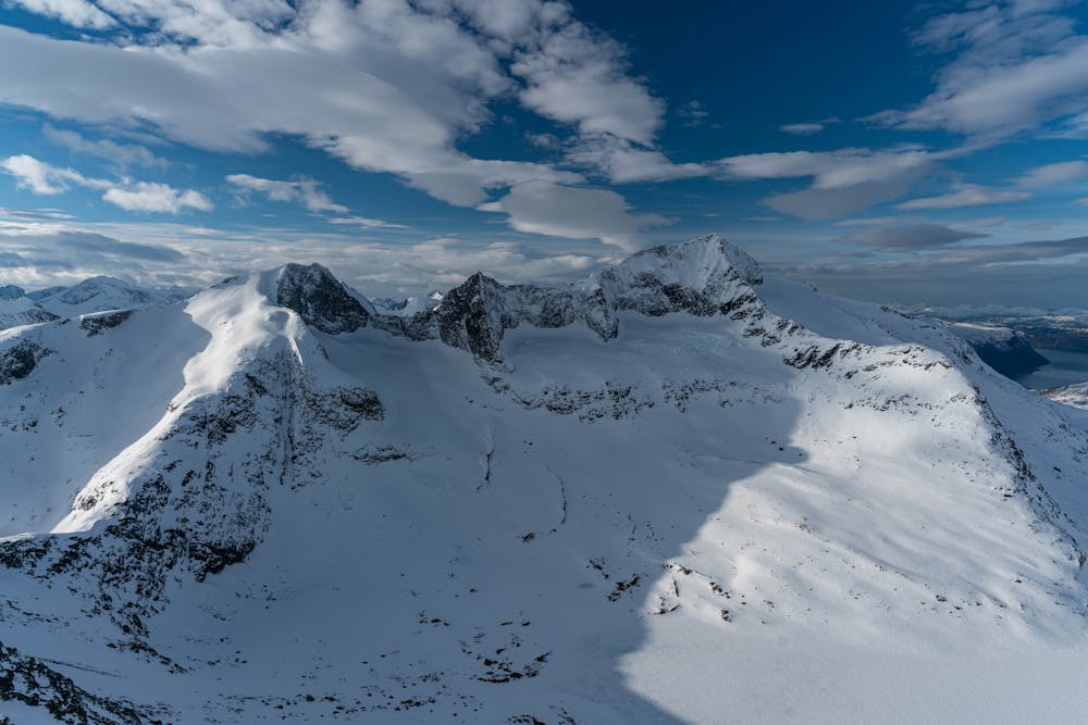
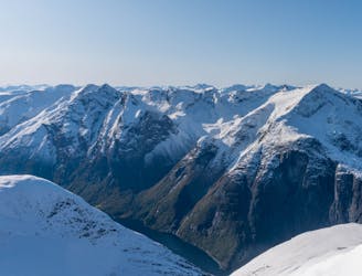
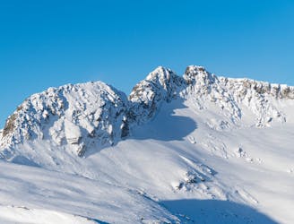
The summit is airy to the west and offers great views over the remaining mountains in Øksendalen. The descent much follows the ascent route. You can pick the line you want to in the top section, choosing between different steepness. Here you have a huge playground in front of you.
When entering the forest again, head straight towards south crossing some swamp sections. It is more efficient to follow the road from Forsetsetra to NE for the out march back to the car.
Difficult
Serious gradient of 30-38 degrees where a real risk of slipping exists.

As well as the slope itself, there are some obstacles (such as rock outcrops) which could aggravate injury.
Away from help but easily accessed.
4 km away
The best descent in Øksendalen!
Difficult Ski Touring
4.1 km away
The most popular ski tour in Øksendalen has a long season
Moderate Ski Touring
7.5 km away
Alpine ski traverse with stunning view over the fjord and a long season
Difficult Ski Touring
8 routes · Ski Touring