Stortinden, Leines
Lofoten
Beautiful half day hike in Brennvika.
Hiking Difficult
- Distance
- 5.2 km
- Ascent
- 741 m
- Descent
- 341 m
- Duration
- 2-3 hrs
- Low Point
- 4 m
- High Point
- 687 m
- Gradient
- 32˚
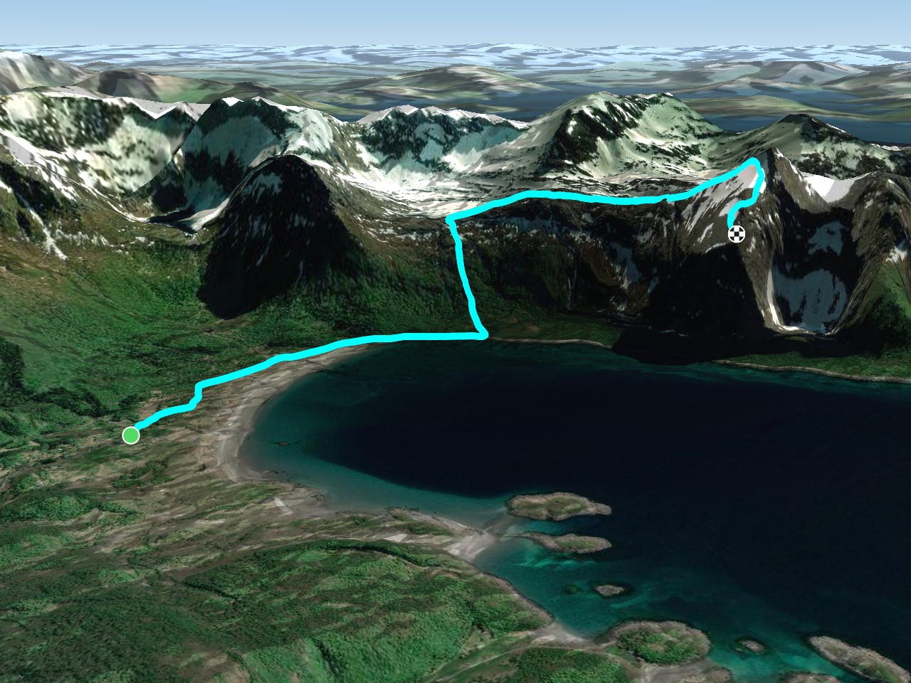
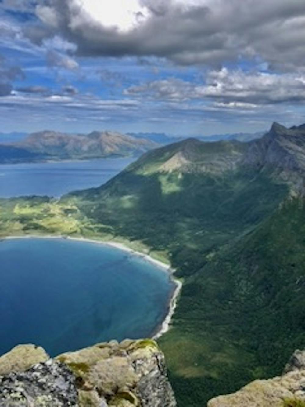
The trail starts in the forest, where you can find a lot of blueberries (in july/august). It's a steep start but the path is very visible until the first lake. Once you get to the lake you're on a rocky path until you reach the top (follow marks or make your own path). Last part can be vertiginous if you are scared of heights. At the top you can enjoy the amazing view of Brennvika (see the picture).
Difficulty
Difficult
Hiking trails where obstacles such as rocks or roots are prevalent. Some obstacles can require care to step over or around. At times, the trail can be worn and eroded. The grade of the trail is generally quite steep, and can often lead to strenuous hiking.
High Exposure

Some trail sections have exposed ledges or steep ascents/descents where falling could cause serious injury.
Remoteness

Away from help but easily accessed.
Best time to visit
Features
- Picturesque
- Summit Hike
- Water features