1.6 km away
Hagskaret Ned Descent
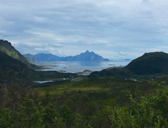
An easy, fast, and fun descent with classic Lofoten scenery.
Moderate Mountain Biking
- Distance
- 2.3 km
- Ascent
- 34 m
- Descent
- 270 m
This natural MTB route is surrounded by stunning, classic Lofoten scenery—an incredible place to ride your bike!
Mountain Biking Difficult
Norway is famed throughout the world for being one of the most dramatic and breathtaking places on the planet! As a result, it's a haven for adventurous explorers.
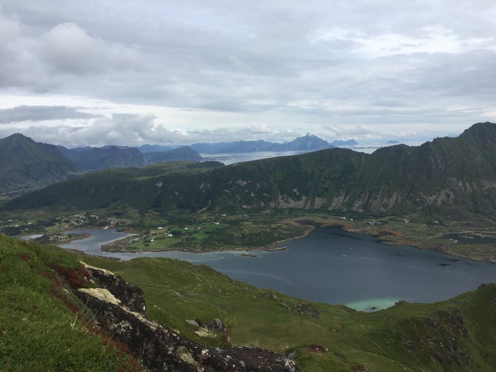
The Lofoten Islands, some would argue, offer the most spectacular of the drama and scenery with hundreds of rugged, foreboding mountains soaring out of the sea, looming high over deep, majestic fjords and with smaller bubble-like islands interspersed.
The Lofoten archipelago on the western coast of Norway is within the Arctic Circle, making it a destination with a restricted period for exploration. All of this makes for a very special, memorable, and challenging place to ride your bike.
The steep landscape of this stunning area does, most often, deny the opportunity to mountain bike, and the routes that are possible mostly utilize existing hiking trails.
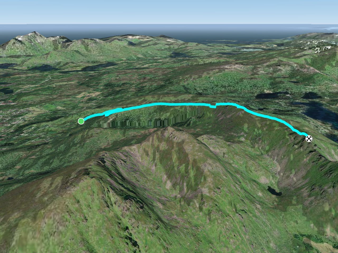
This route is an out-and-back and is mostly all rideable, except for one small section of hike-a-bike on the way up. On the way back down, this same section may prove too steep and technical for the inexperienced rider. At least, during the way up riders can assess this section with a view to riding (or walking) it on the way down. (Alternatively, see the, easier descending route available on FATMAP titled "Hagskaret Ned" which avoids this section on the descent.) Walking down the section is always an option.
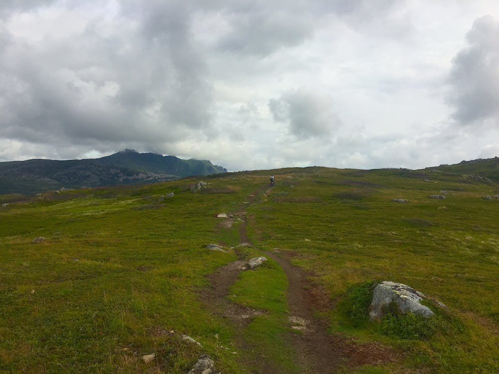
From the small trailhead, the route starts climbing straight away—easy at first, along cattle tracks initially, then onto singletrack winding up through a small wood where the gradient is much steeper.
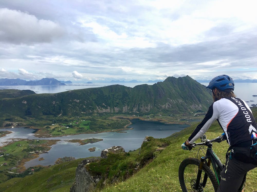
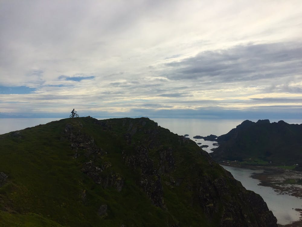
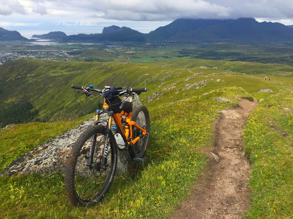
Once above the tree line, the route climbs a flattened ridge, and the Finngluntan summit (and turn around point) can be seen ahead in the distance beyond the lower, earlier peak of Smørdalskammen. The 360 views from this point are incredible, looking over toward neighbouring mountains and ridges, down to fjord and sea ingresses, with small villages dotted around and out to the Arctic Ocean.
To return, follow the same route down, this time with all the fun and thrill of the descent, or opt for the alternative descent option. The descent along the ridge is straight and fast with little to get in the way. Remember the short, technical section once at the tree line.
Difficult
Mostly stable trail tread with some variability featuring larger and more unavoidable obstacles that may include, but not be limited to: bigger stones, roots, steps, and narrow curves. Compared to lower intermediate, technical difficulty is more advanced and grades of slopes are steeper. Ideal for upper intermediate riders.

Some trail sections are extremely exposed where falling will almost certainly result in serious injury or death.

Away from help but easily accessed.
1.6 km away
An easy, fast, and fun descent with classic Lofoten scenery.
Moderate Mountain Biking