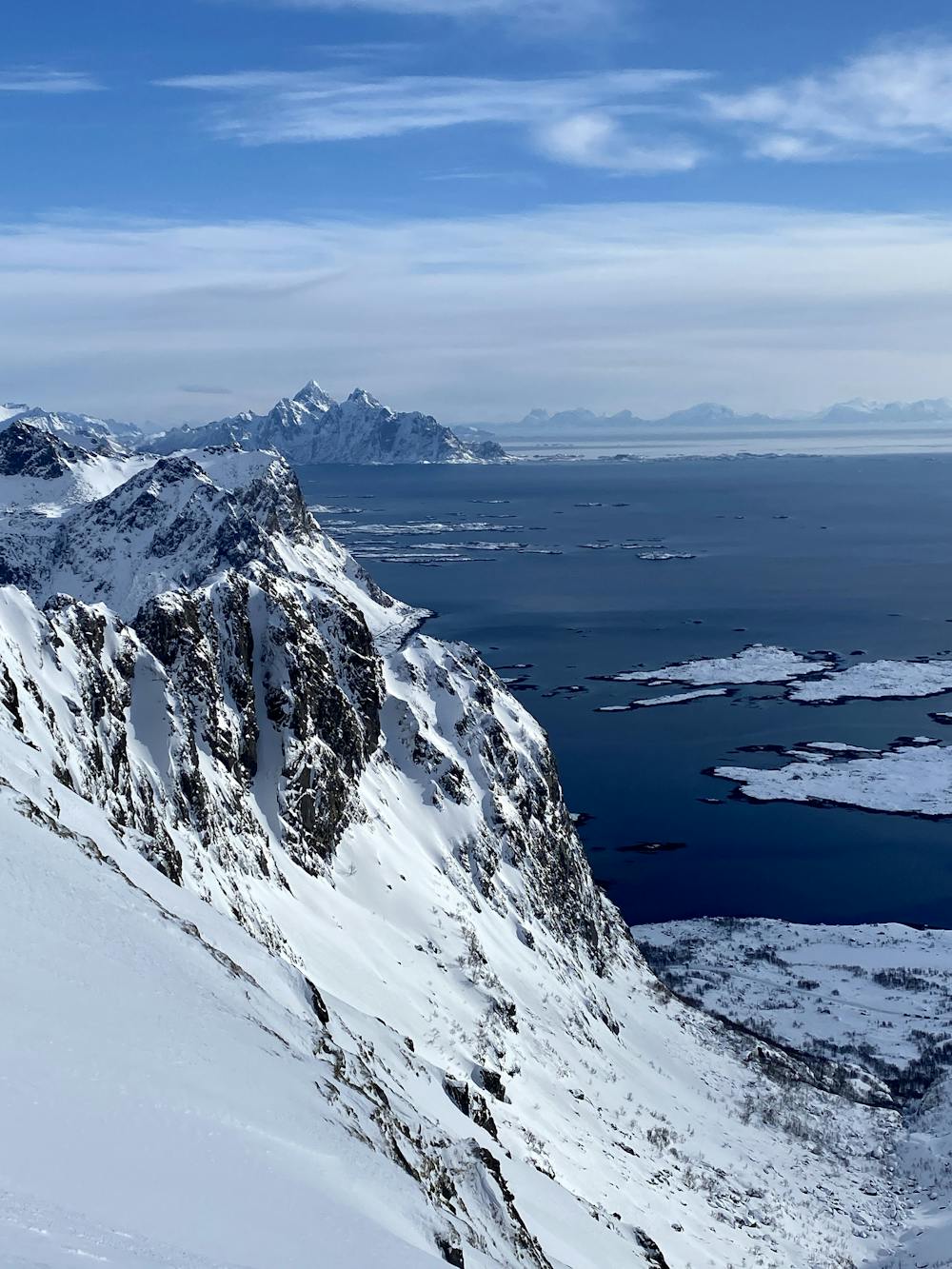
Kangerurtinden Couloir
Lofoten
Beautiful little couloir hidden away from the road with the perfect Lofoten views over the fjords.
Ski Touring Severe
- Distance
- 2.2 km
- Ascent
- 366 m
- Descent
- 366 m
- Duration
- 1-2 hrs
- Low Point
- 5 m
- High Point
- 368 m
- Gradient
- 53˚

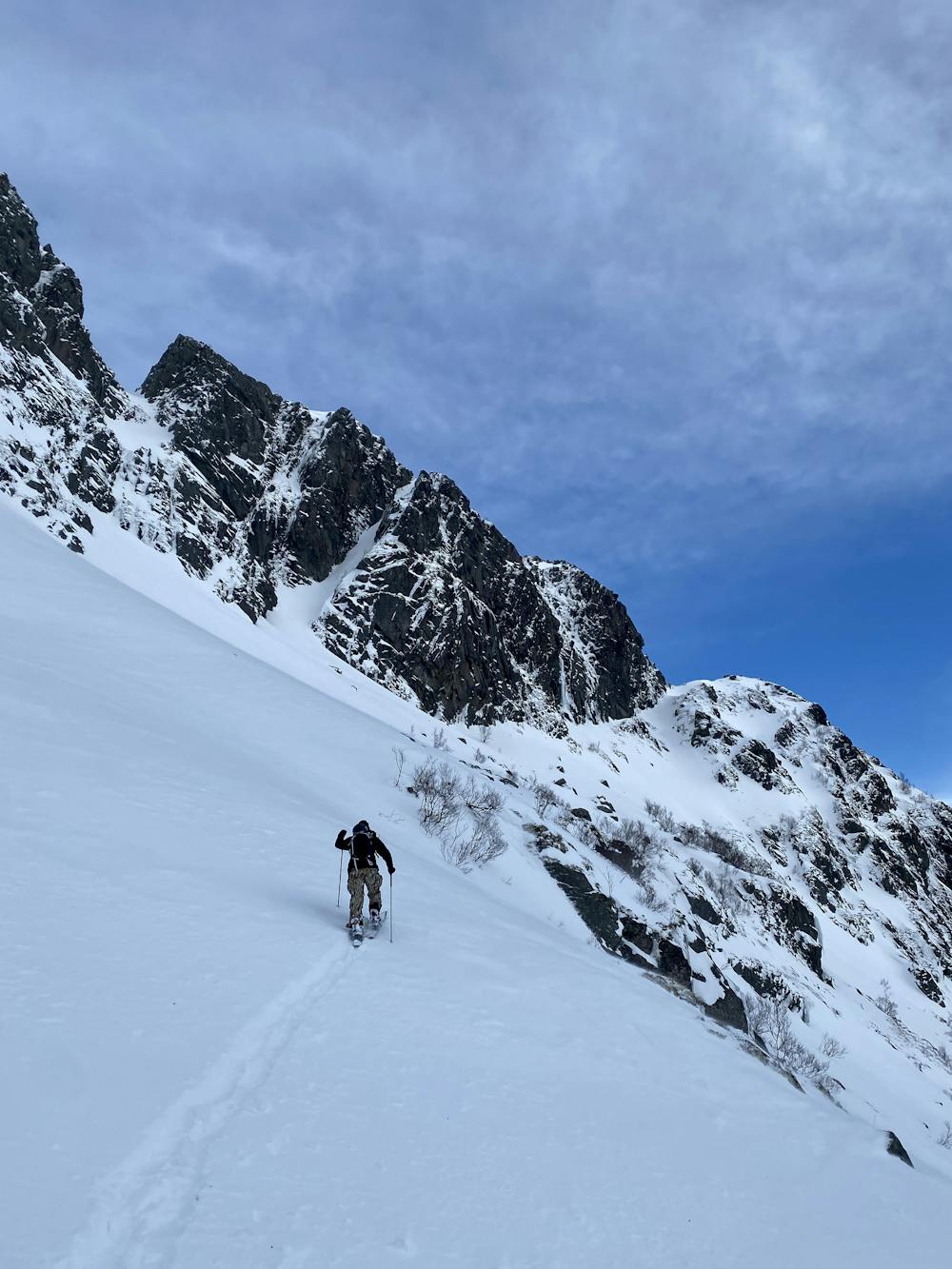
This is a popular ski touring route which is generally considered to be severe. It's very remote, it features medium exposure (e2) and is typically done between February and March. From a low point of 5 m to the maximum altitude of 368 m, the route covers 2.2 km, 366 vertical metres of ascent and 366 vertical metres of descent. It's graded 4.1 and Labande grade 5. You'll need skins to complete it safely.
- •
- •
- •
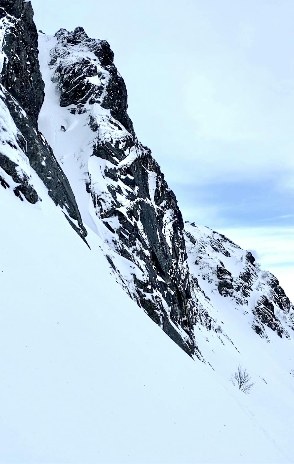
Description
Beautiful little couloir hidden from the road on Kangerurtinden mountain with stunning views of the Fjords and mountains and a nice little line to ride too!
Difficulty
Severe
Steep skiing at 38-45 degrees. This requires very good technique and the risk of falling has serious consequences.
Medium Exposure (E2)

As well as the slope itself, there are some obstacles (such as rock outcrops) which could aggravate injury.
Remoteness

Little chance of being seen or helped in case of an accident.
Best time to visit
Features
- Couloir
Equipment required
- Skins