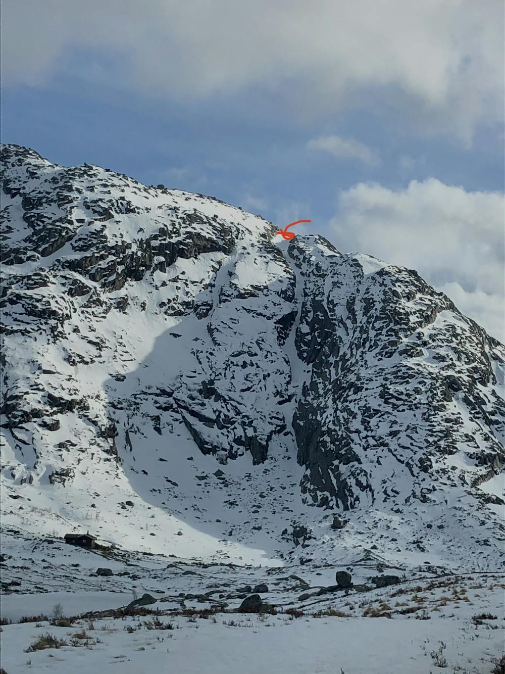
Krolifjellet couloir
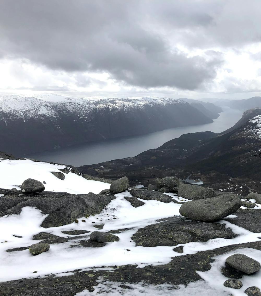
Steep line with nice view of Lysefjorden from the summit
Ski Touring Severe
- Distance
- 2.6 km
- Ascent
- 333 m
- Descent
- 332 m
- Duration
- 1-2 hrs
- Low Point
- 557 m
- High Point
- 874 m
- Gradient
- 46˚

This is a popular ski touring route which is generally considered to be severe. It's not remote, it features medium exposure (e2) and is typically done between January and March. From a low point of 557 m to the maximum altitude of 874 m, the route covers 2.6 km, 333 vertical metres of ascent and 332 vertical metres of descent. It's graded 4.1 and Labande grade 4. You'll need ice axe and crampons to complete it safely.
- •
- •
- •
Description
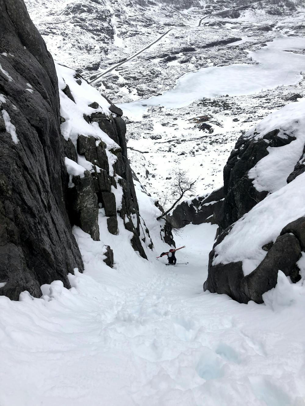
Steep and narrow couloir with nice view of Lysefjorden from the summit. The couloir is easily spotted from the road - park at the closest lay-by, head past the cabin at the bottom of the couloir and up the couloir until it flattens out. Continue easiest way to summit.
Difficulty
Severe
Steep skiing at 38-45 degrees. This requires very good technique and the risk of falling has serious consequences.
Medium Exposure (E2)

As well as the slope itself, there are some obstacles (such as rock outcrops) which could aggravate injury.
Remoteness

Close to help in case of emergency.
Best time to visit
Features
- Couloir
Equipment required
- Ice axe
- Crampons