Gorsa
Lyngen
Ride the Gorsa bridge
Mountain Biking Difficult
- Distance
- 49 km
- Ascent
- 2.7 km
- Descent
- 2.7 km
- Duration
- 6-7 hrs
- Low Point
- 111 m
- High Point
- 602 m
- Gradient
- 12˚

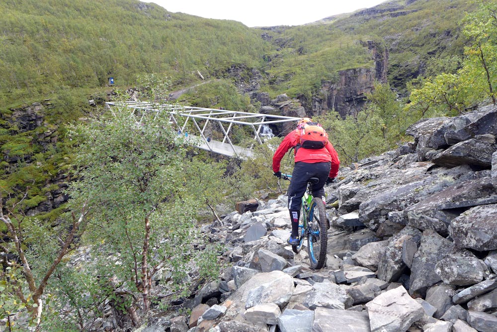
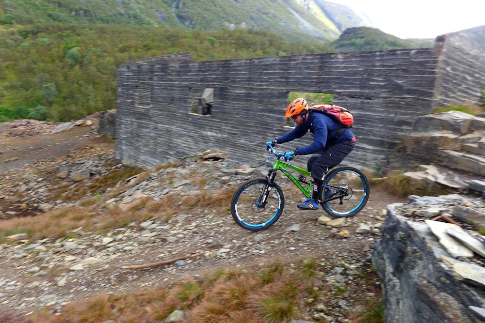
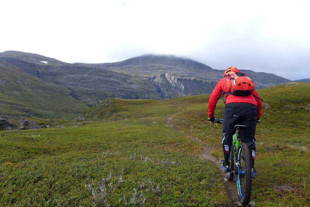
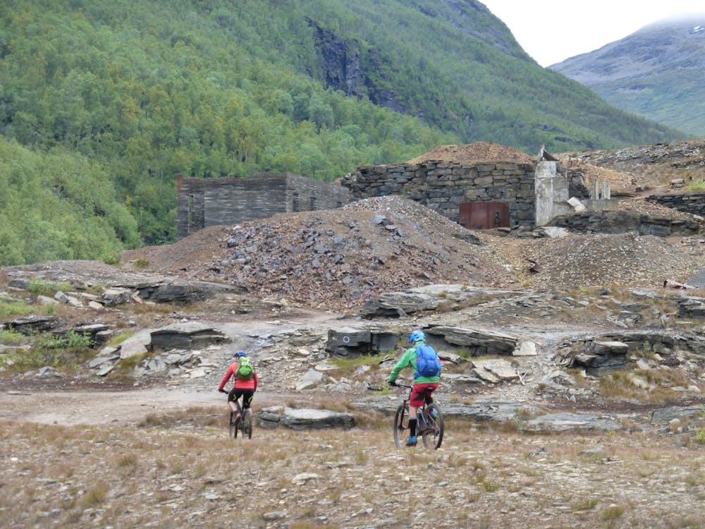
The Gorsa Trail is the gem of the Kåfjorddalen valley. Ride across the breathtaking Gorsa Bridge, which stretches over the 153 m deep Gorsa Canyon. Thrill seekers can even bungee jump off the bridge during the summer season. Pedal up to the highest point on the road. You will pass the impressive steep waterfall, some caves dating from the mining era and the ruins of a three-storey building. There is an alternative start about 1 km earlier, but it’s worth riding all the way to the highest point. Start riding down towards the Sabetjohka hut. Follow the route to the old hut and the Gorsa Bridge. Turn left after 1.8 km. This is a flowy S2 trail with some technical rocks and roots. It’s a lot of fun to ride. The steep descent by the bridge is difficult. Enjoy the airy feeling on the bridge then continue the trail on the other side. There is a 100 m boulder field that you will need to walk across. The next 200 m is a tricky S3 traverse on a narrow single trail with a lot of roots and rocks. After the traverse, the trail gets easier and is mostly comfortable rolling all the way to Ankerlia.
- •
- •
- •
- •
Difficulty
Difficult
Mostly stable trail tread with some variability featuring larger and more unavoidable obstacles that may include, but not be limited to: bigger stones, roots, steps, and narrow curves. Compared to lower intermediate, technical difficulty is more advanced and grades of slopes are steeper. Ideal for upper intermediate riders.
High Exposure

Some trail sections have exposed ledges or steep ascents/descents where falling could cause serious injury.
Remoteness

Away from help but easily accessed.
Best time to visit
Features
- Technical
- Hike a bike
- Picturesque
- Shuttle-run
- Singletrack
- Roots
- Rock Rolls
- Wooden Feature