Round Hike: Dolina Strążyska - Giewont - Kopa Kondracka - Hala Kondratowa - Kalatówki - Sarnia Skała - Dolina Strążyska
Tatra National Park
A round trek summiting Giewont, Kondracka Kopa and Sarnia Skała
Hiking Moderate
- Distance
- 21 km
- Ascent
- 1.6 km
- Descent
- 1.6 km
- Duration
- 6-7 hrs
- Low Point
- 917 m
- High Point
- 2 km
- Gradient
- 25˚

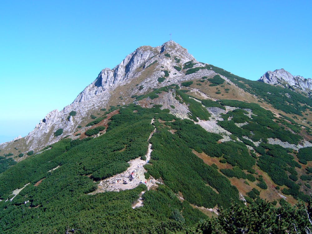
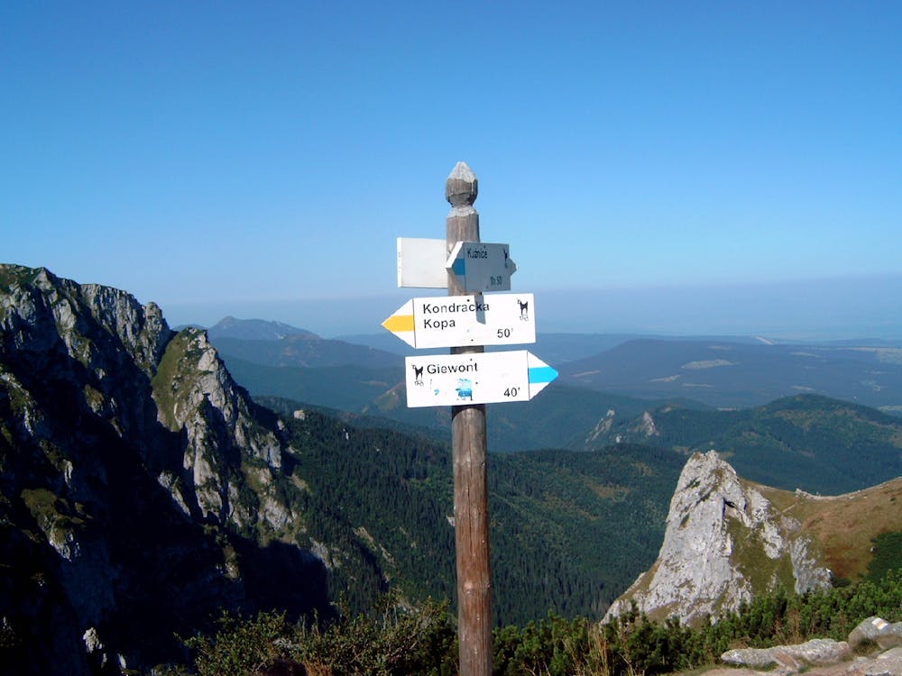
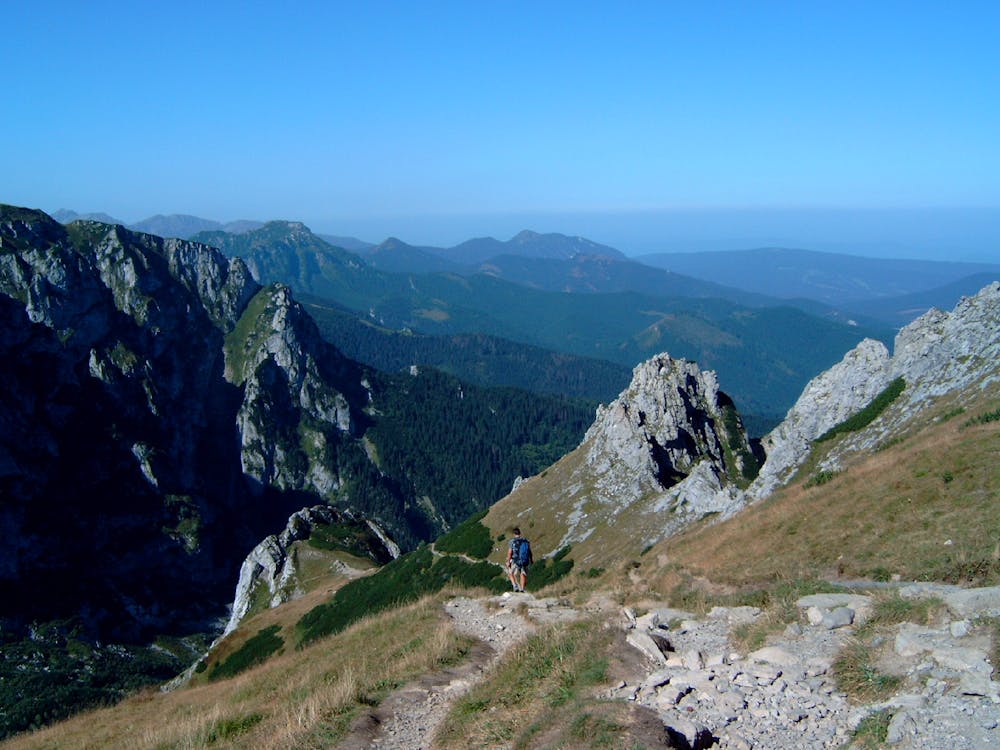
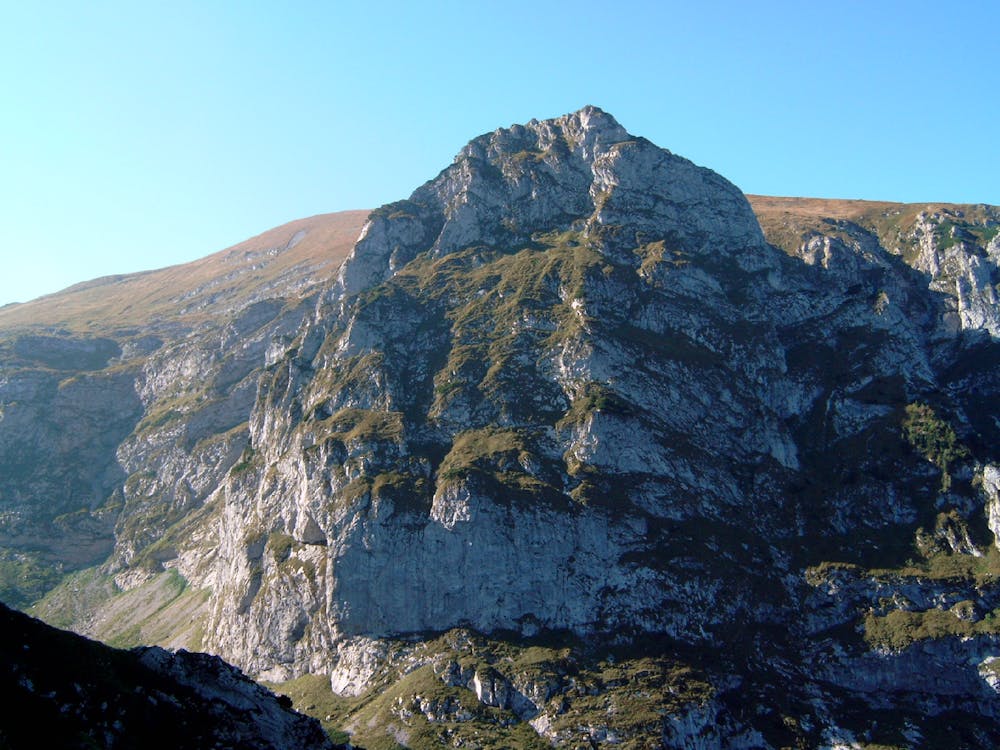
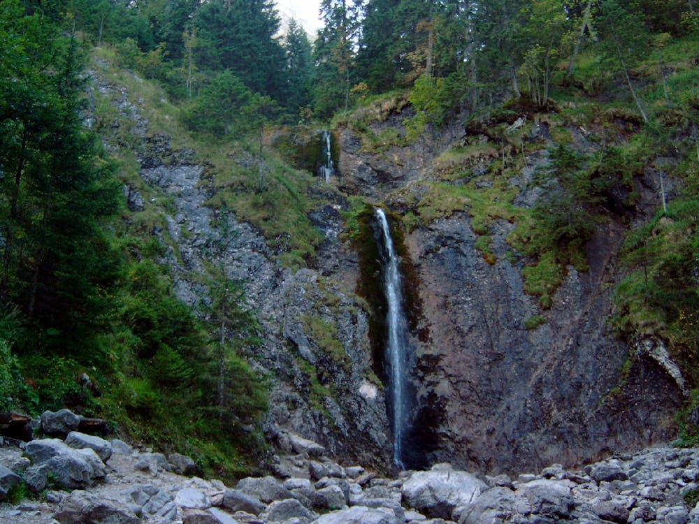
This full day round hike is an ideal proposition for an easy excursion from Zakopane, although you will need stamina for the ascent to Giewont. There is only 30 minutes of quite easy scramble close to the top of Giewont (this section is secured with chains, rocks are very worn out and polished). You can shorten the hike by skipping the last section – from Kalatówki to Sarnia Skała (you can make it a separate walk). You start at the entrance to the Tatra National Park at the exit of the Strążyska valley. You walk up the valley on the only available path leading up the stream (path colour is red) and after 30-45 minutes you reach a path corssing – the red path leading up to the right is the one you will take later – after visiting the café and the cascade that are reached on the black path. You can see the café situated at the foot of Giewont. Another 15 minutes up the black path will take you to the Siklawica cascade (this section is more rocky and slippery). From there you retrace your steps back to the path crossing as the cascade is flowing from a vertical wall up which there is no path. Now you take the red path that is going steeply up the forest slope of Grzybowiec and after 45- 60 minutes to reach the path crossing at the Grzybowiec Pass. You follow the red path up and after some 30 mins of pretty level ridge walk you are exiting the forest and entering the level of the mugo pin. The vista onto the limestone walls of the Great Crag opens on your right. Now the ascent gets steeper again on rocks and loose scree and you can see Giewont rising above you on the left. 45-60 minutes later you reach the Kondracka High Pass, from which you can see the corss on the top of Giewont. You turn upwards on the blue path leading up to Giewont’s summit. This section is an easy rocky scramble secured by chains – the rocks are polished and slippery. Keep to the right as he path diverges – the movement is one way only. After reaching the summit you have wonderful panorama of Zakopane and Podhale from the top of this iconic 500 m limestone wall. Be mindful not to try and explore as the seemingly easy ridge to your right ends in chasms and bluffs that are very treacherous and only available to properly equipped climbers. Descent start behind the cross. After exiting from the secured section continue the blue path to the Kondracka path and then continue on the yellow one along the ridge upwards to the top of Kopa Kondracka, which is a limestone hill. Its top is a perfect place to rest and enjoy the Tatras panorama, before you start descending along the ridge on the red path to the Pass beaneth the Kondracka Kopa. There you leave the ridge and descend into the Kondratowa meadow on the green path. You can see the mountain hut there – a perfect place for lunch. At that hut the green path joins the blue one and you continue down the valley on the blue path. After some 30 minutes the blue path will start climbing up left to the small meadow Kalatówki, where a mountain hotel is situated. There the blue path is crossing with a black one ascending steeply through the forest. You take the black path to ascend to the Red Pass and farther to Sarnia Skała (the Doe Rock). From the pass the path up to the top of the rocky crag of Sarnia Skała is about 30 minutes and you can take a look back at Giewont’s northern wall as well as get a picturesque panorama of Zakopane. You go back to the pass and turn right on the black path that brings you back to the café at the Strążyska clearing, from where you go down the valley on the red path and exit the national park, ending the hike.
- •
- •
- •
- •
- •
Difficulty
Moderate
Hiking along trails with some uneven terrain and small hills. Small rocks and roots may be present.
Medium Exposure

The trail contains some obstacles such as outcroppings and rock which could cause injury.
Remoteness

Close to help in case of emergency.
Best time to visit
Features
- Wildlife
- Picturesque
- Summit Hike
- Wild flowers
- Water features
- Family friendly
- Forestry or heavy vegetation