Round hike: Kuźnice - Murowaniec - Zawarat - Świnica - Kasprowy Wierch - Przełęcz pod Kopą Kondracką - Hala Kondratowa - Kuźnice
Tatra National Park
Spectacular round hike up the forests of Tatras and along the main ridge of the Polish Tatras, summitting Świnica and Kasprowy Wierch
Hiking Moderate
- Distance
- 24 km
- Ascent
- 1.8 km
- Descent
- 1.7 km
- Duration
- 1 day +
- Low Point
- 912 m
- High Point
- 2.2 km
- Gradient
- 29˚

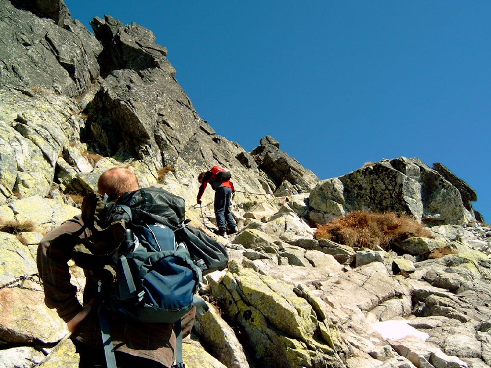
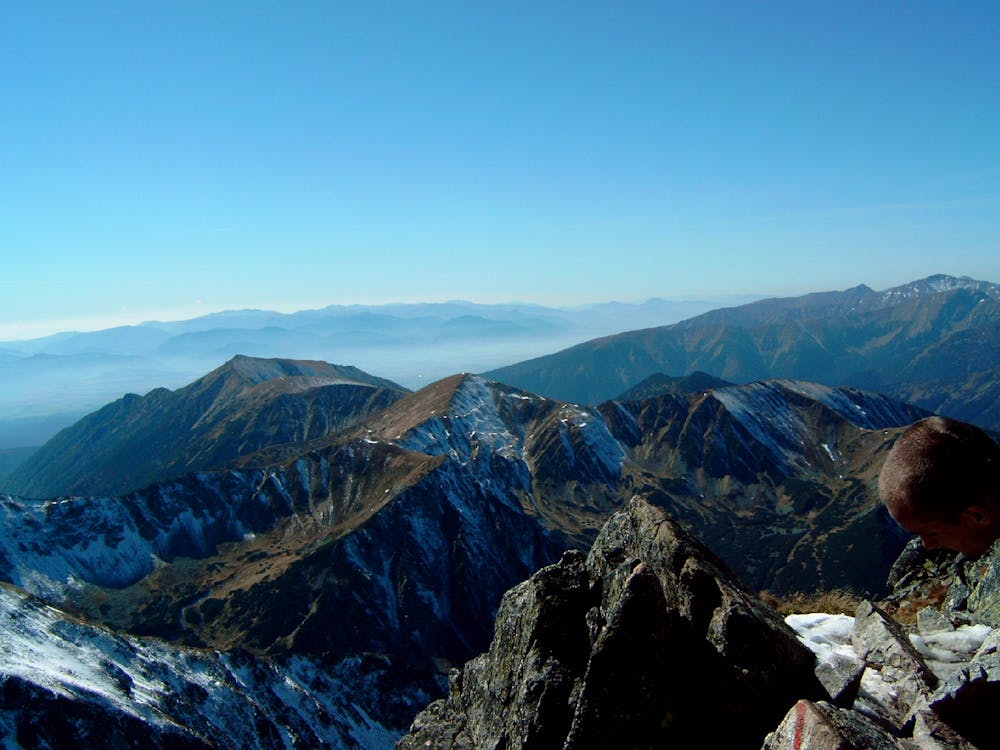
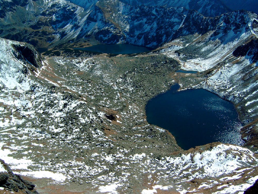
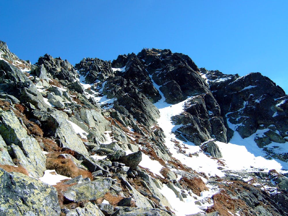
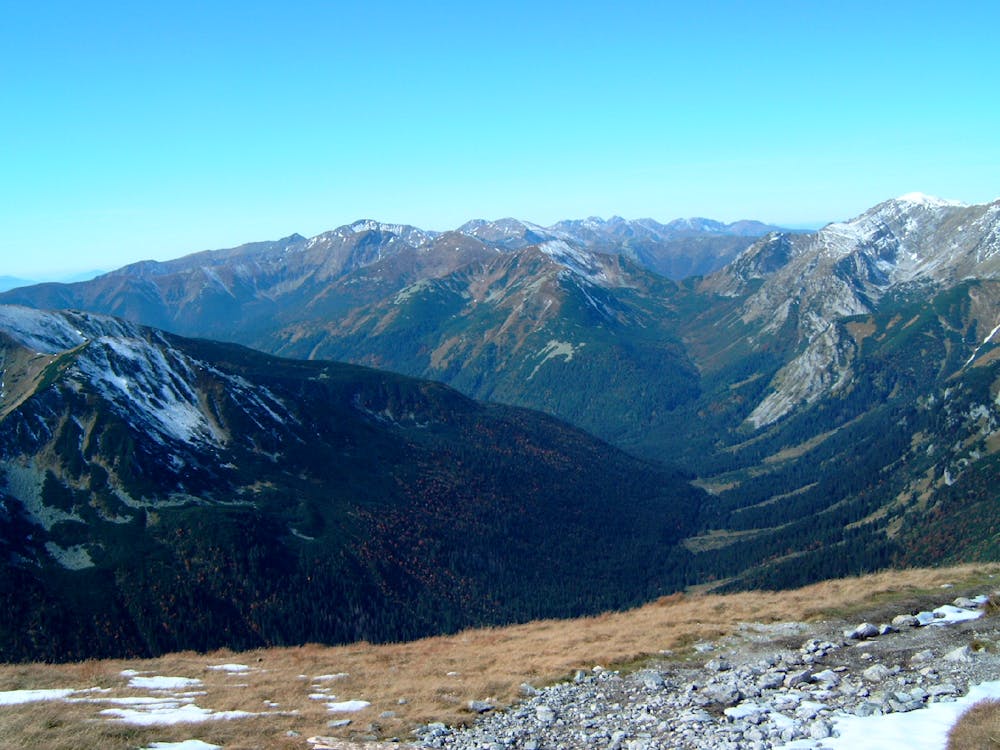
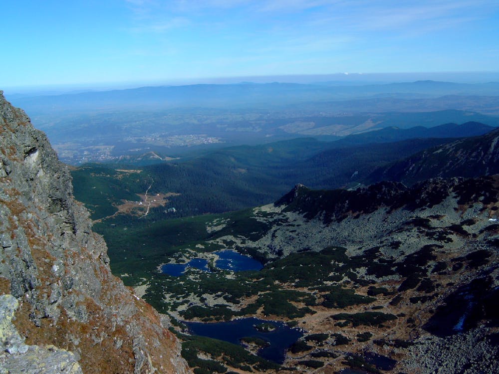
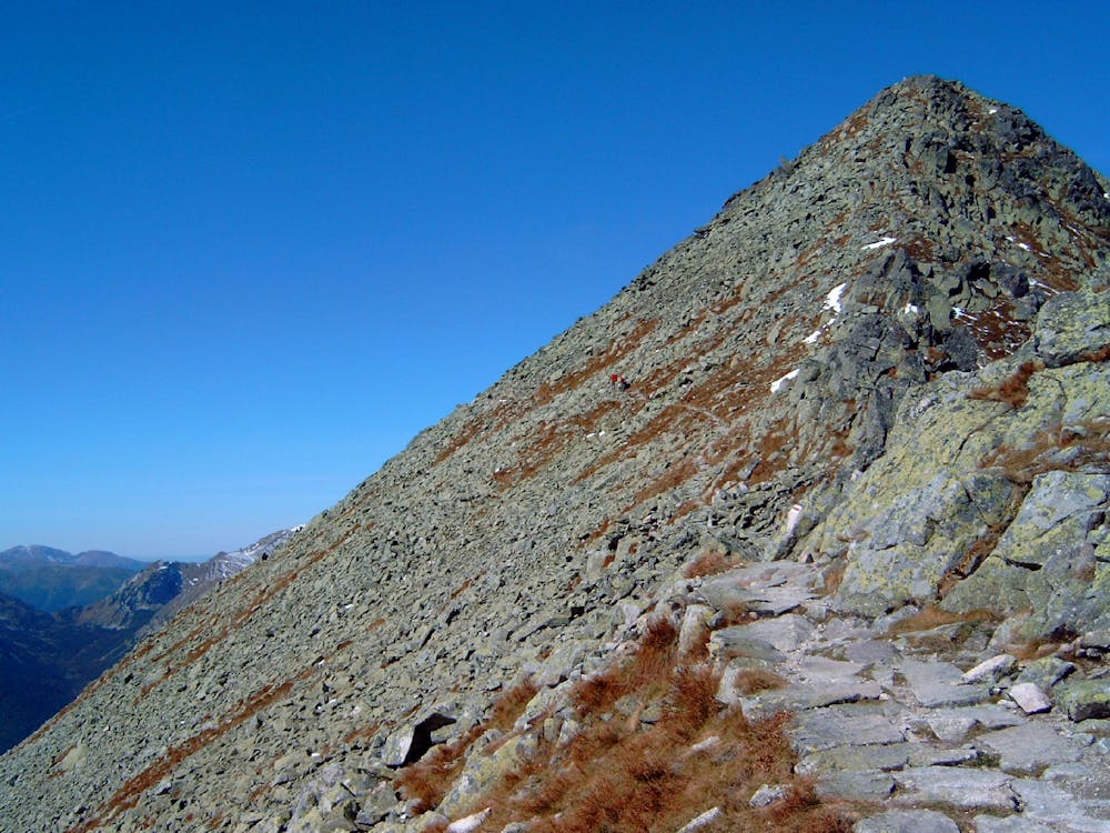
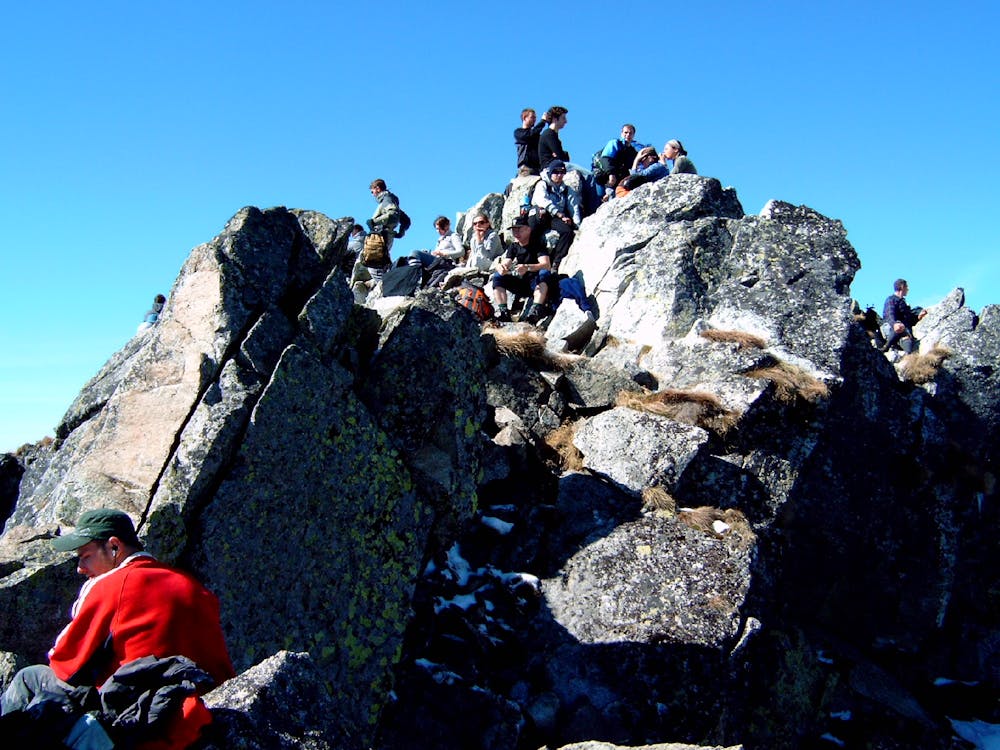
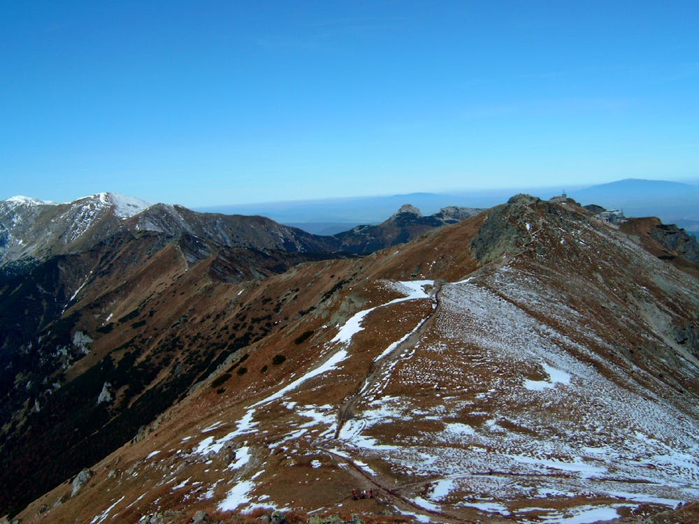
THIS HIKE IS CURRENTLY IMPOSSIBLE (2019) DUE TO ACTIVE ROCKFALL BETWEEN ZAWRAT PASS AND ŚWINICA, IN THE REGION OF THE BLUE CRAG (NIEBIESKA TURNIA) Starting in Kuźnice, next to the bottom cable car station you ascend through the Tatra forest and across the Kopas ridge on the blue colour path. You should reach the Gąsienicowa high mountain vast meadow and valley, where you can visit the Murowaniec mountain hut afte 90-120 minutes. From there you ascend mildly to the Black Gąsienicowy Pond with a wonderful vista of the main Polish High Tatras ridge. You walk around the big pond and start ascending more steeply to a smaller 'Frozen' Pond and further up, towards the Zawrat Pass on a section that gets ever steeper and ends in a 45-1h long secured section that requires surefootedness and some rock scrambling. From the pass you would west on the red-colour path but keep in mind – as of 2019 this section is closed due to active rock fall – please check the TPN website to see if the trail was re-open and if not – do not take it! The red trail traverses a steep slope and here your surefootedness and head for heights will be tested. After some 45 minutes you reach the slopes of Świnica, where you climb up on steep rock plates. There are some chains and metal ladders making this possible. The crux is a gully of a dozen meters, which leads to the summit section. Świnica has two summits – only one of them is available for hikers – the other one can be climbed only by climbers with full equipment. The summit is a great place to take a break but be mindful of the steep northern walls that are several hundred meters high. The summit is also famously attracting lighting during thunderstorms and should be avoided in the afternoons, when thunderstorms are common. From the summit you continue on the red trail through crumbly rock plates and boulder slopes that are secured with metal chains and clasps at places. Soon you descend on a boulder slope out of which the path leads out onto the easy grassy ridge with several hilly summits that do not give you any problems. You continue on the ridge to the top station of the cable car at Kasprowy Wierch. You obviously can take the car or one of the several paths descending back to Kuźnice but this hike continues on the main ridge, which is very picturesque and easy, giving a vista onto the Slovakian part of the Tatras. After some 60-90 minutes on the ridge you reach the pass before the longer ascent of Kopa Kondracka and you start descending quite steeply on the rock path of green colour. You reach the Kodratowa meadow with its mountain hut and from there continue down the valley on the same path, which now changes its colour to blue. Another 60-90 minutes down that path you will reach the entrance to the national park, where your hike started.
- •
- •
- •
- •
- •
- •
- •
- •
- •
Difficulty
Moderate
Hiking along trails with some uneven terrain and small hills. Small rocks and roots may be present.
High Exposure

Some trail sections have exposed ledges or steep ascents/descents where falling could cause serious injury.
Remoteness

Away from help but easily accessed.
Best time to visit
Features
- Alpine
- Wildlife
- Picturesque
- Summit Hike
- Wild flowers
- Water features
- Forestry or heavy vegetation