MIUT 2019
Ultra Trail World tour
Trail Running Extreme
- Distance
- 114 km
- Ascent
- 7.9 km
- Descent
- 7.9 km
- Duration
- 1 day +
- Low Point
- 4 m
- High Point
- 1.8 km
- Gradient
- 19˚
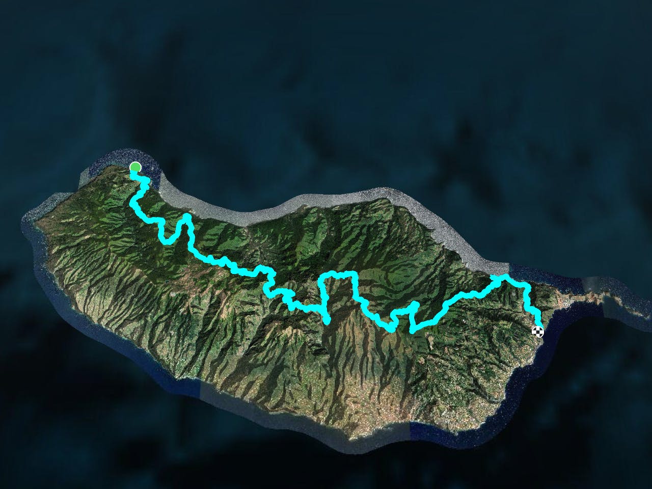
This is a popular trail running route which is generally considered to be extreme. It's not remote, it features low exposure and is typically done in undefined. From a low point of 4 m to the maximum altitude of 1.8 km, the route covers 114 km, 7891 vertical metres of ascent and 7910 vertical metres of descent.
Description
A very nice route, but difficult to do in one day
Difficulty
Extreme
Low Exposure

The path is on completely flat land and potential injury is limited to falling over.
Remoteness
Close to help in case of emergency.