TELEGONDOLA - CABANA PUZDRELE-GALATZ-PALTINIS
Traseu tematic din Parcul National Muntii Rodnei cu doua variante de dificultate
Hiking Moderate
- Distance
- 11 km
- Ascent
- 697 m
- Descent
- 680 m
- Duration
- 3-4 hrs
- Low Point
- 1.5 km
- High Point
- 2 km
- Gradient
- 14˚

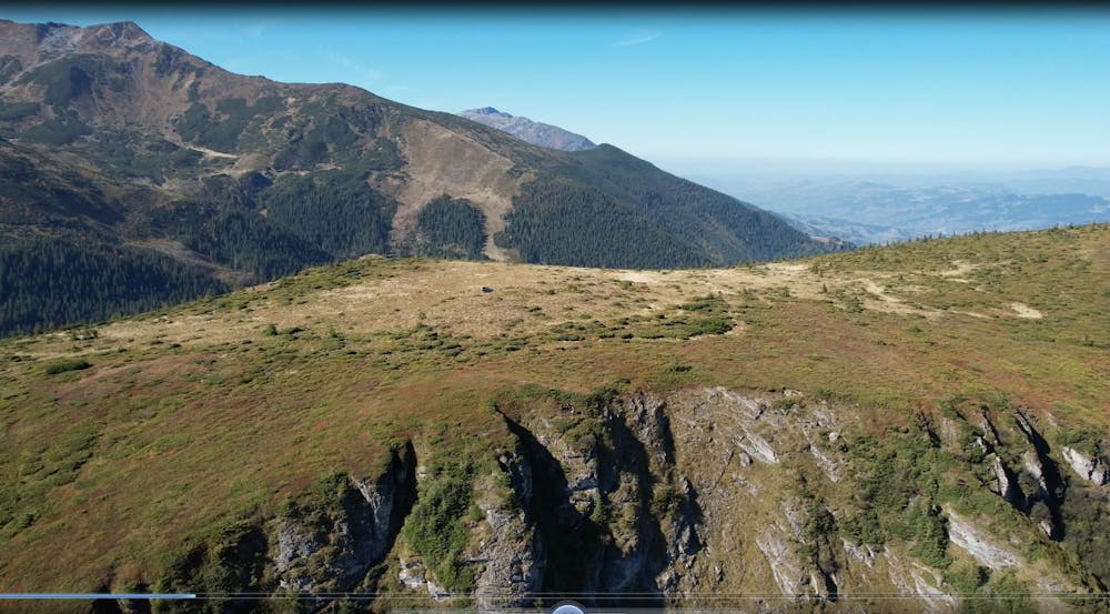
This is a popular hiking route which is generally considered to be moderate. It's remote, it features medium exposure and is typically done between April and October. From a low point of 1.5 km to the maximum altitude of 2 km, the route covers 11 km, 697 vertical metres of ascent and 680 vertical metres of descent.
Description
Traseul tematic are 11 statii de vizitare , fiecare topic prezentand cateva dintre ecosistemele, habitatele speciile pentru care acest teritoriu a fost desemnat parc national
Difficulty
Moderate
Hiking along trails with some uneven terrain and small hills. Small rocks and roots may be present.
Medium Exposure

The trail contains some obstacles such as outcroppings and rock which could cause injury.
Remoteness
Away from help but easily accessed.
Best time to visit
Features
- Alpine
- Wildlife
- Picturesque
- Summit Hike
- Wild flowers
- Family friendly
- Forestry or heavy vegetation