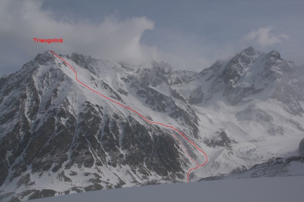
Trieugolnik
Trieugolnik из Уллу-Тау
Ski Touring Difficult
- Distance
- 13 km
- Ascent
- 1.5 km
- Descent
- 1.5 km
- Duration
- 7-8 hrs
- Low Point
- 2.3 km
- High Point
- 3.8 km
- Gradient
- 43˚

This is a popular ski touring route which is generally considered to be difficult. It's very remote, it features high exposure (e3) and is typically done between February and March. From a low point of 2.3 km to the maximum altitude of 3.8 km, the route covers 13 km, 1495 vertical metres of ascent and 1498 vertical metres of descent. It's graded 3.3 and Labande grade 4. You'll need rope, skins, ice axe and crampons to complete it safely.
Description
Вершина Трегольник
Difficulty
Difficult
Serious gradient of 30-38 degrees where a real risk of slipping exists.
High Exposure (E3)

In case of a fall, death is highly likely.
Remoteness
Little chance of being seen or helped in case of an accident.
Best time to visit
Equipment required
- Rope
- Skins
- Ice axe
- Crampons