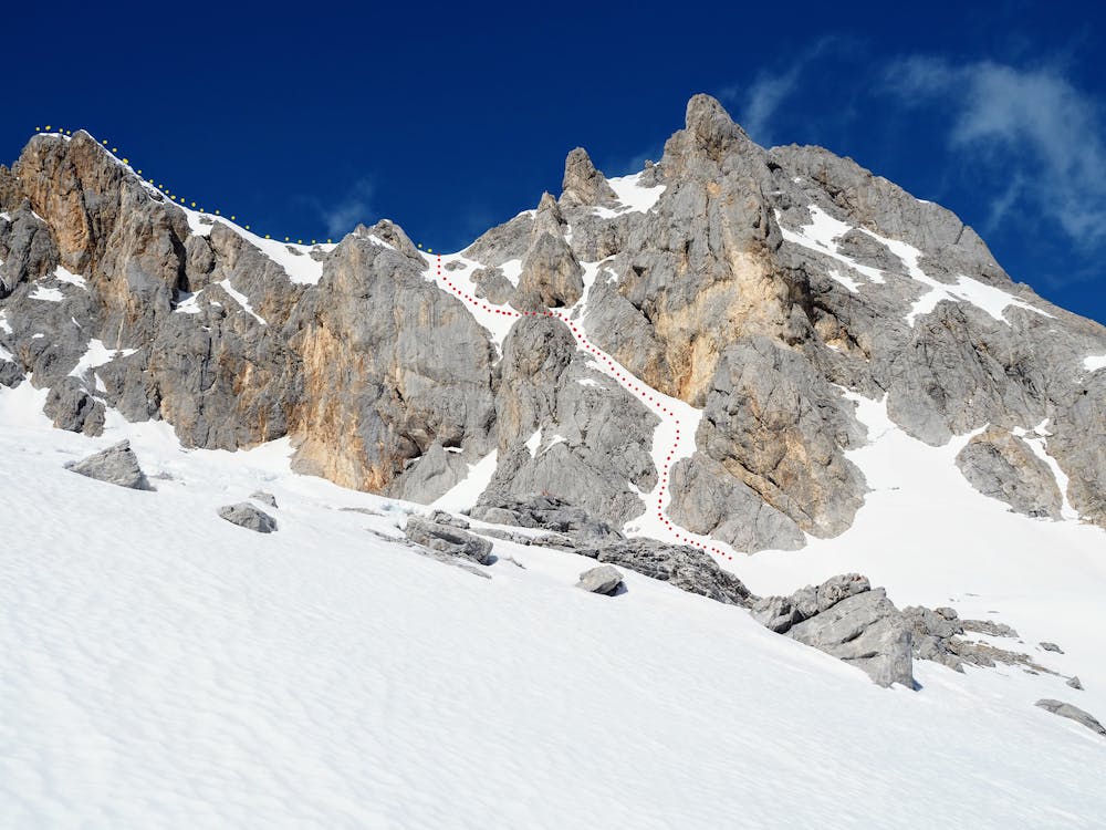
Torre de La Párdida (2.592 m.), Canal SE
Picos de Europa
Invernal a la canal SE de la Torre de la Párdida
Alpine Climbing Difficult
- Distance
- 5.9 km
- Ascent
- 696 m
- Descent
- 696 m
- Low Point
- 1.9 km
- High Point
- 2.6 km
- Gradient
- 25˚

This is a popular alpine climbing route which is generally considered to be difficult. It's remote, it features medium exposure and is typically done between November and March. From a low point of 1.9 km to the maximum altitude of 2.6 km, the route covers 5.9 km, 696 vertical metres of ascent and 696 vertical metres of descent. You'll need ice axe, crampons and 2 ice axes to complete it safely.
Description
Ascensión desde Refugio Urriellu Invernal a la Torre de la Párdida por la canal SE y vuelta por ruta normal y Corona del Raso
Difficulty
Difficult
The beginning of truly technical terrain which might involve pitched climbing on rock and/or ice, exposed terrain and complex route finding in ascent and descent. Equivalent to AD, AD+
Medium Exposure

The route features some exposed and/or difficult to protect sections.
Remoteness
Away from help but easily accessed.
Best time to visit
Equipment required
- Ice axe
- Crampons
- 2 Ice Axes