Circular Peña Santa - Picos de Europa - ETAPA 2
Picos de Europa
Espectacular travesía por el corazón de Picos de Europa
Also in León, Spain
Hiking Difficult
- Distance
- 9.1 km
- Ascent
- 897 m
- Descent
- 829 m
- Duration
- 3-4 hrs
- Low Point
- 1.4 km
- High Point
- 2.1 km
- Gradient
- 19˚
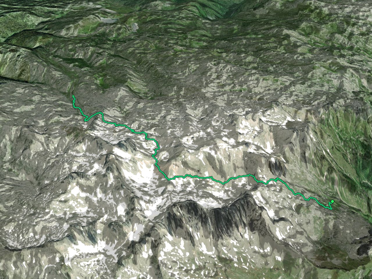
This is a popular hiking route which is generally considered to be difficult. It's very remote, it features high exposure and is typically done between June and October. From a low point of 1.4 km to the maximum altitude of 2.1 km, the route covers 9.1 km, 897 vertical metres of ascent and 829 vertical metres of descent.
Description
Travesía desde la Majada de Mesones por la vertiente norte de Peña Santa hasta el refugio de Vega Redonda, donde haremos noche en sus inmediaciones.
Difficulty
Difficult
Hiking trails where obstacles such as rocks or roots are prevalent. Some obstacles can require care to step over or around. At times, the trail can be worn and eroded. The grade of the trail is generally quite steep, and can often lead to strenuous hiking.
High Exposure

Some trail sections have exposed ledges or steep ascents/descents where falling could cause serious injury.
Remoteness
Little chance of being seen or helped in case of an accident.
Best time to visit
Features
- Alpine
- Picturesque