55 m away
Collado de Borreguiles traverse

Gentle steepness on this line between rocks where fall can be dangerous.
Moderate Freeride Skiing
- Distance
- 583 m
- Ascent
- 5 m
- Descent
- 109 m
Short line into a ridge area where rocks are often present.
Freeride Skiing Severe
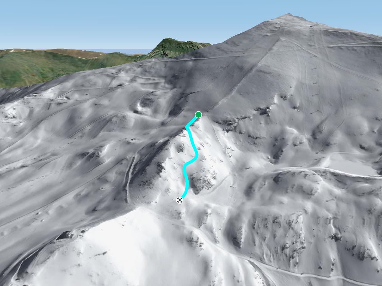
This is an easily accessed line as we need to continue straight for 20 meters from red slopes "Cordón" junction and "Collado Alto" before taking a left into the ridge area. The line gets some steepness in the higher section and can feel like a piste in the lower section but there are some rocks to avoid. The line gets a lot of sun so make sure there's enough snow before heading in. Avalanche risk is present due to the steepest part of the ridge at the lower section of the line, remember line can often be frozen in the morning due to the aspect, or slushy in the afternoon. The line finishes on the red piste "Carril del Collado" which leads back to Borreguiles area or going to the "Lagunas de las Yegas" area.
Severe
Steep skiing at 38-45 degrees. This requires very good technique and the risk of falling has serious consequences.

As well as the slope itself, there are some obstacles (such as rock outcrops) which could aggravate injury.
Away from help but easily accessed.
55 m away
Gentle steepness on this line between rocks where fall can be dangerous.
Moderate Freeride Skiing
375 m away

More a crossing line than anything else, however the bottom 100 metres can be surprisingly good.
Severe Freeride Skiing
384 m away

Line guided by an area clear of rocks and available gully.
Severe Freeride Skiing
484 m away

One the classic steep lines of Laguna chairlift's west side, this is an exciting line mixing cliff drops and speed.
Extreme Freeride Skiing
617 m away

Short lines with some steepness.
Severe Freeride Skiing
627 m away

One of the best lines, where rocks will be the main issue
Severe Freeride Skiing
677 m away

Another classic of the laguna's chairlift west side line with some really nice fast riding.
Severe Freeride Skiing
710 m away

A short line without much difficulty.
Difficult Freeride Skiing
710 m away

A fairly easy, brilliant line, giving you a small taste of freedom
Difficult Freeride Skiing
784 m away

This lovely area offers many possibilities but bear in mind the way out!
Difficult Freeride Skiing