87 m away
Trampolíne's crossing line

Small shortcut line with lots of rocks!
Severe Freeride Skiing
- Distance
- 490 m
- Ascent
- 0 m
- Descent
- 120 m
This is a variation of the Trampoline black slope, possibly less steep than the black slope itself. Optional cliff jump
Freeride Skiing Difficult
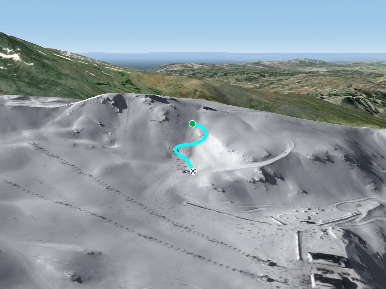
There is easy access to this line from the top of the lift- no walking is required. Just follow the black slope, our line is not too steep, probably even less than the piste. If you stay close to the black about 10 meters from it you are into the line. You also get the chance to jump a small cliff, remember but the snow cover can be thin and icy. There is vertical drop of about 200m for this line and your exact route will be dictated by weaving between the rocks. Then once you pass the drop, you can continue the line straight down with a few turns, giving you a bit of speed before getting get back close to the black slope "Trampolin", basically bringing you back to the chairlift and the main Borreguiles plateau.
Difficult
Serious gradient of 30-38 degrees where a real risk of slipping exists.

As well as the slope itself, there are some obstacles (such as rock outcrops) which could aggravate injury.

Close to help in case of emergency.
87 m away
Small shortcut line with lots of rocks!
Severe Freeride Skiing
107 m away

A nice steep line between 2 black slopes, sometimes lacking snow.
Severe Freeride Skiing
118 m away

A small shortcut into a empty wild area getting back into the blue slope.
Moderate Freeride Skiing
168 m away

Small shortcut line with a little steep section and optional cliffs if wanted.
Severe Freeride Skiing
218 m away

Steep entrance and short line with a few rocks finishing close the slopes.
Severe Freeride Skiing
231 m away

Steep entrance where good riding skills are required.
Severe Freeride Skiing
237 m away

A nice off piste line in the Laguna area which is easy to access to and get out of.
Moderate Freeride Skiing
241 m away

A longish walk to a fairly short run, but with great views and (sometimes) great snow
Severe Freeride Skiing
250 m away

Short line again with entrance around 40 degrees.
Severe Freeride Skiing
263 m away

Short line with gentle steepness where fresh snow can be found.
Moderate Freeride Skiing