Caldera Blanca
The route to the summit of the extraordinary Caldera Blanca crater is one of Lanzarote's most famous hikes and a must-do adventure through other-worldly terrain.
Hiking Difficult
- Distance
- 9.7 km
- Ascent
- 400 m
- Descent
- 400 m
- Duration
- 2-3 hrs
- Low Point
- 193 m
- High Point
- 450 m
- Gradient
- 12˚

The hike to the summit of Caldera Blanca is a truly brilliant route! However, it is tougher than the statistics might suggest because conditions underfoot are quite poor. As such, take plenty of water and don't underestimate this one.
- •
- •
Description
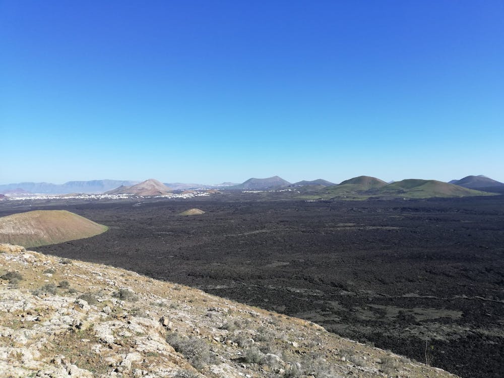
Start at the car park at the end of Camino al Cráter street, west of Mancha Blanca village. Hike west along the clear path through spectacular lava fields, heading directly towards Caldera Blanca itself, and its neighbouring crater Montaña Caldereta. The path through the lava fields is easy to follow but tough to walk on, because (despite the best efforts of those who created it) it is loose, rocky, and energy sapping. Along the route is a series of information boards with some interesting facts about volcanoes and lava fields.
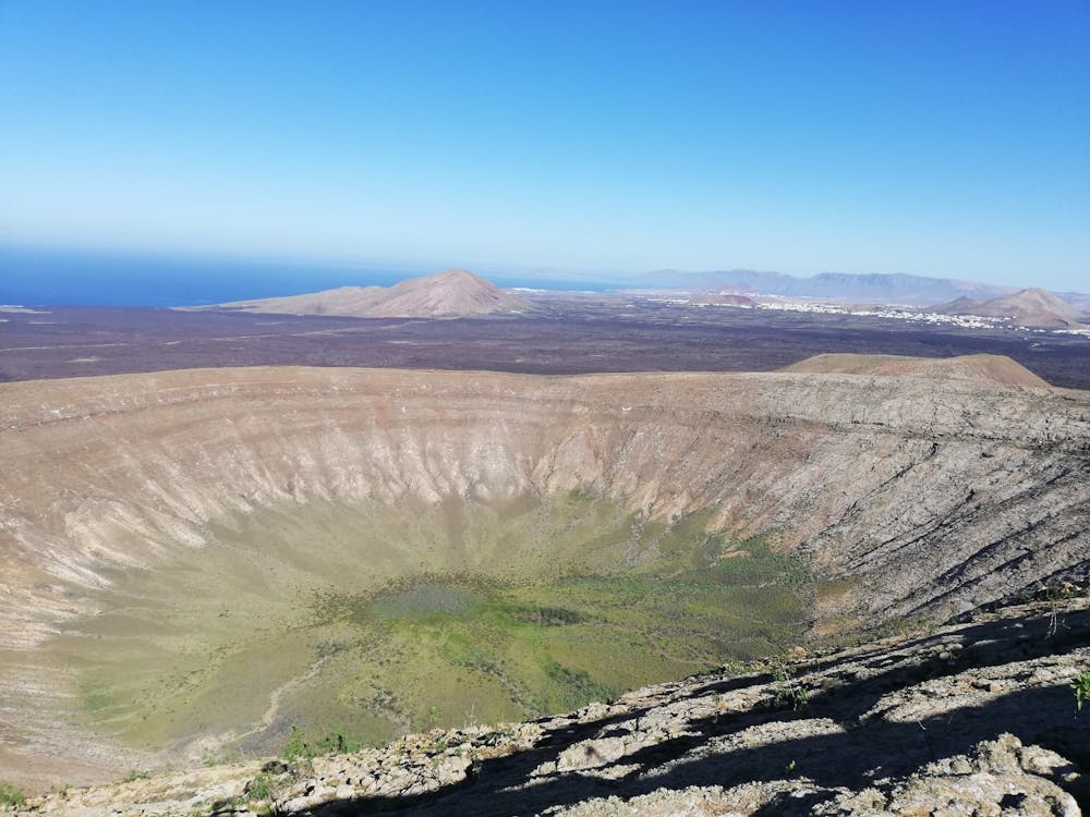
Having passed north of Montaña Caldereta, keep going all the way to the foot of Caldera Blanca itself and then head south along the foot of the caldera before turning west and climbing up to the crater rim. The view across the 1.5 kilometre wide crater is incredible so before continuing, sit down and soak it in.
Turn south and head up the rim of the crater. There isn't a clear path and some micro navigation is required to find the line of least resistance, but you won't go far wrong if you stick to the ridge crest all the way. Eventually, the ridge leads all the way to the summit of Caldera Blanca itself, which is marked by a somewhat unspectacular metal post. Luckily the staggering 360-degree panorama more than compensates for the lack of a decent summit marker!
Carry on around the rim of the crater and descend down some rocky terrain, heading for a broad col at the western edge of the rim. From here, climb up the hump to your north and then swing around east to where you first reached the rim. (Don't be tempted by the traverse path from the broad col, which looks like it leads you easily back to where you first reached the rim. The traverse turns out not to be a path but a series of awkward rock slabs).
Reverse your steps back to the carpark and then grab a cold beer at the Las Malvas bar in Mancha Blanca.
Difficulty
Difficult
Hiking trails where obstacles such as rocks or roots are prevalent. Some obstacles can require care to step over or around. At times, the trail can be worn and eroded. The grade of the trail is generally quite steep, and can often lead to strenuous hiking.
Medium Exposure

The trail contains some obstacles such as outcroppings and rock which could cause injury.
Remoteness
Away from help but easily accessed.
Best time to visit
Features
- Picturesque
- Summit Hike