407 m away
Cigalera
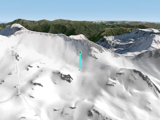
Choose your line in an easily accessible snow field
Moderate Freeride Skiing
- Distance
- 174 m
- Ascent
- 0 m
- Descent
- 54 m
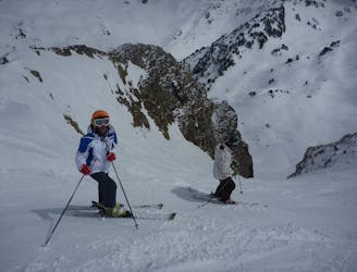
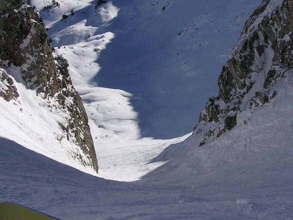
A wild couloir!
Freeride Skiing Difficult

Turn left at the top of the ‘TQ Tuc de la Llança’ lift and ski for 100 metres down the blue ‘La Llança’ piste. Put on your skins on and walk up until you reach the southern col of the Escornacrabes peak. It's a 20 minute hike, with a 200m elevation gain and about 1 kilometre long. If you don't have skins you can do it walking, but if snow conditions are good and powdery for the descent, they will likely be bad for the hike! The hike goes around a small lake and by the pass between Tuc de la Llança and Escornacrabes. Once at the top, you can put your skis or snowboard on for the descent and enter the amazing couloir. Following this slope, you will reach the blue piste ‘Argulls’.
Difficult
Serious gradient of 30-38 degrees where a real risk of slipping exists.

As well as the slope itself, there are some obstacles (such as rock outcrops) which could aggravate injury.

Little chance of being seen or helped in case of an accident.
407 m away
Choose your line in an easily accessible snow field
Moderate Freeride Skiing
1.6 km away

A short, steep run
Severe Freeride Skiing
1.6 km away

A short steep run for adventurers.
Severe Freeride Skiing
2 km away

A short steep run.
Severe Freeride Skiing
2.1 km away
One of the classic Baqueira off piste runs for experienced skiers.
Severe Freeride Skiing
2.2 km away

A beautiful, steep run between the pistes
Difficult Freeride Skiing
2.6 km away

An open snow field.
Moderate Freeride Skiing
2.6 km away

A run for the adrenalin junkies
Severe Freeride Skiing
2.7 km away

A long run to finish the day.
Severe Freeride Skiing
3 km away

A natural kicker to show off on!
Easy Freeride Skiing
10 routes · Freeride Skiing