52 m away
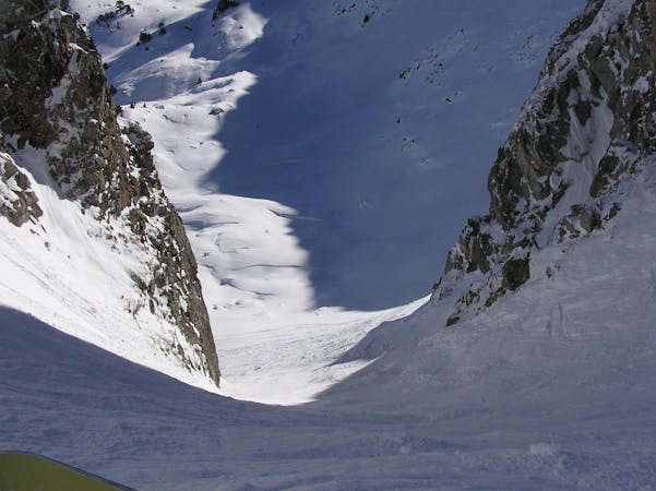
Perdiu Blanca

Freshies beside the Perdiu Blanca slope.
Moderate Freeride Skiing
- Distance
- 330 m
- Ascent
- 0 m
- Descent
- 121 m
Tree lines and open powder fields
Freeride Skiing Difficult

This run starts at the crossing of the Isards and Perdiu Blanca runs. Here there is a sign with two posts that people use as an entrance to get into this beautiful freeride area. Once you have passed the sign, you will have to turn left to avoid a small wall underneath you. Once in the forest, turn right and you will find an open area between the trees.You will ski under the TSD Mirador and reach the red piste Os. Some people search for a line to jump the wall, instead of avoiding it - it is a 2m high wall but if you know where the trees are your landing should be safe, but make sure you check! This entrance can make the run a little bit more exciting.
Difficult
Serious gradient of 30-38 degrees where a real risk of slipping exists.

As well as the slope itself, there are some obstacles (such as rock outcrops) which could aggravate injury.

Close to help in case of emergency.
52 m away
Freshies beside the Perdiu Blanca slope.
Moderate Freeride Skiing
267 m away

An open powder field to improve your freeriding
Moderate Freeride Skiing
391 m away

A beautiful tree run.
Moderate Freeride Skiing
409 m away

A natural kicker to show off on!
Easy Freeride Skiing
483 m away

A tree run between creeks and boulders.
Moderate Freeride Skiing
795 m away

An open snow field.
Moderate Freeride Skiing
858 m away

An open run with many different options.
Moderate Freeride Skiing
920 m away

A run for the adrenalin junkies
Severe Freeride Skiing
1 km away

A long run to finish the day.
Severe Freeride Skiing
1.1 km away

A tree run under the chairlift
Moderate Freeride Skiing
10 routes · Freeride Skiing