1.6 km away
Eiger West Flank
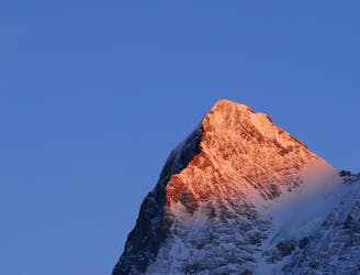
One of the most sought after ski lines in the Alps on a truly legendary mountain.
Extreme Ski Touring
- Distance
- 5.3 km
- Ascent
- 1.6 km
- Descent
- 1.6 km
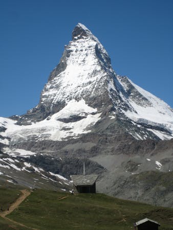
Ski descent of Eiger West Flank
Ski Touring Severe

This is a popular ski touring route which is generally considered to be severe. It's not remote, it features high exposure (e3) and is typically done between March and May. From a low point of 2.1 km to the maximum altitude of 3.9 km, the route covers 10 km, 2066 vertical metres of ascent and 1811 vertical metres of descent. It's graded 5.1 and Labande grade 5. You'll need rope, skins, ice axe and crampons to complete it safely.
Stunning views and a good amount of exposure
Severe
Steep skiing at 38-45 degrees. This requires very good technique and the risk of falling has serious consequences.

In case of a fall, death is highly likely.

Close to help in case of emergency.
1.6 km away
One of the most sought after ski lines in the Alps on a truly legendary mountain.
Extreme Ski Touring
4.5 km away
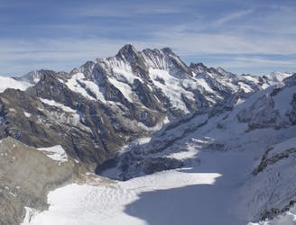
Day 1: A positioning day from the top of the Jungfraujoch train, easily down the glacier then a 500m skin over a pass at 3820m.
Moderate Ski Touring
4.6 km away
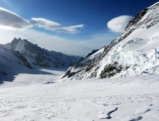
Day 1: The amazing Jungfraujoch railway accessing the biggest glaciated area in Europe and our first ski peak on the way to the hut.
Difficult Ski Touring
5 routes · Ski Touring

16 routes · Ski Touring
3 routes · Ski Touring