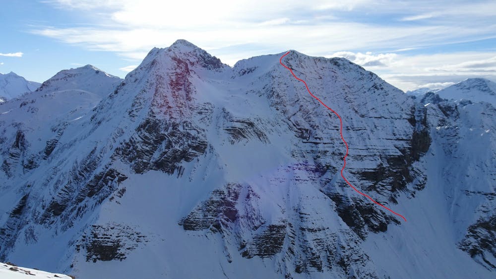
Männliflue spur north face
North Face ski descent
Ski Touring Extreme
- Distance
- 37 km
- Ascent
- 2.1 km
- Descent
- 2.7 km
- Duration
- 1 day +
- Low Point
- 668 m
- High Point
- 2.6 km
- Gradient
- 22˚

This is a popular ski touring route which is generally considered to be extreme. It's extremely remote, it features extreme exposure (e4) and is typically done between January and March. From a low point of 668 m to the maximum altitude of 2.6 km, the route covers 37 km, 2073 vertical metres of ascent and 2748 vertical metres of descent. You'll need rope, skins, ice axe and crampons to complete it safely.
Description
Männliflue North Face descent. Uphill from south side. Taking the Männliflue normal way from Fieldirch then at the end going more on the left side. the last 40m requires crampons for a little steeper part, this is in grass.
Difficulty
Extreme
Extreme skiing terrain above 45 degrees. These routes are reserved for experienced experts.
Extreme Exposure (E4)

In case of a fall, the skier faces certain death.
Remoteness
In the high mountains or remote conditions, all individuals must be completely autonomous in every situation.
Best time to visit
Features
- Face
- Cliffs
- Ski Mountaineering
Equipment required
- Rope
- Skins
- Ice axe
- Crampons