Corvatsch - Tschierva
St Moritz
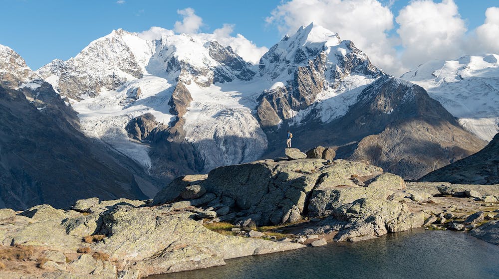
Surley, fuorcla surlej, val roseg, chamanna tschierva, pontresina, surlej
Mountain Biking Difficult
- Distance
- 40 km
- Ascent
- 1.8 km
- Descent
- 1.8 km
- Duration
- 4-5 hrs
- Low Point
- 1.8 km
- High Point
- 2.8 km
- Gradient
- 12˚

This is a popular mountain biking route which is generally considered to be difficult. It's not remote, it features low exposure and is typically done between June and October. From a low point of 1.8 km to the maximum altitude of 2.8 km, the route covers 40 km, 1765 vertical metres of ascent and 1774 vertical metres of descent.
Description
Amazing ride amongst beautiful glaciers and majestic peaks
Difficulty
Difficult
Mostly stable trail tread with some variability featuring larger and more unavoidable obstacles that may include, but not be limited to: bigger stones, roots, steps, and narrow curves. Compared to lower intermediate, technical difficulty is more advanced and grades of slopes are steeper. Ideal for upper intermediate riders.
Low Exposure

The path is on completely flat land and potential injury is limited to falling over.
Remoteness
Close to help in case of emergency.
Best time to visit
Features
- Flow
- Technical
- Hike a bike
- Picturesque
- Singletrack
- In the forest
- Road sections
- Roots
- Rock Rolls
- Rock Slabs
- Rock Gardens