9.5 km away
Splügen to Innerferrera
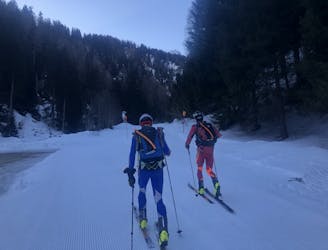
A relatively short but very pleasant day, dipping in and out of Italy
Moderate Ski Touring
- Distance
- 22 km
- Ascent
- 1.7 km
- Descent
- 1.7 km
Tour with multiple descent possibilities and excellent snow conditions in all seasons
Ski Touring Moderate

Starting from the built-up area of Hinterrheim, go up in a northerly direction passing some huts on wide fairly sloping ground. From here, bend towards West going up the wide section characterized by multiple valleys and wide canals that offer ever new ascent possibilities and an almost infinite range of possibilities to find excellent snow in winter and spring. The final stretch requires attention, especially after recent snowfalls or in the presence of ice. For the descent you can opt for wide slopes as well as for steeper channels, depending on your ability and snow conditions

Moderate
Slopes become slightly steeper at around 25-30 degrees.

Exposure is limited to that of the slope itself. Getting hurt is still likely if the slope is steep and/or the snow is hard.
Close to help in case of emergency.
9.5 km away
A relatively short but very pleasant day, dipping in and out of Italy
Moderate Ski Touring