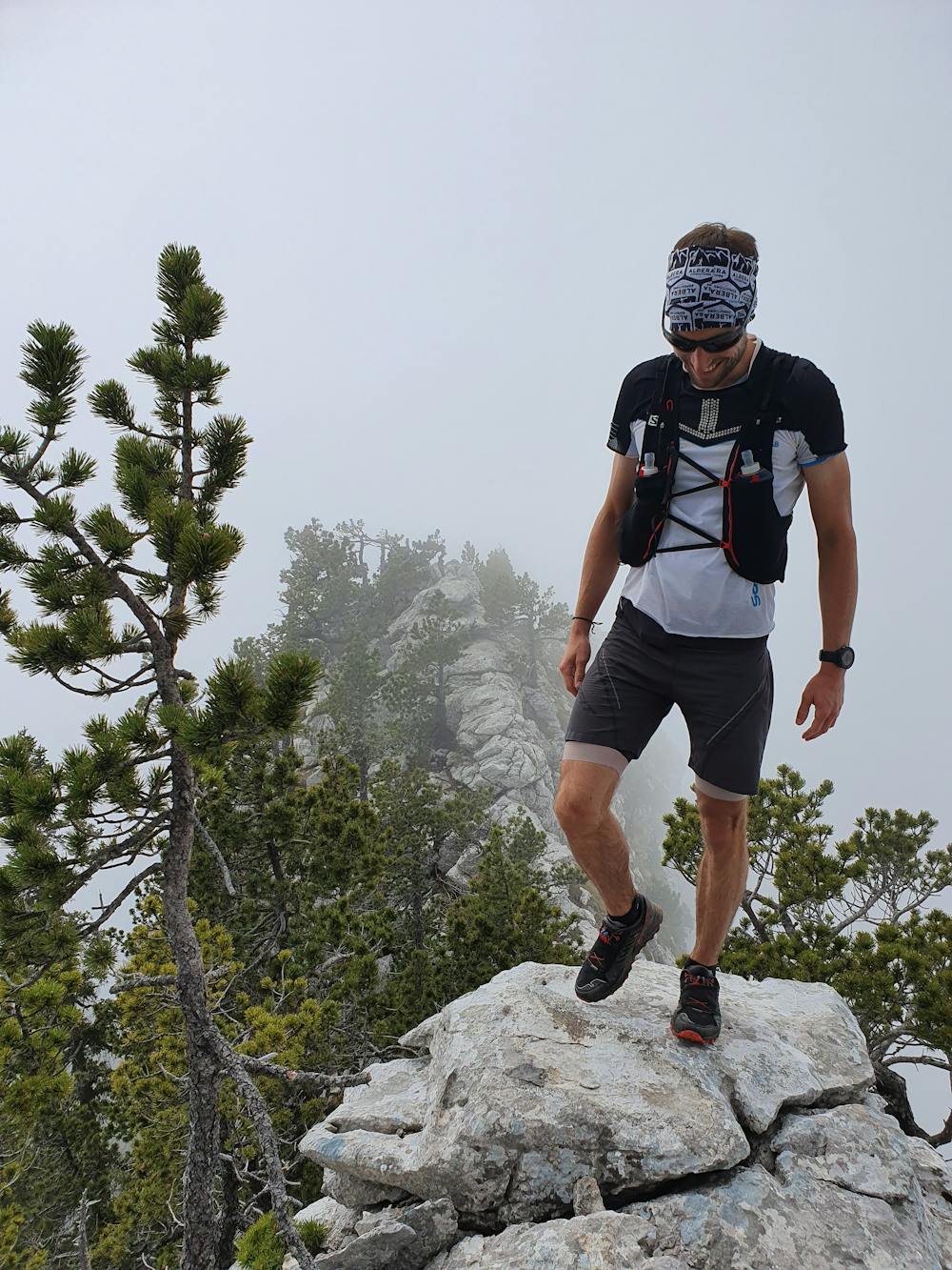
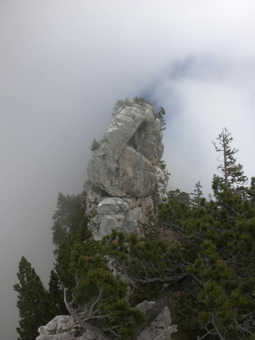
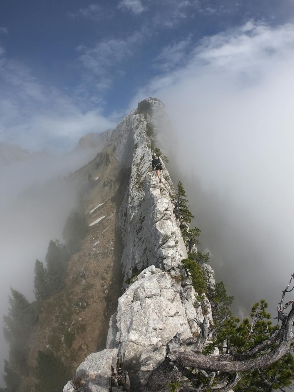
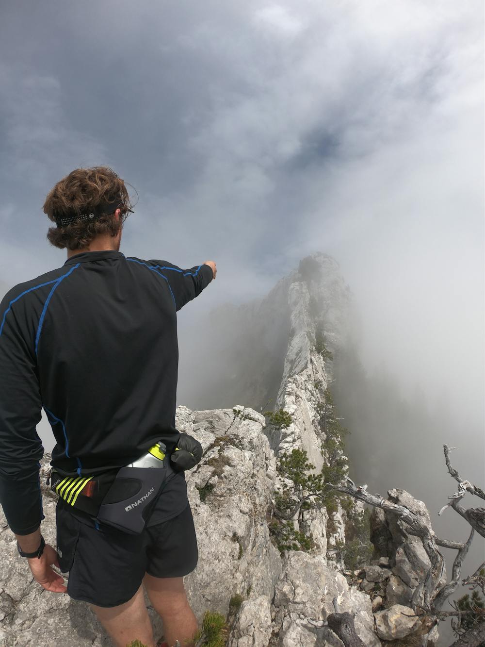
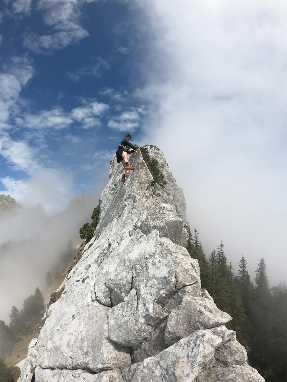
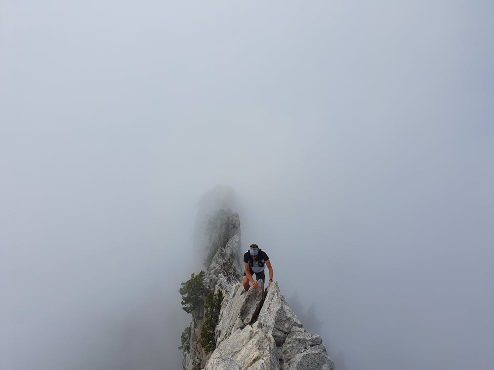
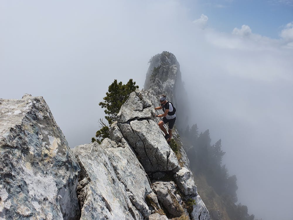
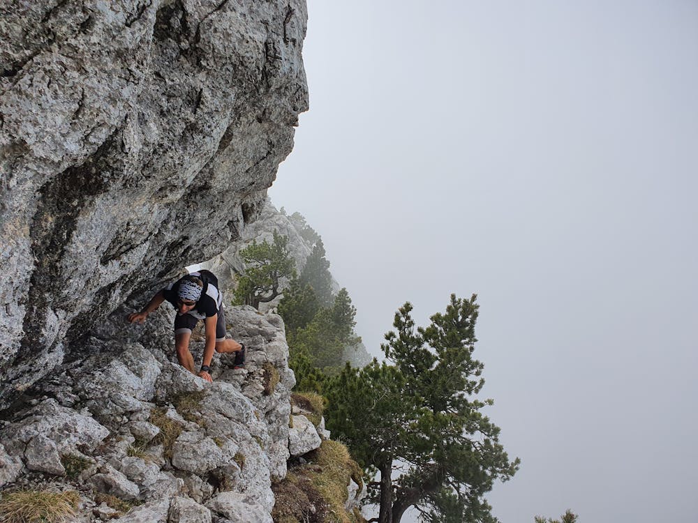
Ruessi Grat
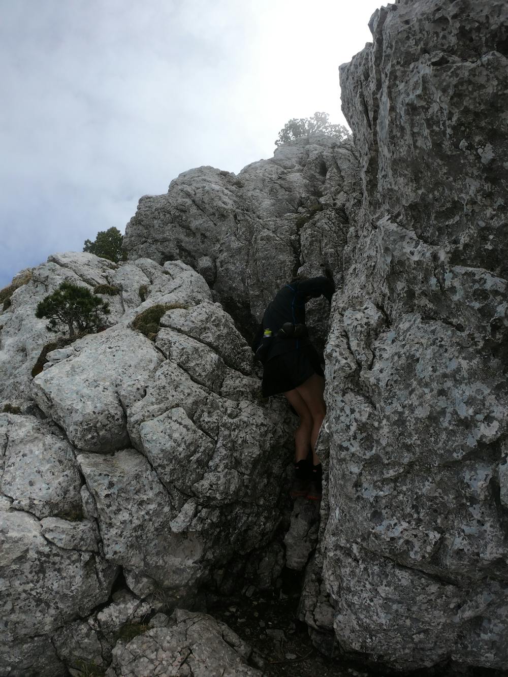
An extremely narrow ridge requiring some climbing skills (grade 3 or 4)
Alpine Climbing Severe
- Distance
- 11 km
- Ascent
- 948 m
- Descent
- 953 m
- Low Point
- 1.1 km
- High Point
- 2 km
- Gradient
- 26˚

This is a popular alpine climbing route which is generally considered to be severe. It's very remote, it features extreme exposure and is typically done between May and October. From a low point of 1.1 km to the maximum altitude of 2 km, the route covers 11 km, 948 vertical metres of ascent and 953 vertical metres of descent. You'll need wires and friends to complete it safely.
- •
- •
- •
- •
- •
- •
- •
- •
- •
Description
This stunning ridge is often combined with a trailrun in the region around Pilatus (LU). Due to its exposure it cannot be rated as a "run" anymore and requires some climbing skills / experience. Do not go there if you don't feel comfortable climbing in 3rd or 4rd grade!
Difficulty
Severe
Steep, sustained and serious terrain on rock/ice. Routes will be long, exposed and possibly committing. D, D+
Extreme Exposure

The majority of the route is "no fall" terrain.
Remoteness

Little chance of being seen or helped in case of an accident.
Best time to visit
Equipment required
- Wires and Friends