Rottenmeiers Ultra Trail
A true Ultra Trail with over 110 performance kilometers with start and finish at the valley station of the Pizolbahnen in Bad Ragaz.
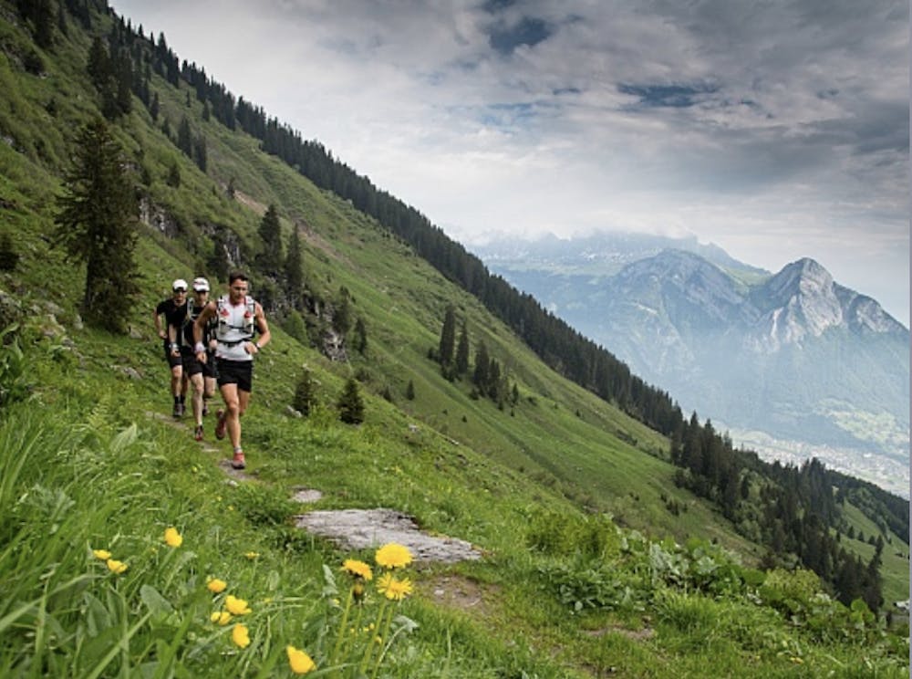
Trail Running Extreme
- Distance
- 66 km
- Ascent
- 4.3 km
- Descent
- 4.3 km
- Duration
- 1 day +
- Low Point
- 486 m
- High Point
- 2.5 km
- Gradient
- 16˚

We start on the hiking trail behind Pizolbahnen’s valley station in Bad Ragaz and run towards Vilters / Wangs. Below the church in Vilters, we cross the stream and follow the path via Rappagugg to Wangs. We pass the valley station of Pizolbahnen Wangs, cross the concrete bridge and then turn left in the direction of the grotto (wodden signpost). We pass the cave and follow the paved road to Bazal. Here we take the steep Geissgass towards Maienberg / Furt. This path takes us along the Grossbach along meadows, through woods and a ravine to the junction Gaspurweg and later Gampidels. At the end of this mountain path, we see the Alp Mugg. Below the alp, we follow the forest road to the left, cross a stream shortly after that and then immediately turn right again along the marked mountain path to Furt. Behind the valley station of the chair lift, we turn right towards the Water Forest to Fürggli, continue to Unter- and Obervermii and then to the summit cross of Garmil. Despite the prospect of a lengthy tour, it's worth taking a short break. After a magnificent and varied trail, we arrive at Wildseeluggen via the Alte Alp Gaffia and the famous 5-Lake-Hike. On the way, we walk past a Steinmandlifeld, and the lakes Baschalvasee, Schwarzsee, Schottensee, and Wildsee. The environment is gorgeous and will certainly distract you from the hardships. From the Wildseeluggen you pass the Pizolhütte and lake Wangsersee to the 360° view at the Tagweidlichopf. A look back and a picture through the photo spot let you hold the memories to take back home. Via Laufböden, we run over a long descent to Pardiel. At the junction above the gondola lift, we pass wooden goats in direction of the lookout Schwarzbüel. The next stopover is Alp Schwarzbüel. Once there, we turn left towards Vilterser Obersäss. We reach this location via a great trail through woods, across meadows and past a moorland. From Vilserser Obersäss, head uphill towards lake Viltersersee. Above the lake, we turn left towards Laufböden and right at the next opportunity towards lake Wangsersee. Behind the shore of Wangsersee, the trail progresses left towards Lasa, opening up a completely different view overlooking Grisons and the Tamina valley. Once arriving Alp Lasa, we turn left and follow the signs Bettlerweg. This course leads us over a varied trail to Pardiel. At the mountain station of the gondola lift Pardiel we follow the junction to Wildboden / Bad Ragaz and run through the forest and across meadows to the junction Guschachopf. Here we turn right, enjoy a magnificent view of the extended home of Heidi after a few hundred meters and then turn left towards Bad Ragaz (use the trail which indicates 30 minutes). At the valley floor, we walk towards Taminaschlucht and Altes Bad Pfäfers. Above us we see the 265 meters long arch bridge, which is the longest of its kind in Europe. At the end of this path, we reach the historic bathing area of the old Bad Pfäfers. We take the same way back and turn right at the junction Badtobel Steg, walk over the bridge and then uphill through the forest to Pfäfers. Once at the top, we take the main road in the direction of Pfäfers / Wartenstein, past the baroque monastery church and the sculpture Cristo Salvador to the ruin Wartenstein. After enjoying the splendid view of Bad Ragaz and mountain Gonzen, we follow the mountain path below ruin Wartenstein towards Bad Ragaz. We leave behind today's bath Tamina Therme, although we surely long for recovery in its regenerative water. Our day will come... We cross the river Tamina at the entrance of the gorge, then turn right and immediately left at the village boundary, direction Freudenberg. To avoid the asphalt, we run on the forest road towards Pardiel for a short time. At the intersection Talstation Pizolbahnen, we jog to the right over a meadow and forest path to the ruin Freudenberg. Directly behind the ruin, another forest path takes us back into the valley. Once at the bottom we run to the left towards the valley station Pizolbahnen. After a short time, we reach our destination and can look back proudly on our accomplished ultra run.
Description
Info:
It is not possible to provide a detailed route description with all changes of direction throughout the tour. Take a map with you and use GPS data. In case you miss an intersection, then usually the next larger destinations are provided on signposts, and you can continue with the tour.
Tip 1: If the ascent from Wangs to Furt is too steep, you can follow the nature trail and the hiking trail Furt. Although this route is mostly on asphalt, it is less steep and easier to locate.
Tip 2: En route, there are many restaurants and accommodations. Nevertheless, take sufficient food and beverages with you.
Tip 3: You can also finish the Ultratrail as a multiday run or with short cuts (for example through the usage of gondolas or chairlifts). Please take into account PIZOL’s operating times.
Difficulty
Extreme
High Exposure

Some trail sections have exposed ledges or steep ascents/descents where falling could cause serious injury.
Remoteness
Little chance of being seen or helped in case of an accident.