Rigi Highroute
Traversing the Rigi Massive from Küssnacht to Brunnen
Trail Running Difficult
- Distance
- 27 km
- Ascent
- 2.3 km
- Descent
- 2.3 km
- Duration
- 5-6 hrs
- Low Point
- 436 m
- High Point
- 1.8 km
- Gradient
- 27˚

This route traverses the whole of Mount Rigi from West to East, with the added bonus of tagging most of the alpine terrain Rigi has to offer along the way.
- •
- •
- •
- •
Description
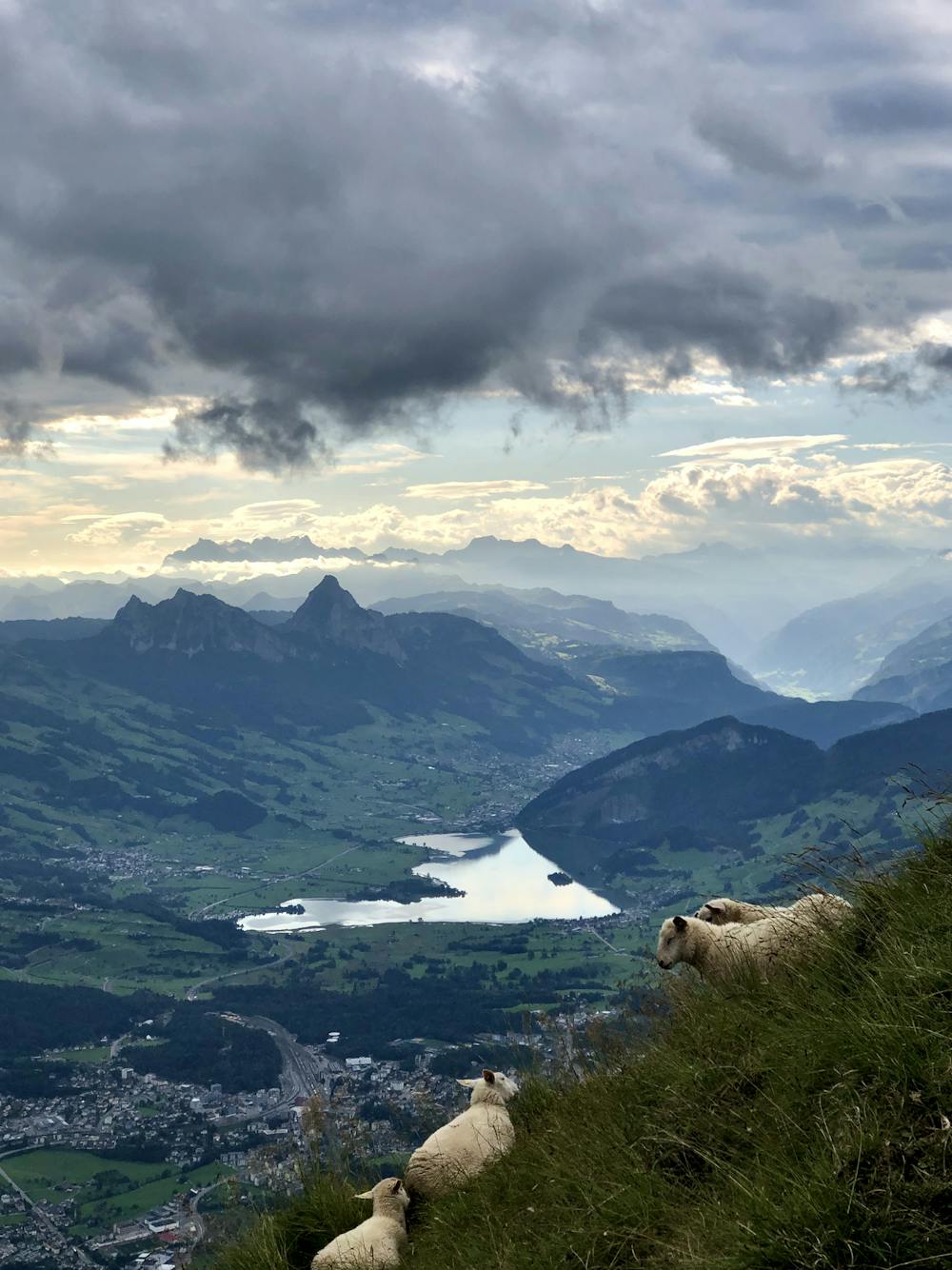
This route was designed with public transport in mind and so the start of the route is at the train station in Küssnacht am Rigi. After crossing the small town head straight up to Seebodenalp, from there you can deviate from the normal route and traverse alongside the mountain to then head up the most direct path up to Rigi Kulm. This section requires some bushwhacking and a good GPX track as this is the path less traveled. The last few 100 Meters beneath the summit is where you'll encounter the first section of exposed terrain which is still secured by chains and fixed ropes.
From the summit it is more or less flat running with a few short climbs and descents up to Rigi Scheidegg. From here descend down to Gätterli Pass. Until now the trails and roads have mostly been gravel but this is one of the only sections where you can't avoid a small section of paved road.
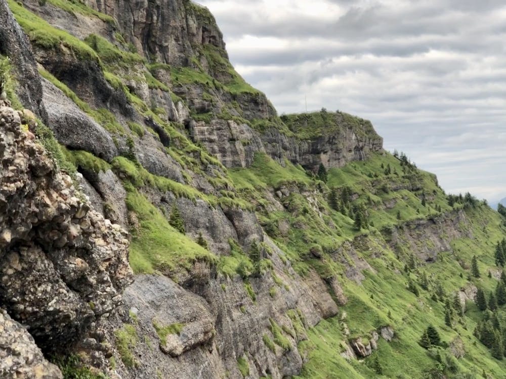
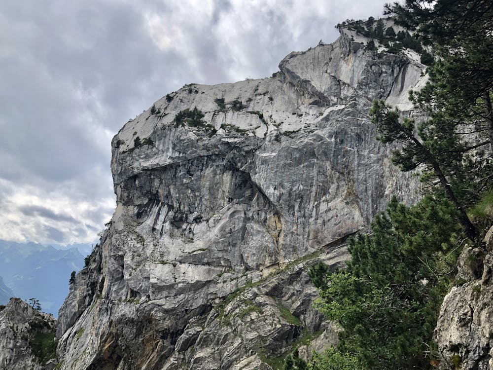
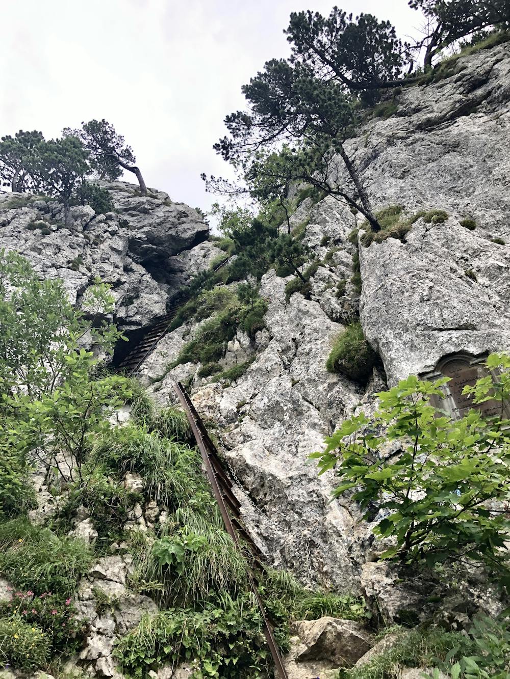
Arriving at Gätterli Pass, climb up the most direct route to Rigi Hochflueh. It is very steep in parts but not unsafe at any point. Only the last few steps are on a (very solid) 25m long ladder. From here you can enjoy our first view down to our finishing point at Brunnen. Of the three routes leading down from Hochflueh, take the most demanding one downhill on the Eastside. This part involves some very technical sections especially when climbing down, but the views and the landscape are surprisingly alpine despite the low elevation. If you wish to skip this part you could take the alternate route along an easy trail to the north side of Hochflueh.
The last section is again an alpine (blue-white) trail down to Brunnen. Although this trail is an official hiking trail it more closely represents a via ferrata. Some of the more exposed sections are secured with chains and fixed ropes but most of the climbing on this section is somewhat exposed, and slipping or falling will probably result in serious injuries or more. Again if you want to skip this section just take the regular route down to Brunnen (roughly along the cable car). But if you commit to the set route we can guarantee a pseudo-alpine adventure that you wouldn't expect around these woods. After that you'll arrive at Brunnen train station. Alternatively you could take the ship at the port, depending on where you came from.
All in all a beautiful day in the low-mountains with enough scrambling to make the trip worth it even for more experienced mountain lovers. This route can also be done in reverse if you want to skip all the down climbing to Brunnen.
Difficulty
Difficult
High Exposure

Some trail sections have exposed ledges or steep ascents/descents where falling could cause serious injury.
Remoteness

Away from help but easily accessed.