8.5 km away
Haute Route Glacier Trek Day 4 - Cabane de Chanrion to Cabane de Dix via the Col du Mont Rouge.
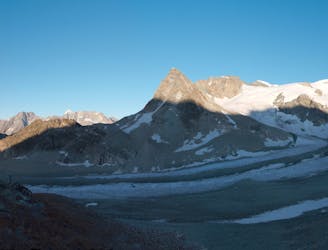
A high and wild walk through some epic scenery.
Moderate Alpine Climbing
- Distance
- 9.7 km
- Ascent
- 917 m
- Descent
- 467 m
A relatively straightforward scramble on mainly reasonable rock and snow, traversing a high foresummit
Alpine Climbing Difficult

The Grand Combin is a satisfying peak as it is geographically isolated, lying midway between the Mont Blanc Massif and the Pennine giants. You also have amazing views of Mt Velan nearby and S to the Italian plains. It was traditionally climbed from the N side, but this has gone out of vogue, due to substantial serac danger in the so-called Corridor Route. The Meitin Ridge from the Valsorey Hut, however, is free of such objective danger and is an enjoyable scramble.
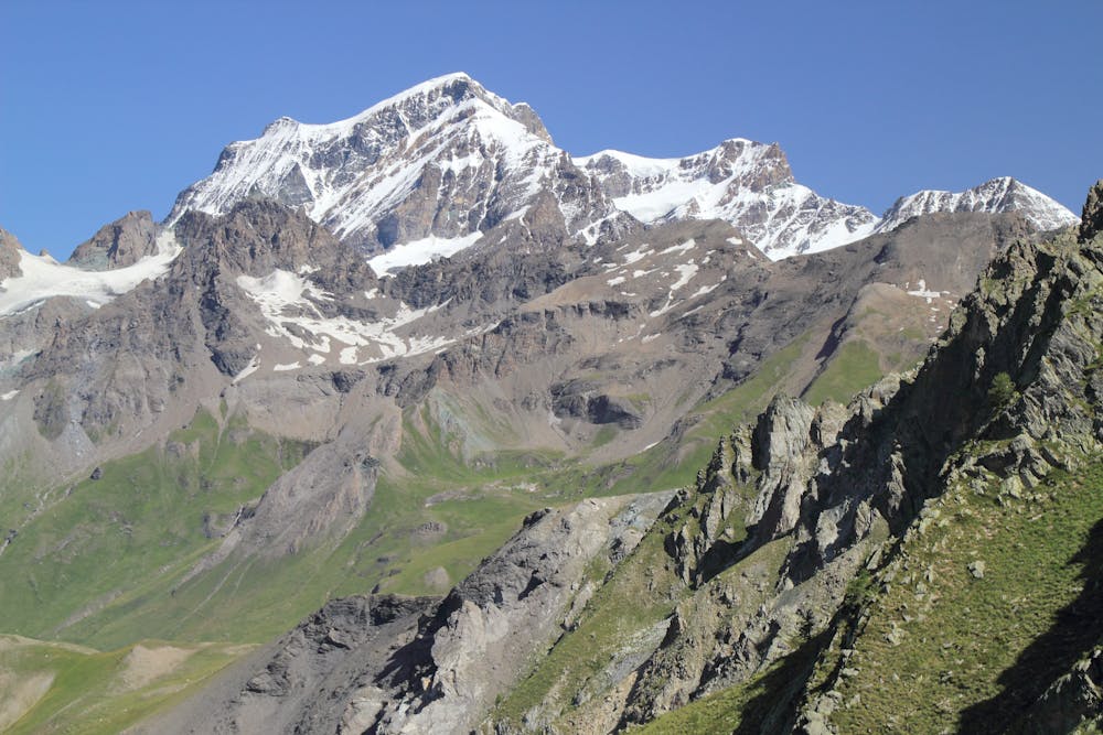
From the hut follow the path N then E to the remnant of the Meitin Glacier, then go L to the foot of the couloir coming from the Col du Meitin. You can follow the couloir but it is often better to take the rocky rib which leads to the ridge immediately above the Col du Meitin, 3611m. There are 3 main steps on the ridge above, but initially the ridge is easy scrambling. Once at the base of the first buttress move R to a crack, climbing up (UIAA 3) to regain the ridge. Continue along the ridge (UIAA 2+) until a roof bars the way. Traverse R to a corner (UIAA 2+) then up to the ridge again and to the top of this first step. It is now easy to the foot of the second step.
Go 200m R to reach a gully, with a pillar on its R. Climb the loose gully until the notch above the step on the R, fixed rope. Continue along the ridge (UIAA 2) which becomes progressively looser, with the odd bit of in situ gear, until you arrive at a snowy shoulder below the third step. Climb this near to the crest, passing any tricky sections to the R (UIAA 2) to reach the Grand Combin de Valsorey, 4184m.
From here descend easy snow to the col at 4127m, then further easy snow slopes to the main summit at 4314m. Descent is the reverse, downclimbing and possibly making the odd careful rappel, taking care not to dislodge rocks.
Difficult
The beginning of truly technical terrain which might involve pitched climbing on rock and/or ice, exposed terrain and complex route finding in ascent and descent. Equivalent to AD, AD+

The route features some exposed and/or difficult to protect sections.

Little chance of being seen or helped in case of an accident.
8.5 km away
A high and wild walk through some epic scenery.
Moderate Alpine Climbing

9 routes · Alpine Climbing · Hiking

10 routes · Alpine Climbing · Hiking

20 routes · Alpine Climbing · Hiking