1 routes · Mountain Biking
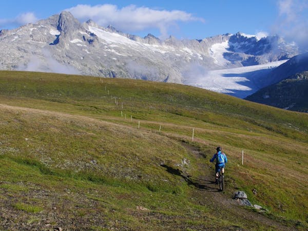
A thrilling descent from the Furka Pass to Oberwald.
Mountain Biking Difficult

An exhilarating burst of downhill from the Furkapass to Oberwald. Enjoy fantastic views of the Rhone Glacier from start to finish. The 1070m uphill to get the pass is a strenuous climb that can be avoided by hopping on the bus (book in advance).
Difficult
Mostly stable trail tread with some variability featuring larger and more unavoidable obstacles that may include, but not be limited to: bigger stones, roots, steps, and narrow curves. Compared to lower intermediate, technical difficulty is more advanced and grades of slopes are steeper. Ideal for upper intermediate riders.

The trail contains some obstacles such as outcroppings and rock which could cause injury.

Close to help in case of emergency.
1 routes · Mountain Biking