8.4 km away
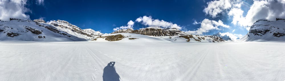
Western Oberland Traverse: Wildstrubel Hut to Lammeren Hut
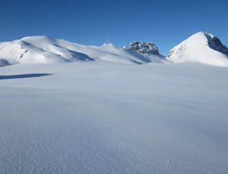
Day 4 of the Western Oberland Traverse, running from Wildstrubel Hut to Lammeren Hut.
Moderate Ski Touring
- Distance
- 10 km
- Ascent
- 797 m
- Descent
- 1.1 km
Day 5 of the Western Oberland Traverse, running from Lammeren Hut to Kandersteg.
Also in Bern, Switzerland
Ski Touring Difficult

There is a short ascent to a summit followed by a long descent. There are a few variations possible on this day in different snow and weather conditions. It's worth seeking local advice from the hut. The route described here allows for a cable car descent at the end of the valley down to Kandersteg, which may be gratefully received rather than a long walk down a road in the spring.
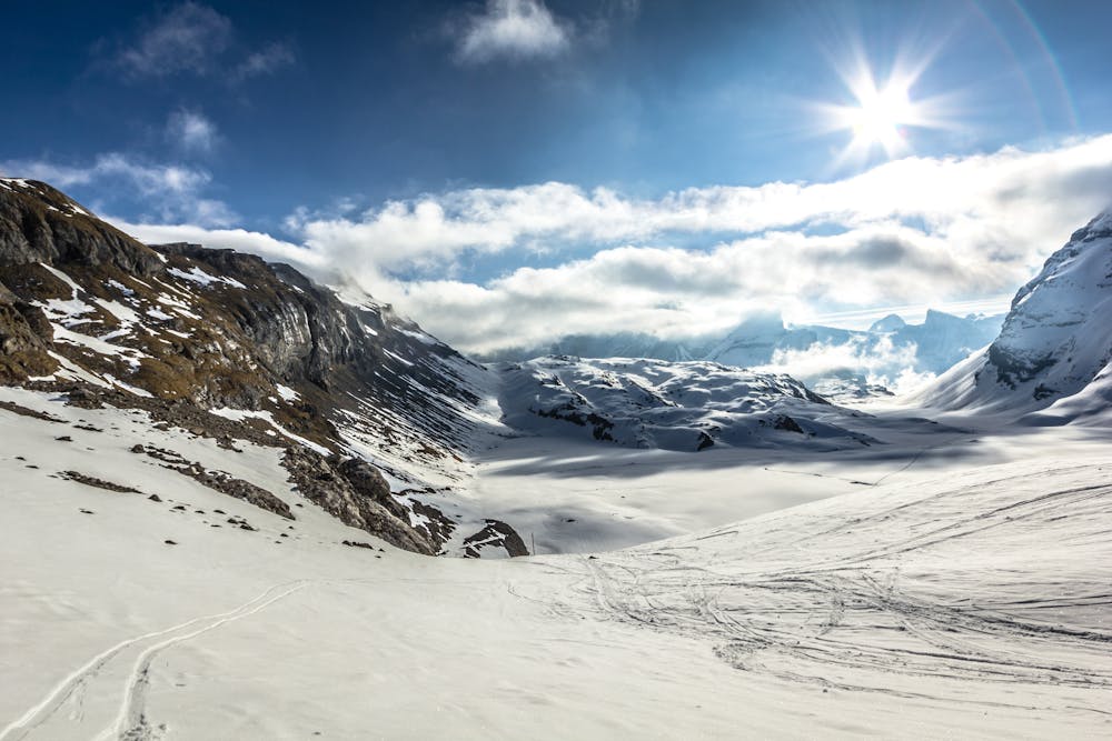
Head north from the hut, then northeast up the easy, angled Lammeren valley to the Rote Totz Lucke, then onto the Roter Totz summit at 2848m.
From the summit, briefly retrace your tracks, then descend a bench to the southwest, before turning left and down onto a lower, easier-angled bench, which heads northeast, north, then northwest, to access the descent down the Rote Chumme to the southeast. At the foot of this streambed, take another bench to the northeast on gentle terrain, but both below and above steep ground, to arrive at the well-positioned Schwarenbach Hotel at 2060m.
From here it is a relatively low-angled descent with flat sections to the top of the cable car at 1934m, which takes you down to Kandersteg.
Difficult
Serious gradient of 30-38 degrees where a real risk of slipping exists.

As well as the slope itself, there are some obstacles (such as rock outcrops) which could aggravate injury.

In the high mountains or remote conditions, all individuals must be completely autonomous in every situation.
8.4 km away
Day 4 of the Western Oberland Traverse, running from Wildstrubel Hut to Lammeren Hut.
Moderate Ski Touring

5 routes · Ski Touring