Кольцо вокруг Тахталы с восхождением на вершину и с протяжённостью в 33км (The ring around Tahtali with climbing to the top and with a length of 33 km)
Difficult but adventurous.
Hiking Difficult
- Distance
- 33 km
- Ascent
- 2.5 km
- Descent
- 2.6 km
- Duration
- 1 day +
- Low Point
- 367 m
- High Point
- 2.3 km
- Gradient
- 19˚
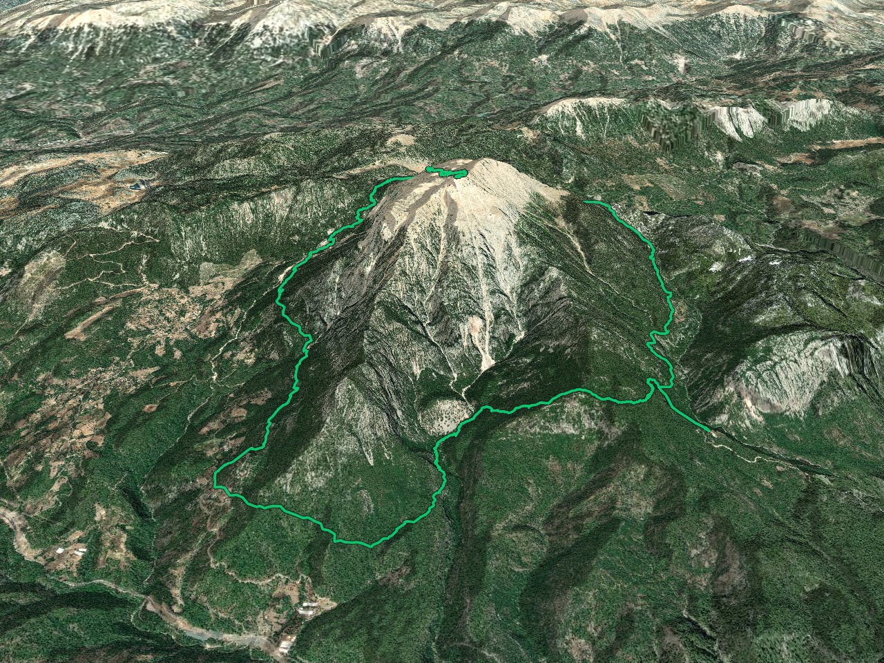
This is a popular hiking route which is generally considered to be difficult. It's not remote, it features medium exposure and is typically done between April and December. From a low point of 367 m to the maximum altitude of 2.3 km, the route covers 33 km, 2547 vertical metres of ascent and 2551 vertical metres of descent.
Description
Beautiful track with outstanding views and sights which includes part of a Licyan and Lyra ways. Due to route length, the route is quite difficult and is for trained active people who are ready to walk 20 - 30km daily over rough terrain.
Difficulty
Difficult
Hiking trails where obstacles such as rocks or roots are prevalent. Some obstacles can require care to step over or around. At times, the trail can be worn and eroded. The grade of the trail is generally quite steep, and can often lead to strenuous hiking.
Medium Exposure

The trail contains some obstacles such as outcroppings and rock which could cause injury.
Remoteness

Close to help in case of emergency.
Best time to visit
Features
- Wildlife
- Summit Hike
- Wild flowers
- Family friendly
- Forestry or heavy vegetation