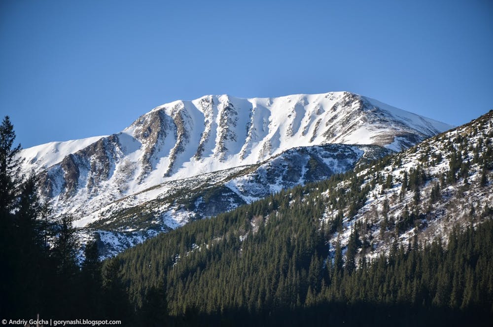
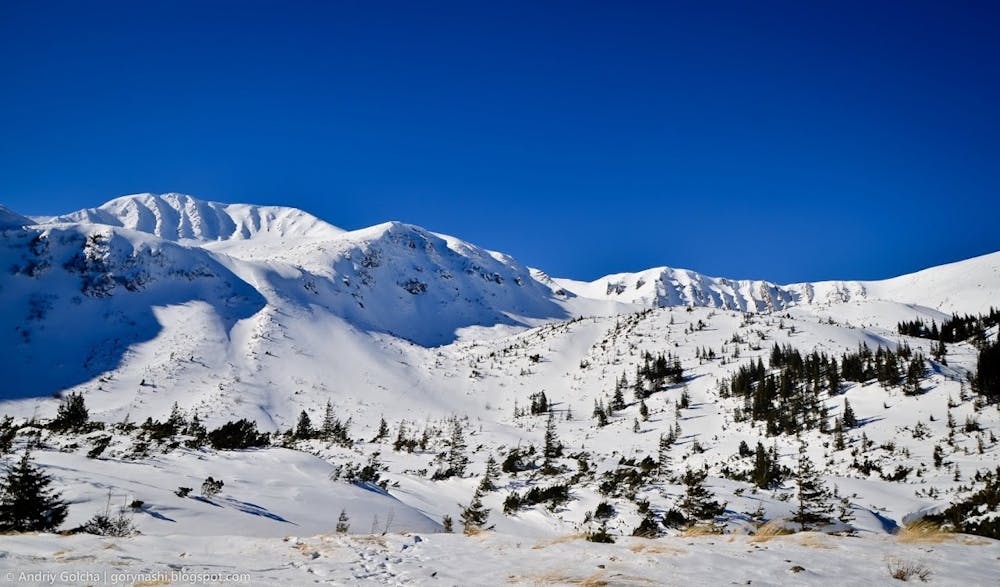
mt.Rebra
One of the most gnarly and difficult lines in Carpathian mountains
Also in Ivano-Frankivs'k, Ukraine
Freeride Skiing Extreme
- Distance
- 1.6 km
- Ascent
- 1 m
- Descent
- 554 m
- Low Point
- 1.4 km
- High Point
- 2 km
- Gradient
- 46˚

This is a popular freeride skiing route which is generally considered to be extreme. It's very remote, it features extreme exposure (e4) and is typically done between January and May. From a low point of 1.4 km to the maximum altitude of 2 km, the route covers 1.6 km, 1 vertical metres of ascent and 554 vertical metres of descent. You'll need rope, skins and crampons to complete it safely.
- •
- •
- •
Description
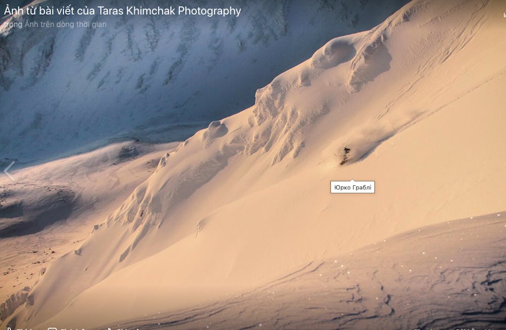
Very difficult to score nice snow, but if lucky this one is for history, very high avy danger
Difficulty
Extreme
Extreme skiing terrain above 45 degrees. These routes are reserved for experienced experts.
Extreme Exposure (E4)

In case of a fall, the skier faces certain death.
Remoteness

Little chance of being seen or helped in case of an accident.
Best time to visit
Features
- Cliffs
- Couloir
Equipment required
- Rope
- Skins
- Crampons