5.9 km away
Bushy Park 5-Mile Circular Route
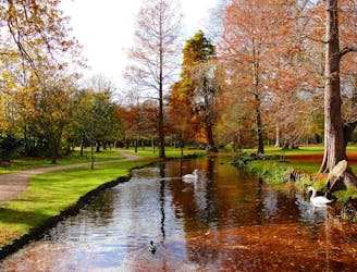
Explore one of London’s eight Royal parks, famed for its roaming herds of red and fallow deer.
Easy Hiking
- Distance
- 8.7 km
- Ascent
- 17 m
- Descent
- 17 m
This long distance walk takes you from the city to the coast, following the route of the London to Brighton Challenge.
Also in East Sussex, United Kingdom • Kingston upon Thames, United Kingdom • Richmond upon Thames, United Kingdom • Surrey, United Kingdom • West Sussex, United Kingdom
Hiking Severe

The route runs for 100km (62 miles) following a series of public footpaths, minor roads and country lanes. It starts in Richmond Park in London and heads south through the North Downs, the Surrey & Sussex countryside before the final section through the South Downs to Brighton. You start off in Richmond Park in South London and follow the Thames Path to Kingston Upon Thames. You then leave the river and head through Old Malden and Stoneleigh before passing through Nonsuch Park in Ewell. The next stage takes you across Banstead Downs to Little Woodcote where you pick up a section of the London Loop to take you through Coulsdon, over Farthing Downs and through Happy Valley Park. You then head into the countryside of the North Downs, passing Chaldon, Bletchingley and Copthorne before a long woodland stretch through Worth Forest. You leave the woods, passing Wakehurst Place, Ardingly, Hayward's Heath and Plumpton where you join the South Downs. The final section takes you over the South Downs to Brighton via Falmer.
Severe
Hiking challenging trails where simple scrambling, with the occasional use of the hands, is a distinct possibility. The trails are often filled with all manner of obstacles both small and large, and the hills are very steep. Obstacles and challenges are often unexpected and can be unpredictable.
5.9 km away
Explore one of London’s eight Royal parks, famed for its roaming herds of red and fallow deer.
Easy Hiking

5 routes · Hiking