Haddington Hill - the highest peak in the Chiltern Hills
Enjoy one of the most popular hikes in the Chilterns and tag the (vague!) summit of their highest hill
Hiking Easy
- Distance
- 5.7 km
- Ascent
- 139 m
- Descent
- 139 m
- Duration
- 1-2 hrs
- Low Point
- 164 m
- High Point
- 277 m
- Gradient
- 5˚

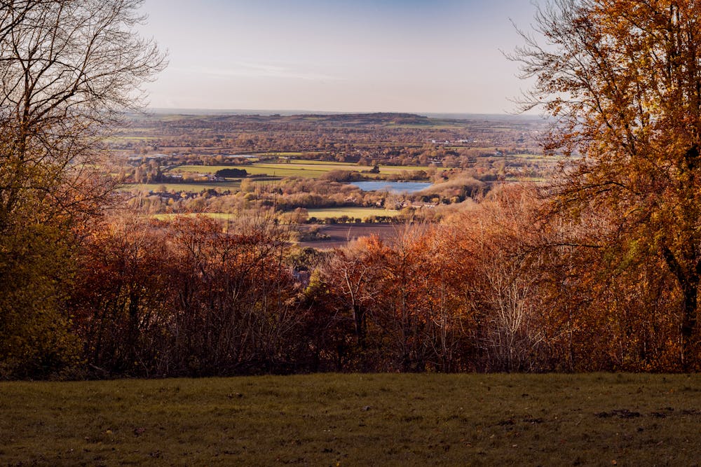
The Chiltern Hills are popular and with good reason - they're close to the busy-ness of London but are wonderfully peaceful and give easy access to lovely countryside.
Description
Haddington Hill is a rather vague summit, but regardless of where precisely the highest point is, you'll enjoy some excellent panoramas across the surrounding area from various parts of this walk.
The trip begins at a large car park which also serves the Wendover Woods Go Ape. There are trails everywhere so either follow our line exactly or just stroll and see where you end up! The walk to Haddington Hill itself is very brief, and from there you've got a lovely loop to look forward to, including a visit to the fort on Boddington Hill, one of the most famous landmarks in the Chiltern Hills. The fort was likely constructed around 2,500 years ago, during a period of significant social and political change in Britain.
The fort was strategically located on the summit of Boddington Hill, which offered excellent views of the surrounding countryside. It is thought that the fort would have been occupied by a local tribe or community, who used it as a defensive stronghold and a centre of trade and commerce.
During the Roman period, the fort was likely abandoned as the Romans gradually conquered and established control over the area. However, it is possible that the fort may have been reoccupied or used for other purposes during later periods of history.
In more recent times, the site has been the subject of archaeological investigations, which have uncovered a range of fascinating artifacts and structures. These include pottery, coins, and evidence of buildings and structures within the fort.
The journey to and from the fort is lovely, so enjoy the fort's history and the stroll either side of it!
Difficulty
Easy
Walking along a well-kept trail that’s mostly flat. No obstacles are present.
Low Exposure

The path is on completely flat land and potential injury is limited to falling over.
Remoteness

Away from help but easily accessed.
Best time to visit
Features
- Wildlife
- Historical
- Picturesque
- Summit Hike
- Dog friendly
- Family friendly