Siblyback Lake and Golitha Falls
An easy stroll through woodland and along a lake shore which takes in one of Cornwall's best known natural wonders.
Hiking Moderate
- Distance
- 9.5 km
- Ascent
- 152 m
- Descent
- 151 m
- Duration
- 2-3 hrs
- Low Point
- 182 m
- High Point
- 248 m
- Gradient
- 5˚

Golitha Falls is one of the most charming spots in inland Cornwall and the short, easy walk to it is very popular. This suggested walk takes you not only to Golitha Falls but adds to the trip by taking you across some lovely rolling farmland to reach and then circumnavigate the peaceful Siblyback Lake. The walk is easily accessed from nearby villages and is also a great route as a day trip from surrounding larger towns like Plymouth, Falmouth and Penzance.
- •
- •
Description
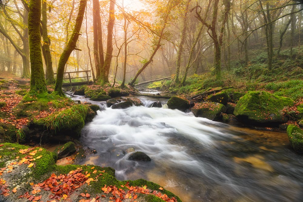
The history of Golitha Falls themselves is rich and mysterious. According to legend, Golitha is the name of an old man of the woods who can still be seen wandering the woodlands on a full moon. Golitha is also a Cornish word for obstruction, which may refer to the cascades along the river. There is also a dark history to the falls, as King Doniert or Dunrgarth, one of the last Cornish kings, was drowned in Golitha Falls in 875 AD - some say he was murdered. You can find King Doniert’s stone, a carved granite cross, on a short walk from Golitha Falls. From 1844 to 1855, Golitha Falls was also the site of Wheal Victoria copper mine, which left some industrial remains in the woodland.
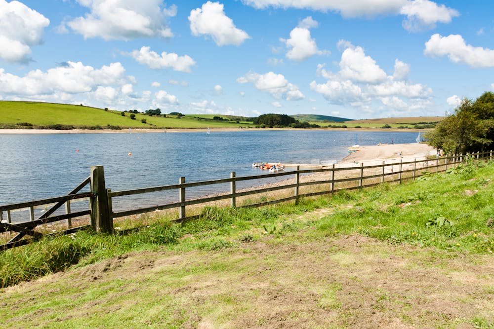
Siblyback Lake, meanwhile, covers an area of approximately 150 acres and is known for its beautiful surroundings, with panoramic views of the surrounding hills and countryside. It is a popular destination for visitors who enjoy outdoor activities such as fishing, walking, cycling, and water sports, including kayaking, windsurfing, and sailing. This circular walking trail around the lake offers stunning views of the water and the surrounding landscape. The lake itself is fed by several small streams and has a dam at one end, which helps to regulate its water levels. There is a car park and a small cafe on site, as well as public toilets and picnic areas.
Difficulty
Moderate
Hiking along trails with some uneven terrain and small hills. Small rocks and roots may be present.
Medium Exposure

The trail contains some obstacles such as outcroppings and rock which could cause injury.
Remoteness
Away from help but easily accessed.
Best time to visit
Features
- Wildlife
- Picturesque
- Dog friendly
- Wild flowers
- Water features
- Family friendly