300 m away
South West Coast Path
A UK National Trail along sea cliffs, across coastal moors, and through harbour towns of England's South West Peninsula.
Moderate Hiking
- Distance
- 1017 km
- Ascent
- 7.6 km
- Descent
- 7.7 km
England's longest National Trail showcases some of country's finest coastal scenery
Also in Somerset, United Kingdom
Hiking Difficult

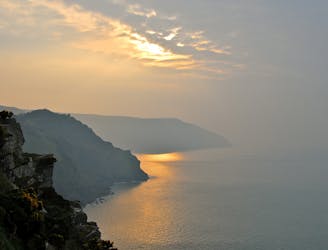
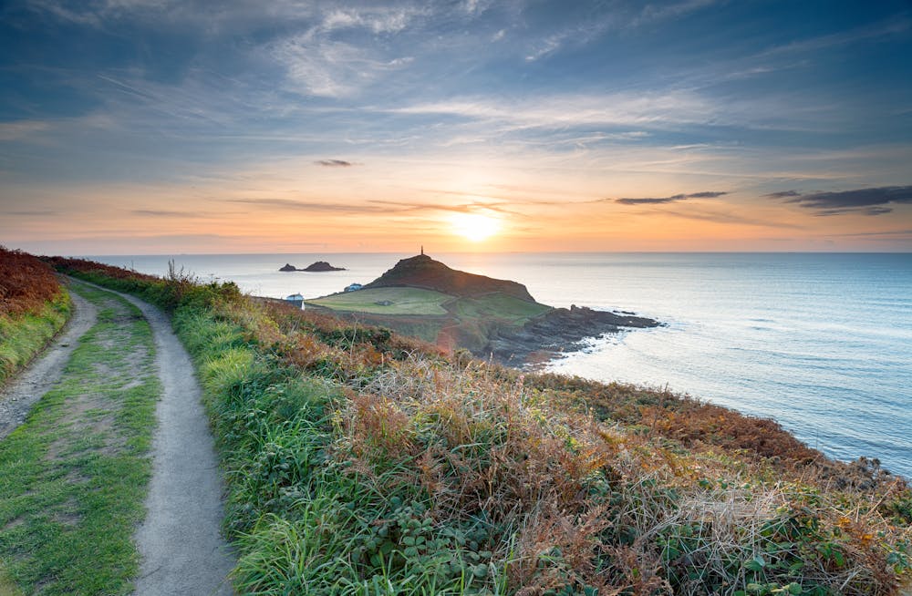
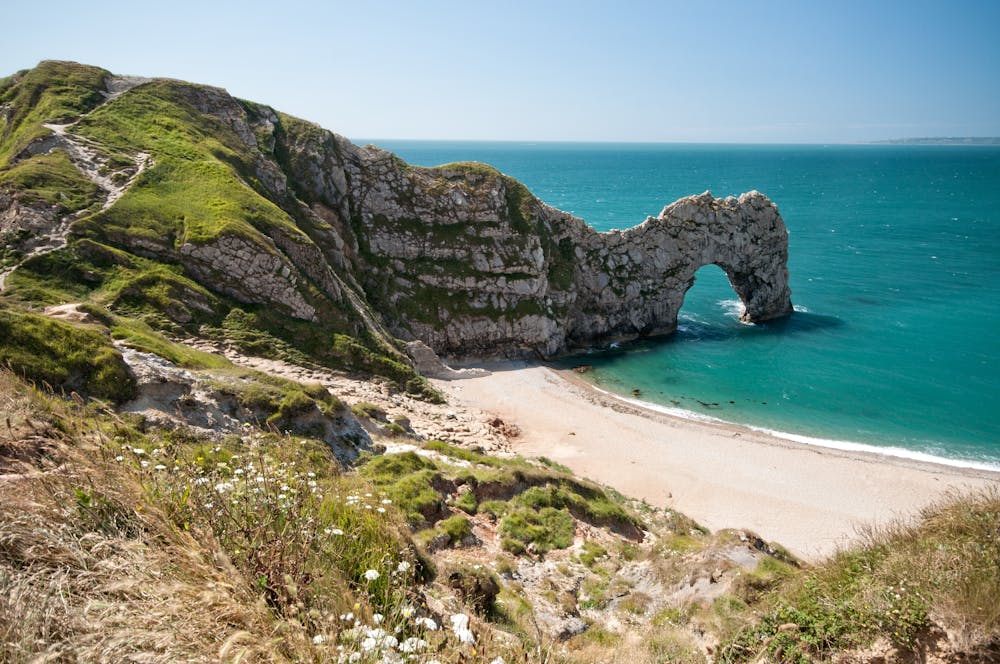
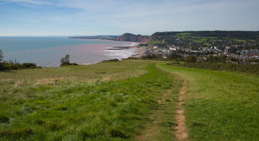
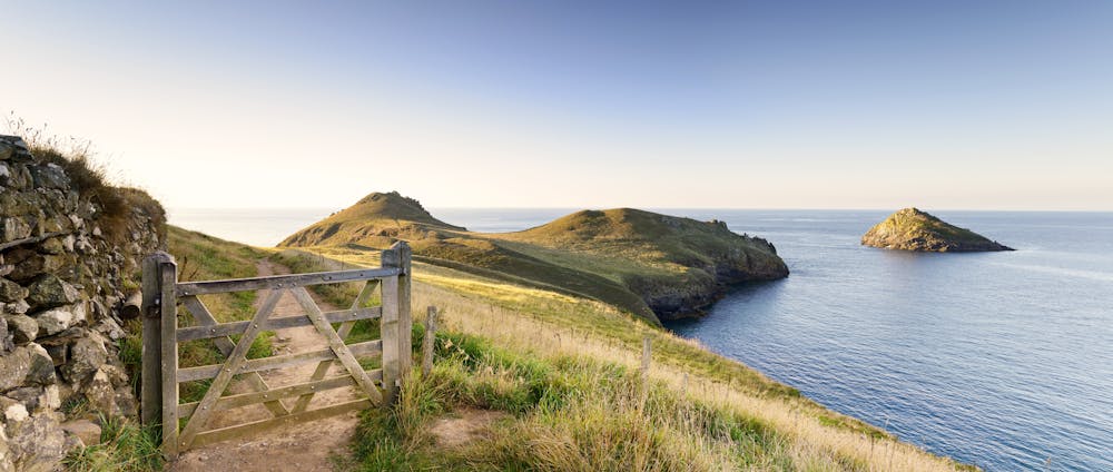
Winding from Minehead along the entirety of the Cornish coast and then moving into the southern parts of Devon and Dorset, this hike is a wonderfully long exploration of England's most scenic maritime areas. A quick look at property prices should give you some indication of just how desirable this part of the world is (!) and completing some or all of this wonderful trail will leave you in no doubt as to its appeal.
The hike can be done in either direction but is more commonly done the way we've shown it here - starting on the northern edge of Exmoor National Park and finishing at Poole harbour, on the outskirts of Bournemouth. Hiking the trail in its entirety in a single push is perfectly doable in a single summer because the height gain and loss is - relative to the overall length of the hike - not huge, so you can cover significant distances on most of the days. However, most hikers break the trail up and either work their way through it a section at a time over the course of several years, or simply pick and choose the sections which appeal the most.
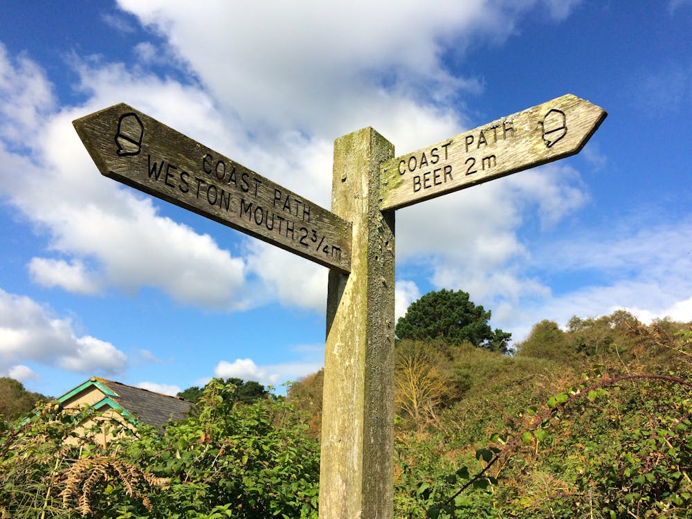
If you do attempt a complete journey along the trail then logistics are remarkably simple - much of the trip is along deserted coastline, but you're never more than a single day's walk from accommodation, so there are no wild camps required. The route is dotted with countless charming villages, each with a character of its own, and staying in these is as much part of the trail experience as the hiking itself. The area through which the trail passes is popular, so booking your accommodation a few days ahead is highly recommended, but booking it too early isn't a great idea because it's good to have a little flexibility in case of bad weather. Taking a look at the weather forecast every evening and making then tweaking plans for the next few days is the best way to do things. That said, there are only a few sections which would be dangerous in bad weather, so if you decide to book your accommodation for the whole trip in advance and stick to your schedule regardless of weather, you should be OK - provided you don't mind getting soaked a few times!
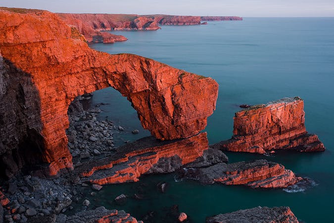
The route takes in a staggering variety of terrain, from stomach-churning views over huge cliffs, to farmland, villages, abandoned ancient cottages and quaint seaside towns. There are also a dozen or ferry crossings on the route and these only add to the experience. (It should also be noted that they add to the logistical issues, so if you've got one coming up then plan accordingly to fit in with the ferry schedule.)
So if you've got a summer to spare, love beautiful coastlines and peaceful villages, and want a challenge - here it is!
Difficult
Hiking trails where obstacles such as rocks or roots are prevalent. Some obstacles can require care to step over or around. At times, the trail can be worn and eroded. The grade of the trail is generally quite steep, and can often lead to strenuous hiking.

The trail contains some obstacles such as outcroppings and rock which could cause injury.

Little chance of being seen or helped in case of an accident.
300 m away
A UK National Trail along sea cliffs, across coastal moors, and through harbour towns of England's South West Peninsula.
Moderate Hiking

9 routes · Hiking
5 routes · Hiking