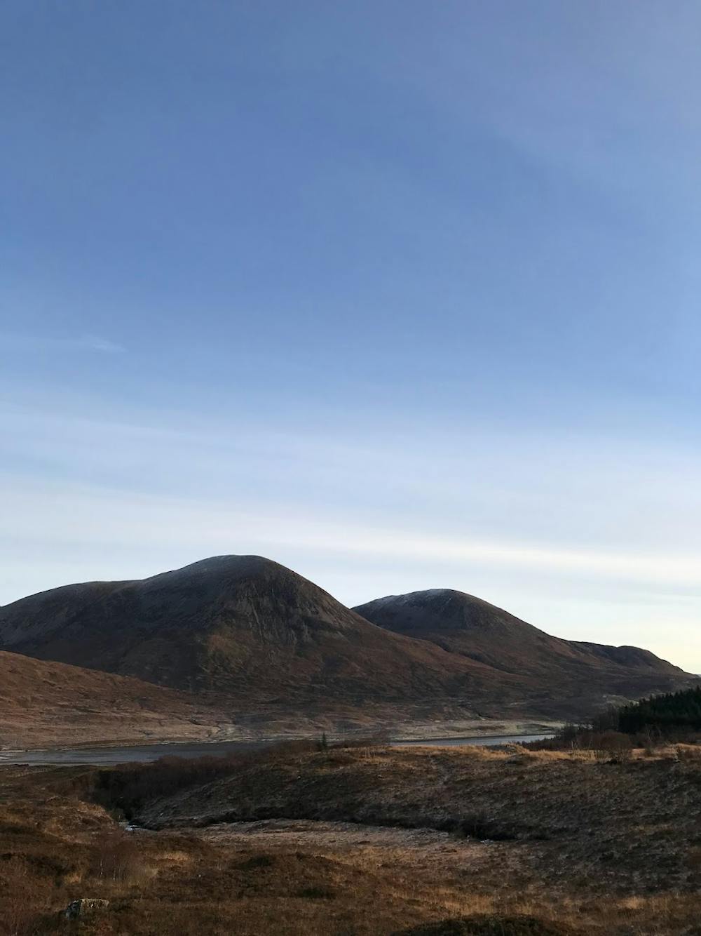
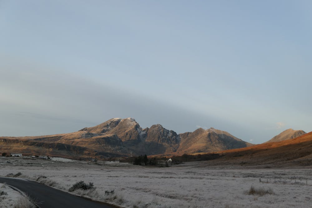
Blà Bheinn - Isle of Skye
Cuillins
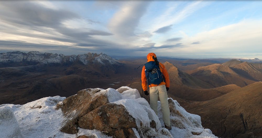
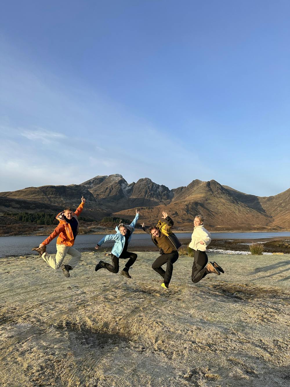
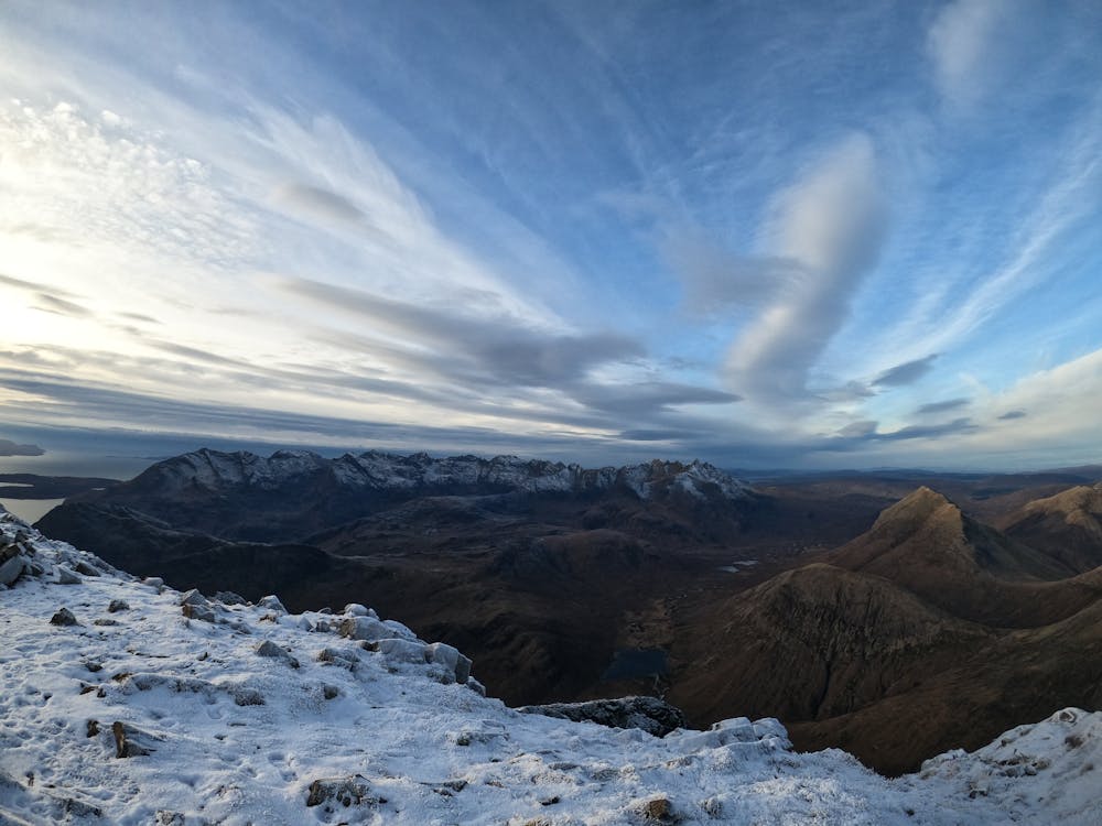
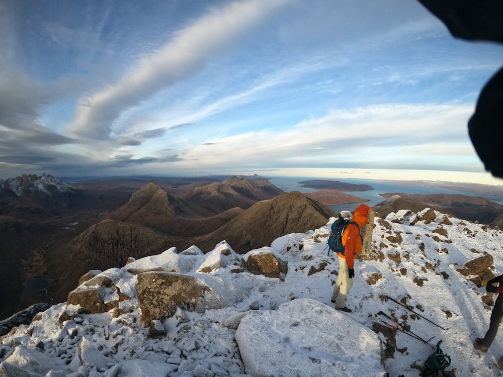
Classic route to reach the summit of munro 'Blà Bheinn' in Isle of Skye. Beautiful 360° view!
Hiking Severe
- Distance
- 9.2 km
- Ascent
- 927 m
- Descent
- 930 m
- Duration
- 3-4 hrs
- Low Point
- 7 m
- High Point
- 924 m
- Gradient
- 21˚

The classic route to reach the summit of the munro 'Blà Bheinn' in Isle of Skye.
- •
- •
- •
- •
- •
- •
- •
- •
- •
Description
Route goes to summit, and down the same way.
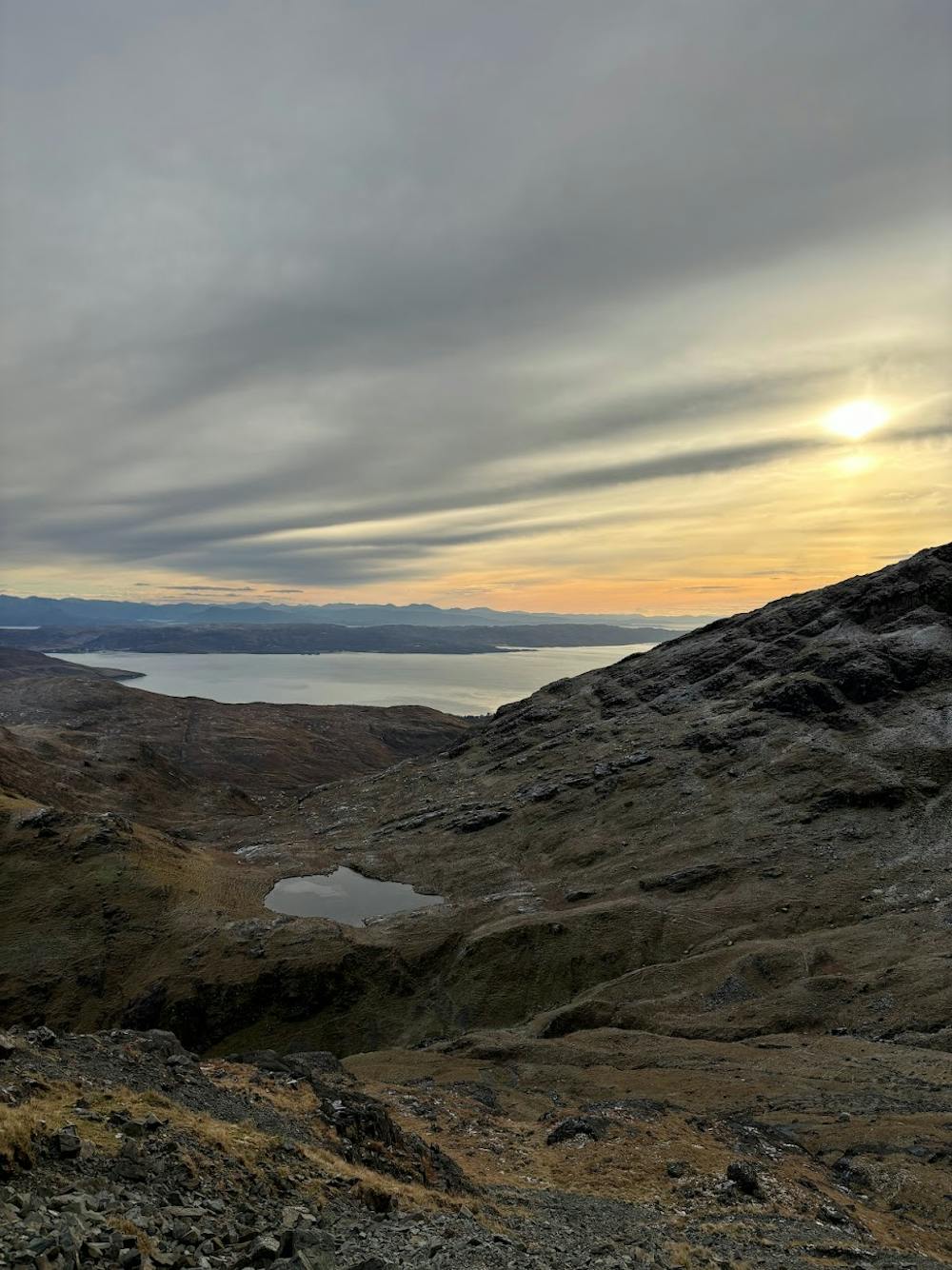
Beautiful 360° view over the Red Cuillins, Black Cuillins and the (almost) entire length of the Highlands.
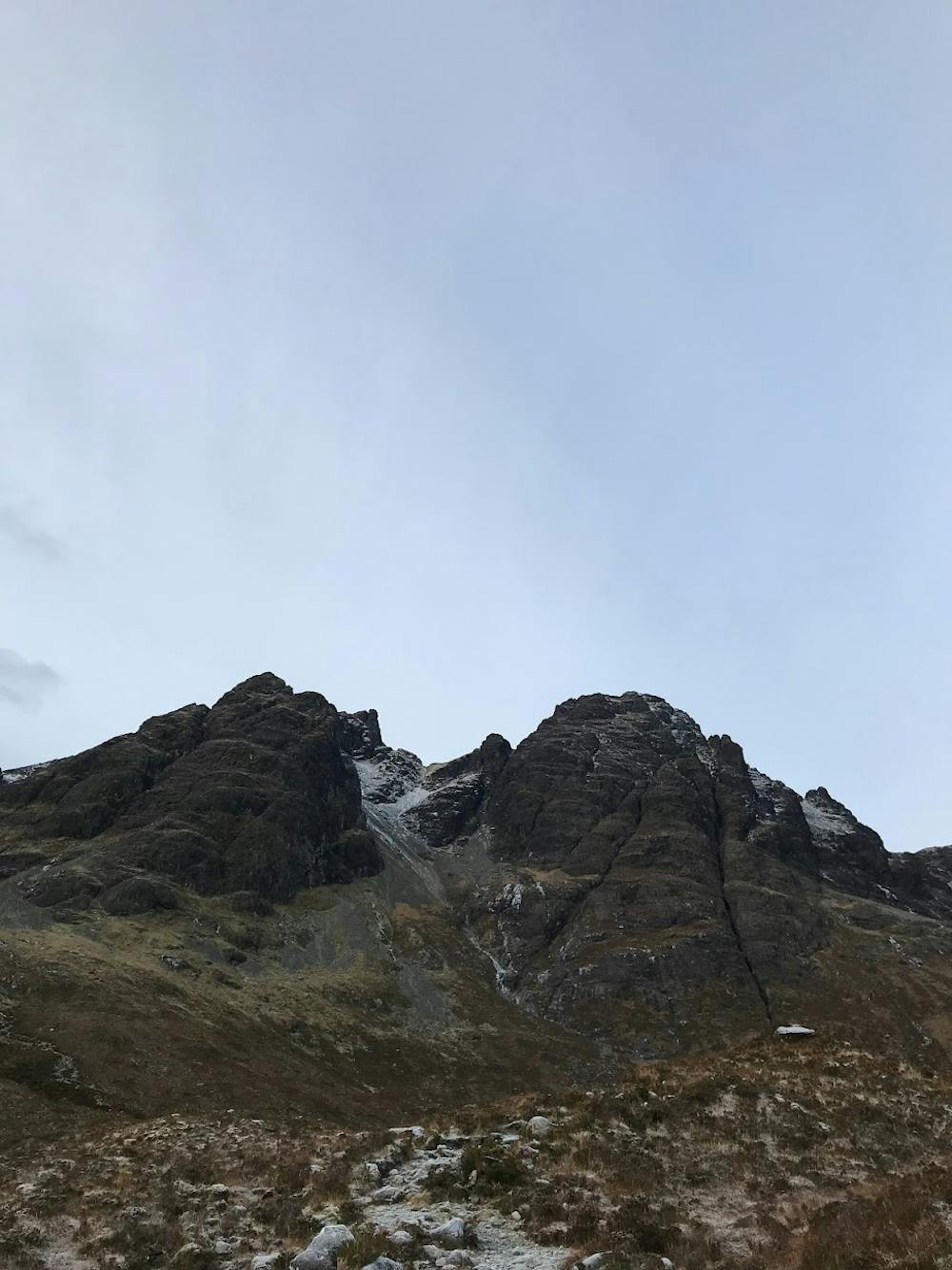
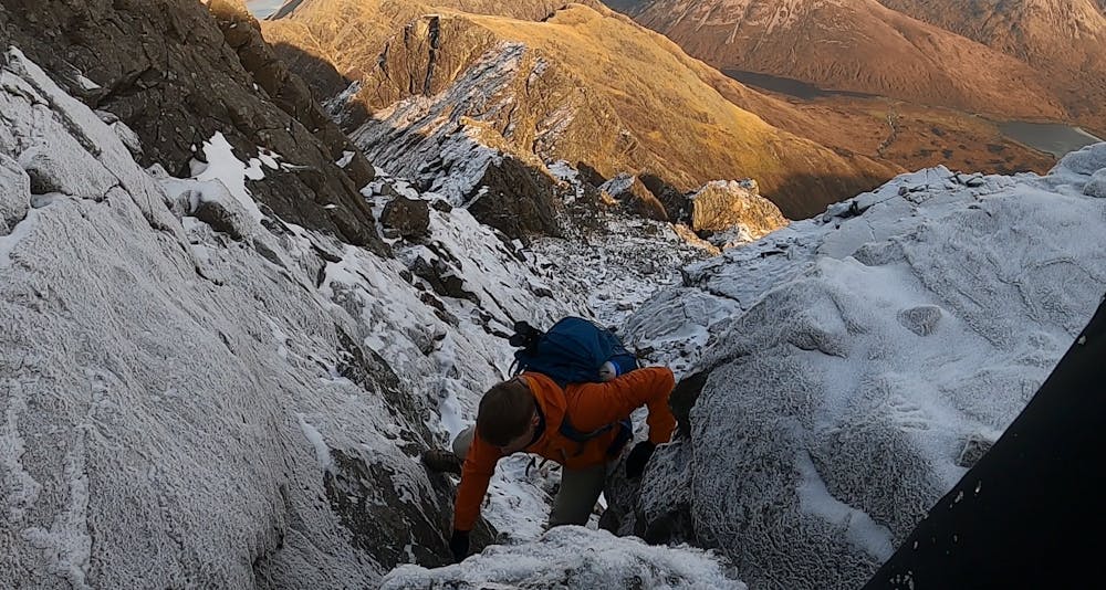
Relatively straightforward hike, with some scrambling halfway and at the top. (Scrambling grade 1 when choosing the easy routes).
Scrambling halfway can be avoided. We scrambled on the way up, but not on way down (see map here, at approx 2.1. miles from start)
Did this in winter conditions. Crampons advised in this case.
Difficulty
Severe
Hiking challenging trails where simple scrambling, with the occasional use of the hands, is a distinct possibility. The trails are often filled with all manner of obstacles both small and large, and the hills are very steep. Obstacles and challenges are often unexpected and can be unpredictable.
High Exposure

Some trail sections have exposed ledges or steep ascents/descents where falling could cause serious injury.
Remoteness

Away from help but easily accessed.
Best time to visit
Features
- Picturesque
- Summit Hike