7.4 km away
Fairy Pools and Coire na Creiche
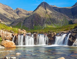
A stunning journey through some of the finest scenery in Scotland
Moderate Hiking
- Distance
- 7.5 km
- Ascent
- 323 m
- Descent
- 324 m
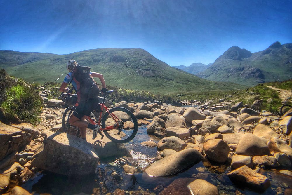
Cycle the classic Sligachan Pass. An exposed coastal hike leads to the longest rock climb in the UK. A multi day adventure.
Hiking Extreme

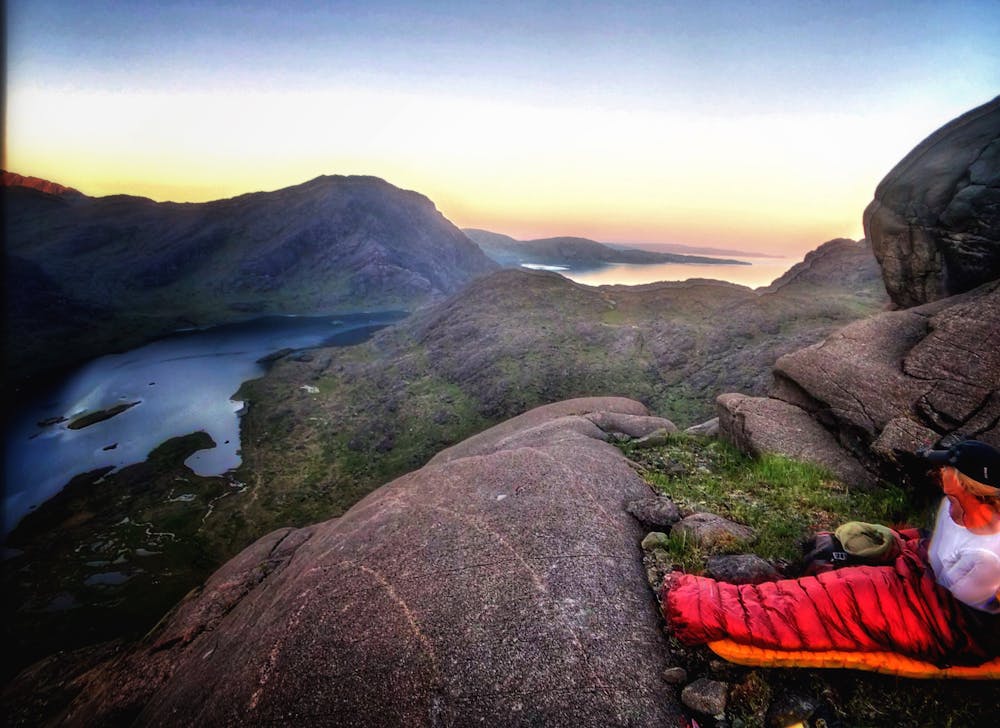
The wild and remote Loch Coruisk located in the heart of the Black Cuillen Mountains of Skye is one of the most iconic landscapes in Scotland. It can be accessed by a regular fishing boat ferry from the village of Elgol. Using MTB's through Sligachan Glenn adds another layer to the adventure.
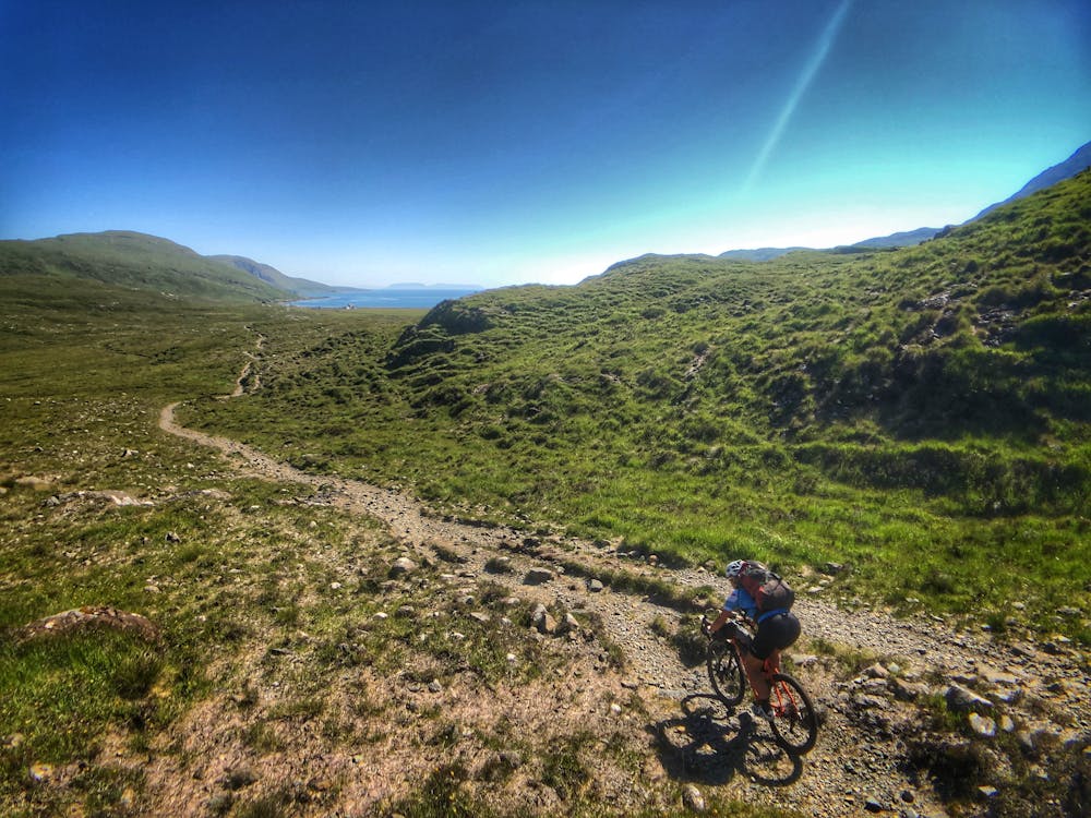
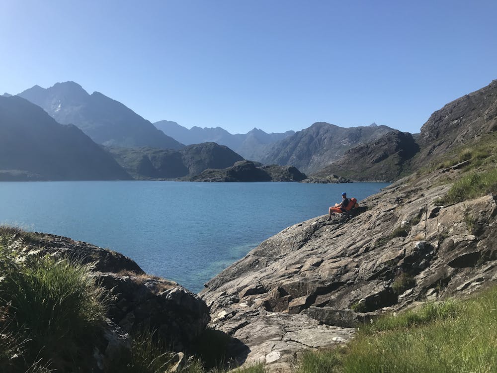
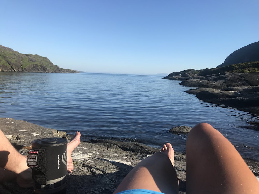
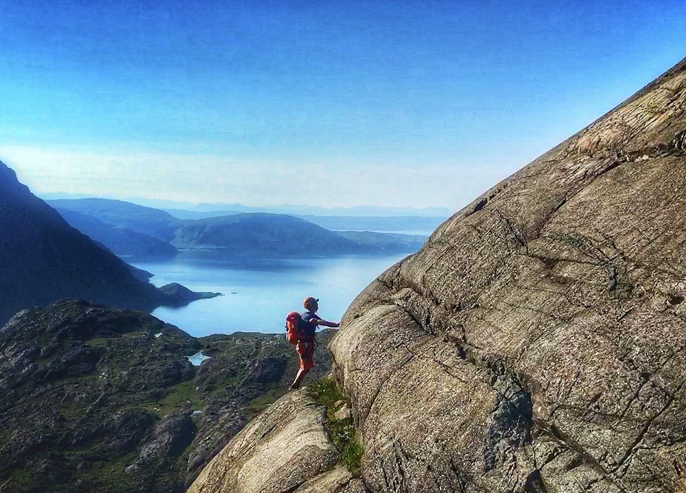
Straight forward mountain biking on an improving hard pack walkers track leads to the beach of Camasunary. Very short sections of hike a bike will be encountered. Once the bikes are depoted an exposed 5km coastal walk skirts the foot of Sgurr na Stri leading to the infamous 'Bad Step'. A compulsory awkward shuffle up a large crack in a rock face that guards the pathway into Loch Coruisk. It looks much worse than it is.
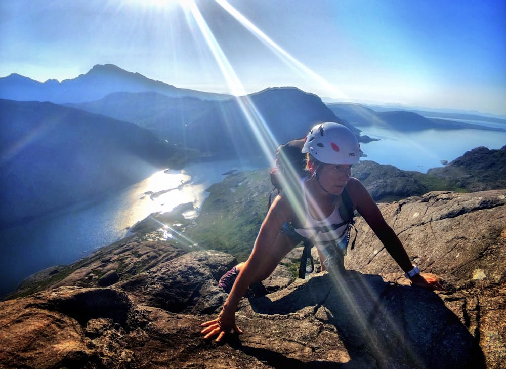
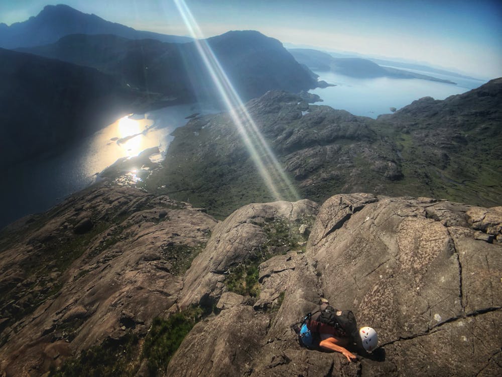
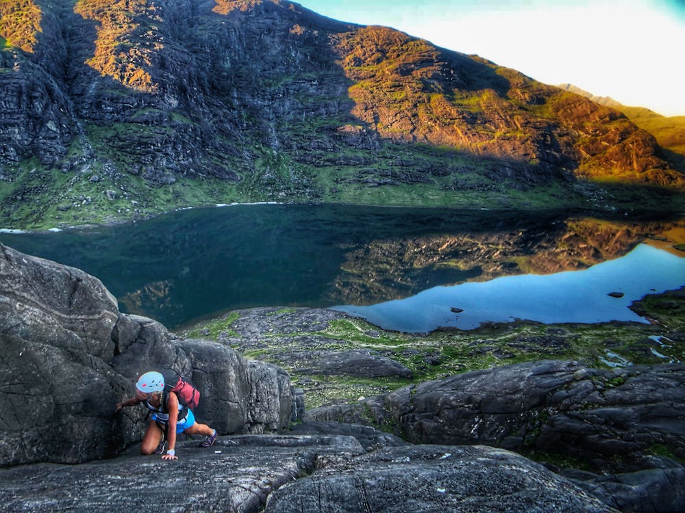
For most of its length the Dubhs Ridge can be tackled as an unroped scramble. A 50m rope is required for two rappels from the summit of Sgurr Dubh Beag. The start of the climb is up a defined chimney which has some of the hardest climbing of the entire ridge. Most parties choose to rope up for the first section. Once established on the ridge the line of least resistance can be climbed at low angle on impeccable gabro rock. Keep to the left side of the face. Once at the summit of Sgurr Dubh Beag the rappel anchor is obvious. A long overhanging rappel leads to a shorter easier rappel from a large flat shelf. Continue up the narrowing ridge to the next summit of Sgurr Dubh Mor or pick your way down through rock bands back to Loch Coruisk
Extreme
Scrambling up mountains and along technical trails with moderate fall exposure. Handholds are necessary to navigate the trail in its entirety, although they are not necessary at all times. Some obstacles can be very large and difficult to navigate, and the grades can often be near-vertical. The challenge of the trail and the steepness of the grade results in very strenuous hiking. Hikes of this difficulty blur the lines between "hiking" and "climbing".

Some trail sections are extremely exposed where falling will almost certainly result in serious injury or death.

Little chance of being seen or helped in case of an accident.
7.4 km away
A stunning journey through some of the finest scenery in Scotland
Moderate Hiking