0 m away
Fort William World Cup Downhill
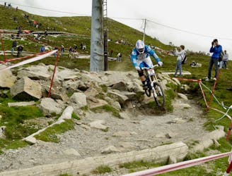
The renowned Fort William World Cup Downhill Track is an iconic test piece for the best downhill MTB racers from around the world!
Extreme Mountain Biking
- Distance
- 2.2 km
- Ascent
- 0 m
- Descent
- 475 m
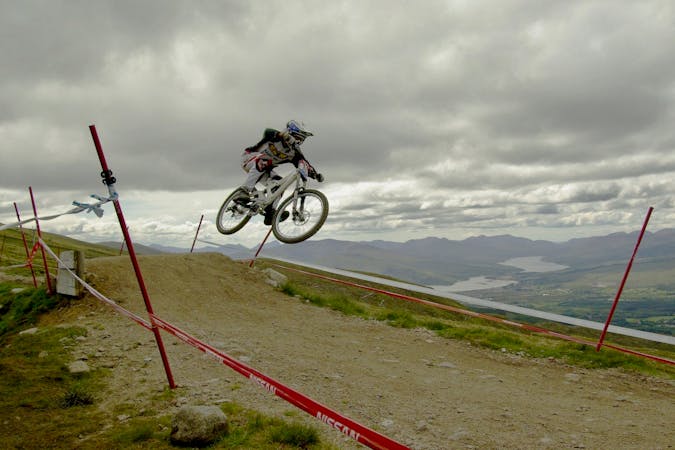
The Red Giant trail is an awesome descent from the top of the Nevis Range gondola, sure to entertain more experienced riders.
Mountain Biking Difficult

The Red Giant trail is accessed using the Nevis Range gondola, and begins by the quad chair just along from the gondola top station. The track starts off with a fast dirt section, weaving its way across the hillside. Several jumps and rollers give the top section an epic playful feel, and will get you excited for what’s to come. As you ride across the hillside, you’ll meet the long boardwalks which weave downhill for several hundred metres. The boardwalks include some huge banked turns, allowing you to carry your speed efficiently. The route takes you in a Westerly direction, all the way to the ridge which drops away towards Carn Mor Dearg. As you ride along the ridge, you’re met with stunning views of much of Carn Mor Dearg, Fort William, and the surrounding Loch Linnhe and Loch Eil. This section has huge lengths of rugged rocks, providing a challenge for all. As the track winds its way back towards Aonach Mor, the surface becomes smoother and allows you to begin to pick up speed again. Crossing through the deer fence, the surface changes back to dirt, and you enter the woods. You can ease off on the brakes at this stage and relax as you cruise down the smooth track. Be sure to take care when crossing through the river, as there are several deep gaps in the rock which can easily catch you off-guard. The last section of the track is a mixture of gravel and dirt, and is much less technical. This is the perfect chance to let your body recover after the testing top sections over all of the rock drops. The red joins a 4X4 access road for approximately 500m, before one final natural off-road section, where you have multiple different route options. The Red Giant finishes in the Nevis Range car park.
Difficult
Mostly stable trail tread with some variability featuring larger and more unavoidable obstacles that may include, but not be limited to: bigger stones, roots, steps, and narrow curves. Compared to lower intermediate, technical difficulty is more advanced and grades of slopes are steeper. Ideal for upper intermediate riders.
0 m away
The renowned Fort William World Cup Downhill Track is an iconic test piece for the best downhill MTB racers from around the world!
Extreme Mountain Biking
8 routes · Mountain Biking