5 routes · Mountain Biking · Hiking
The classic Torridon Coulags loop with tough, rough, rocky descents and epic views.
Mountain Biking Severe

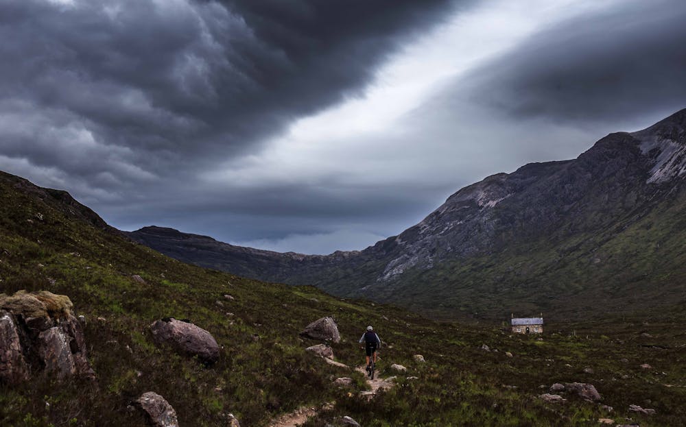
Torridon is the destination for spectacular Scottish wilderness riding. Perfect natural singletrack and technical descents reward the hardy riders who venture out here. The frequent winter storms from the west coast wash away the dirt to expose long rock slabs and epic rocky riding. Ride here on a sunny summer’s day and it’s the best riding in the world. Catch it in a storm and it’s better described as atmospheric!
This is the classic loop, and starting from Loch Torridon means you get the road section out the way first. Or better still, arrange a car shuttle or lift.
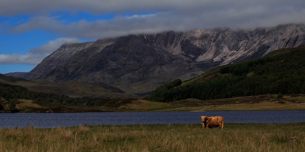
You start out on estate tracks past Loch Clair then Loch Coulin. The riding isn’t technical yet, but great fun past mountain views and highland cows.
The first climb is a challenge, and even the best might be pushing for short sections. On a hot day, there’s some wild swim spots in the river too for a cool down. (Not that that happens too often!)
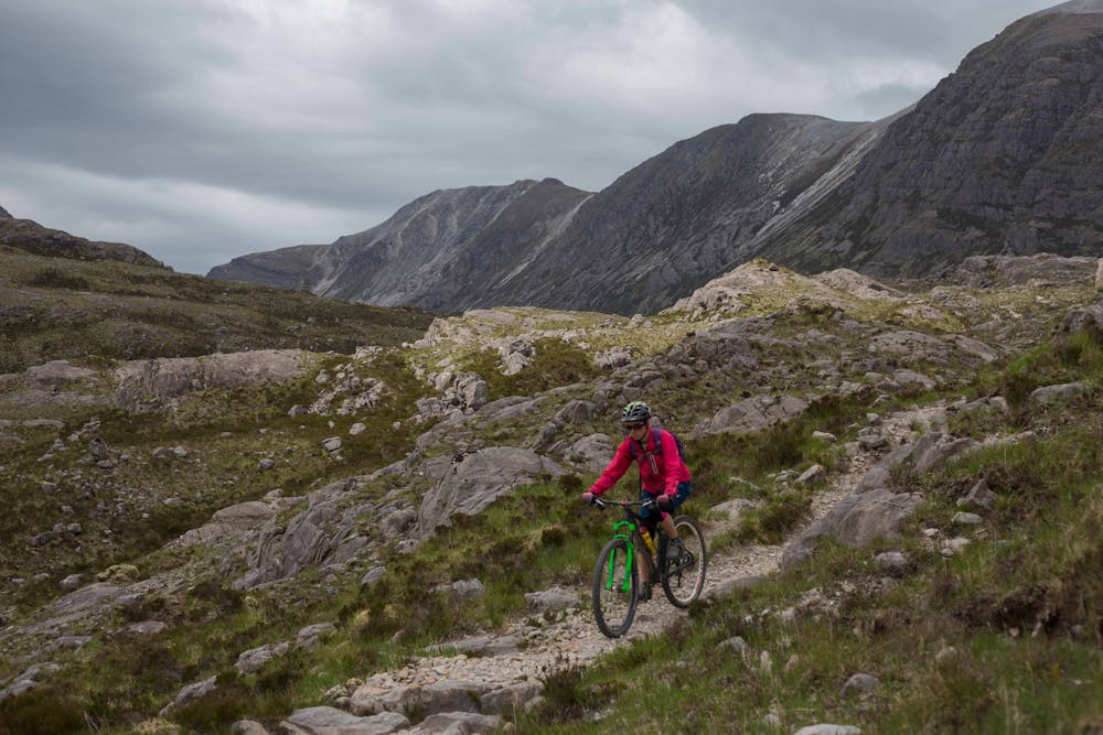
The descents are ever changing from the storms so don’t expect it all to be rideable around the next corner as you hurtle down the descents.
There is a beautifully located railway to cross after the first descent; it is quiet but is active so watch carefully.
After a brief road spin it’s an uphill that certainly ends in a hike a bike for all but the superhuman.
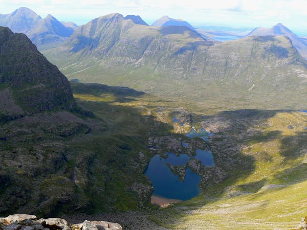
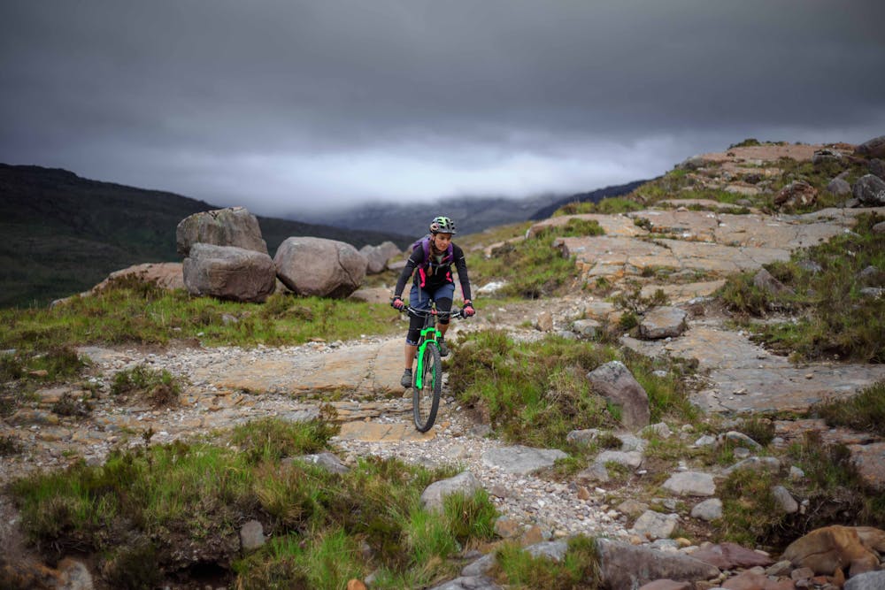
From the top you pass by deep blue lochans on singletrack before the rock slab-heavy descent gives you a bit of everything all the way back to sea level. As it's west facing and this route makes for a full day, you often catch the most amazing sunsets to end.
As these wild trails are no longer a secret, it is important to ride responsibly in this sensitive area of outstanding natural beauty—no shortcuts, and keep that back brake off the skids.
Severe
Widely variable, narrow trail tread with steeper grades and unavoidable obstacles of 15in/38cm tall or less. Obstacles may include unavoidable bridges 24in/61cm wide or less, large rocks, gravel, difficult root sections, and more. Ideal for advanced-level riders.

Some trail sections are extremely exposed where falling will almost certainly result in serious injury or death.
In the high mountains or remote conditions, all individuals must be completely autonomous in every situation.
5 routes · Mountain Biking · Hiking